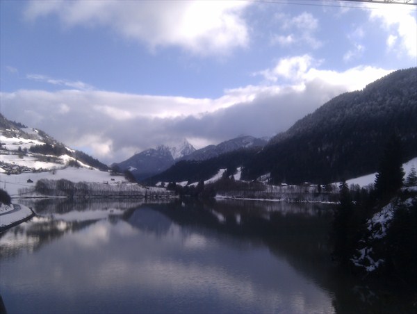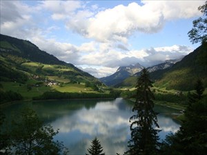
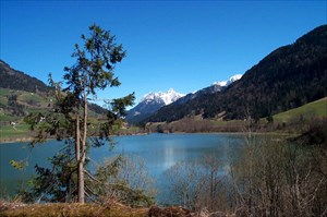
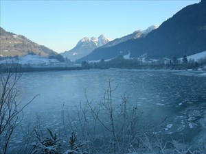
 Le Lac du Vernex est un lac de barrage à Rossinière, dans le District du Pays-d'Enhaut du canton de Vaud, Suisse. Il se situe à une altitude de 860m et a une superficie de 30 ha. Il est alimenté par la Sarine et son bassin versant est de 398 km2.
Le tube qui relie le lac et la centrale mesure 2780m. Il peut évacuer jusqu'à 480m3 par seconde en cas de crue. Le lac est fragile, car il est ensablé par les alluvions, comme beaucoup de lacs de barrage.
Le site est vous offre de nombreuses randonnées dans le Pays D'Enhaut à ski, raquettes, à pieds et proche de la région de Gstaad.
Belle découverte à vous!
 The Lake of Vernex is a maintain lake in Rossinière, in the District of the Pays-d'Enhaut in Canton of Vaud, Switzerland.It is located at a height of 860m and has a surface of 30 ha. It is fed by the Saane river and its pouring pond is 398 km2.
The length of the penstock between the lake and the power plant is 2780m. In case of floods 480m3/s can be evacuated.
The lake of Vernex is in danger because of alluvions wich deposite on the ground.
The site is you offer of numerous hikes around le Pays D'Enhaut. You can choose from numerous activities such as ski, snowshoeing, mountainbiking, canyioning and rafting. It's as well close to the well known Gstaad region.
 Der Vernex See ist ein Dam See Rossinière, im Pays-d'Enhaut, Kanton Waadt, Schweiz. Es liegt auf einer Höhe von 860m und hat eine Fläche von 30 ha. Es wird von der Saane mit Strom versorgt und sein Einzugsgebiet ist 398 km2. Das Röhrchen, das den See und die zentrale Maßnahme 2780m verbindet. Es kann bis zu 480m3 pro Sekunde bei Hochwasser entfernen. Der See ist zerbrechlich, weil es wird von alluvialen Ablagerungen versandet, so viele Stauseen. Die Seite ist bietet viele Wanderungen in das Pays d'Enhaut Ski-, Schneeschuh-, und wandern in der Nähe der Region Gstaad. Schöne Entdeckung für Sie!