Typically, pre-conditional factors build up specific sub-surface conditions that make the area/slope prone to failure, whereas the actual landslide often requires a trigger before being released. At the posted coordinates you should be able to see a clear examples how a landslide can effect the terrain of an area.
Comprehensive ground investigation has taken place locally in parts of Jackfield, Lloyds Coppice and Lloyds Head and detailed mapping has been undertaken across the whole of the World Heritage Site. In the event of a landslide, there is the possibility that it may lead to the partial or total blockage of the river. This happened before in 1773 when a landslide at the Birches resulted in a blockage of the river and its subsequent realignment as it cut a new channel.
In the event of such an occurrence in the Gorge, the effect on river levels would be just as significant as the landslide itself, resulting in flooding upstream of the blockage until a channel could be re-established. The extent of this flood would depend on the level of the river at the time of the landslide and the amount of rainfall within the area of the River Severn.
As a worst case, levels similar to those predicted by the Environment Agency as a 1 in 1000 year flood event may occur.
|
Reasons for land instability
-
The geology of the gorge.
-
Hydrology – surface runoff & underground water flow.
-
Erosion of the Severn river banks.
-
Past mining & quarrying for coal, limestone & clay.
-
The local tipping of waste & spoil.
-
Steep slopes in the gorge.
-
Human changes to vegetation & buildings.
|
What to look out for?
-
Cracks in paths, or pavements
-
Distortion of surfaces
-
Cracked, bowed or leaning walls
-
Garden movement, trees or soil sliding
-
Severely leaning trees, walls, lamp posts, telegraph poles
-
Changes in the profiles of slopes
-
Broken drainage systems, dirty tap water
-
Appearance of new groundwater springs
-
Disruption to services
-
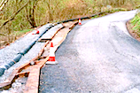
Temporary repairs
|
Examples that you may find in the area and use but you must comply with Question 3a & 3b.
 |
 |
 |
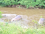
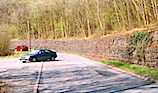
| Example 1. |
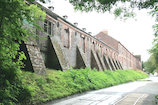
Example 2. |
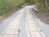
Example 3. |
 |
 |
 |
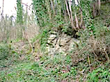
| Example 4. |
Example 5. |
Example 6. |
Earthcache Task
To assist you with this task the following resource is provided;Click here to go to A Geological Trail through the landslides of Ironbridge Gorge.
In order to claim this Earthcache answer the following questions:
Geology - Solifluction and Erosion
1. How is the landslide at Lloyds Cottage classified?
2. What is the imperceptibly slow and steady down slope movement of the regolith called?
3. There are many locations in and around the vicinity of the posted coordinates that show signs of damage or repair as a result of landslides.
A....Your task is to provide Photographic Evidence in your Log of At Least One Location.
B....Explain your findings of your photo in your EMAIL together with the Coordinates of your find; Lloyds Cottage does not count.
OPPORTUNITIES ABOUND FOR PHOTOS SO WHY NOT POST THEM IN YOUR LOG AND INCLUDE YOUR GPS TO PROVE THE VISIT.
Please email your answers to the questions via my profile, I will verify your answers as soon as possible, please log your find if there is an issue I will contact you.
Please do not post your answers on your log.

HISTORICAL INTEREST;Click here To view an interesting short film clip of Jackfield Village in 1952
REFERENCE
Borough of Telford & Wrekin Council - Ironbridge Gorge Instability The Interpretation of Ground Investigations at Jackfield and the Lloyds
A geological assessment of the landslides in the Ironbridge Gorge, Shropshire
A Geological Trail through the landslides of Ironbridge Gorge.
Skempton, A. W. 1964, 'Long-term stability of clay slopes', Geotechnique, 14, 77-101.
Halcrow 1990, Landslides at Ironbridge: Jackfield and Lloyd’s Coppice. Report on Hazard Mapping, report for Shropshire County Council.
High-Point Rendel 2005, Ironbridge Gorge Instability: The Interpretation of Ground Investigations at Jackfield and the Lloyds, report for Telford and Wrekin Council (R/2088/01).