The Legend
The mountain is said to be named after the first Norse settler to Iceland - Ingólfur Arnarson, who is supposed to have both lived on the mountain from 873 to 874 and to have been buried on it. Another story says that on a certain day in summer, his burial site opens and reveals its treasure. It just doesn't say exactly where or on what particular day!
The Geology - How did the table top shape occur?
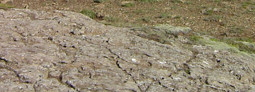
During the Ice Age volcanic eruptions under the ice create a rock called tuff - also known as palagonite. Someties the eruptions of a single vent penetrate through the ice and produce a hard cap of lava, which mixes with water during the eruption to create a glassy mineral with a flat Table Top appearance.
Palagonite
Palagonite and palagonitization was first "discovered" by von Waltershausen in 1845. He describes a transparent, yellow or brown, resin-like substance found in volcanic deposits in Palagonia, Sicily. He defined palagonite as a new mineral substance created by the underwater transformation of volcanic glass at high temperatures.
A mineral - or not?
Contentiously Penck in 1879 put forward the idea that palagonite was not a discrete mineral but a mixture of glass and basalt. This was disproved in the first detailed microscopic and chemical study of altered glasses from Iceland by Peacock in 1926, and it is his theories of the composition of palagonite which are widely accepted today.
The Questions...
(Please email me the answers via the email address in my contact details above. Then go ahead and log the find. If I have issues with your answers I'll email you to discuss further. Please don't post the answers on the site)
1. What is the "bench" and how high is it above the present sea level? How do you think its distinct shape was formed?
2. Estimate in metres the thickness of the glacier rock layer running through the middle of the mountain.
3. Apart from its age, in what interesting way does the rock from the Jamarillo period differ from that of the Matuyama period?
References
Stroncik, NA, and HU Schmincke. "Palagonite - A Review." International Journal Of Earth Sciences 91.4 (n.d.): 680-697. Science Citation Index. Web. 20 Jan. 2013.
The information board at the site provided by the Iceland Geology Institution and Tourism Board.