Entrance into Wisconsin State Parks requires a pass. Either a one-day pass or an annual pass can be purchased at the park or online at https://dnr.wisconsin.gov/topic/parks/admission
The park is named for Jean Brunet, who was born in France in 1791 of nobility and came to America in 1818 and settled in St. Louis. Called a man of “considerable note” he served as an officer in the U.S. Army and participated in the building of Fort Crawford. Later he moved to Prairie Du Chien and then, in 1828, to present-day Chippewa Falls. Brunet was directly responsible for establishing the first dam and sawmill in Chippewa Falls in 1836. The mill quickly opened this area of the Chippewa Valley to an expanding lumber trade.
Northern States Power Company donated the 179-acre island to the state in 1936, and the state park was dedicated to Brunet's memory in 1940. The log shelter was built by the Civilian Conservation Corps in 1938 and renovated in 2003.
A storm which some claimed was a tornado flattened and uprooted hundreds of trees in the park on July 2, 1970. More than 25 volunteers answered a call to help clean up fallen trees and debris.
In the early years, there was a beach on the west side of the island, near the campgrounds. In 1973-74, the power company drew down the water level in the flowage in order to work on the dam, causing a dangerous drop off at the beach. A new beach was developed at its present location on the south end of the island.
In 1977, another tornado touched down and leveled an 18-acre plot of hemlock trees in the center of the island. Due to all the debris, the park remained closed until the spring of 1978. Today, the impact of the tornado can still be seen. Birch trees have regenerated in the area that was once home to huge hemlocks.
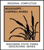
Mississippi and Chippewa Rivers Biome
The Driftless Region serves as home to these two rivers, and many, many more, and is in a deciduous forest biome. Most of this part of southwestern Wisconsin was not touched by the last glaciers and displays a very rugged landscape dominated by limestone bluffs rising above the two main rivers. Valleys carved by smaller rivers and streams abound, but anything resembling a lake is the result of human intervention. The predominant vegetation is mixed hardwoods such as oak, aspen, and maples. With the abundant spring fed streams in every valley, the trout fishing in this biome is world class. The big river is one of the main flyways for bird migration and plays host to birds using that flyway, including huge concentrations of Tundra Swans in the spring and fall. Timber Rattlesnakes are timid venomous snakes that inhabit those rocky bluffs.
WISCONSIN GEOCACHING ASSOCIATION
The Wisconsin Geocaching Association (WGA) is a group of geocachers dedicated to promoting and protecting geocaching within the state of Wisconsin. The WGA organizes geocaching events, works with land owners/managers on geocaching policies, educates the public at large about geocaching, and facilitates communication between WGA members. To learn more about the WGA visit: www.wi-geocaching.com
2013 kicks off the beginning of the Wisconsin Geocaching Association State Parks series. It is our goal to place a geocache in every state park in the state of Wisconsin so watch out for more in this series that encourages geocachers to explore the natural resources in this beautiful state of ours.
The Geocache Notification Form has been submitted to Anne Korman of the Wisconsin DNR. Geocaches placed on Wisconsin Department of Natural Resource managed lands require permission by means of a notification form.
This a WGA STATE PARK SERIES geocache:
 |