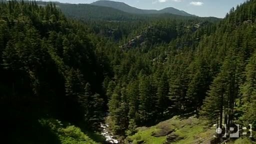
The Oregon Hell Hole, located in the highlands above the North Fork of the Middle Fork of the Willamette River. This geological curiosity is a 200 ft deep rift in the forest floor, deep enough to hold a 20 story building and create a subterranean climate at least 20 degrees cooler than summer temperatures above.
For many decades the Oregon Forest Service has made deliberate efforts to keep this site off maps and out of guidebooks since the 1930s. This is no surprise, since the rift presents a serious safety hazard, especially to those who try to descend along the crumbling basalt walls. Unsurprisingly, his has not deterred hikers from seeking out this natural wonder, and you'll find a well-worn trail straight from the nearest foresting road (approach from the north east) to the edge of the rift. A few years ago a group of geocachers poured over old maps online and at libraries, eventually finding the sight of the Hell Hole. Some of them placed a geocache (GCGG27) at the site, which we hope you'll find while visiting this Earthcache.
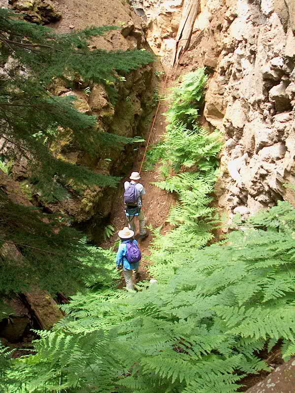
WARNING: Visit this site at your own risk. There is an existing user-created trail and the logging road is close to the site, so it is an easy hike. However, there are no safety barriers here, so please use common sense. Do no get too close to the edge, which may crumble. The trail, which starts on the NE end of the parking pull-out (the trail is there, just hard to see from the road, obvious once you're on it looking back) will take you right to the rift. There are no signs, no safety railings, and there is no ranger here to keep you safe or rescue you if things go wrong. Please do not visit this site alone. We also recommend against bringing small children. While you can make the hour long descent to the bottom, you should not attempt to do so unless you are an experienced climber with proper equipment. You will need at least 100 ft of rope, and you will need to go through a narrow tunnel of boulders to get to the very bottom. Leave a travel plan with friends or family before you leave.
About 2 million years ago, the lava flows that formed the Hell Hole oozed into the upper North Fork Valley from a series of fissure eruptions. The flow filled the depressions in the landscape, creating a formation of new lava cradled by flows from much earlier eruptions. More recently, a progression of glaciers moved through the valley and destabilized the base upon which the newer lava rested. The eventual product was the Hell Hole, which has been apparent for at least 39,000 years. The Hell Hole is a store house of geologic evidence for the history of this region. Silt embedded in bubble holes on the Hell Hole's olivine basalt walls is evidence that the schism formed before or during the life span of a large lake, probably caused by a glacial dam. To preserve the site of the Hell Hole, the State of Oregon has designated these 40 acres of the Willamette National Forest as a "special interest area", which protects it from future development or logging.
The hole has some surprising features. Even though the rift is well into the Cascade snow zone, there is no discernable streambed or any other indication of spring runoff at its bottom. The rock and soil are so permeable, it soaks it up like a sponge! Even in the dead of summer large spans of its silt-encrusted walls remain muddy and you may see steam coming from your own body and your fellow climbers, as you descend into the hole.
(Source: Ellensburg Daily Record, OPB, Oregon Forest Service, Obsidians Club)
You may log this cache after answering the following questions. You do not need to wait for a response from the cache owner, just email the answers and log your find and (optional) photo.
Questions:
1. How long has the Hell Hole been apparent?
2. How do we know that there was likely a large lake covering the Hell Hole around the time it was formed?
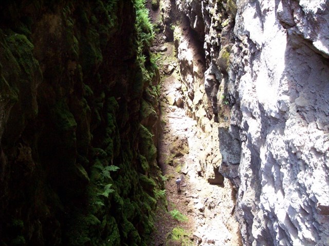
3. How wide is the gap from NW to SE, where you are standing, and can you see the bottom of the rift from here?
4. Which side of the rift is covered in more ferns? The SE or the NW side? Why?
This cache was placed with official permission granted on July 2, 2014 by a committee at Willamette National Forest consisting of a Public Affairs Officer, District Ranger, Forest Geologist and District Recreation Manager. Contact information and further details are on record with the cache owner and with the reviewers at geocaching.com.
Edit: Congratulations to our friends team tobe4evr1 for being First to Find :)