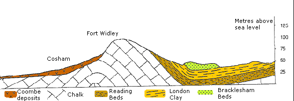
The hill is an inlier of the bedrock chalk, meaning the rock that forms the hill is older than the surrounding area. The chalk bedrock forms a natural basin between Portsdown and the South Downs, into which levels of clay have been deposited. The ridge of chalk that forms Portsdown Hill is known as the Portsdown Anticline and to the east has been eroded to the point it folds back below the clay levels around Havant.
More information about the various tunnels and features within the hill can be found here Portsdown Tunnels
Many of the features within the hill are hidden and out of bounds to the general public (although tours of the Underground Shelter are available through private arrangement). This Earthcache is at one small cave that is open and accessible to the public. The cave was formerly in the grounds of Jones' (Belle Vue) Tearooms, where it was used as a cold food store. The tearooms were demolished in the 1940's when the home guard took over the site to use as strategic defence point.
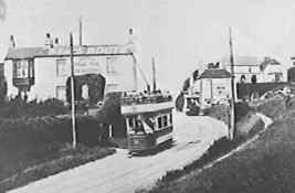
A Tram passes the old tearooms
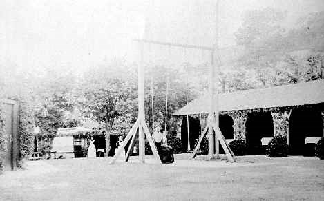
The cave is located behind the sheds in this picture
Although the cave is free to explore, please proceed with caution if entering as the area has in the past been used by drug addicts. Any discarded needles should be reported to Portsmouth City Council.
To log the cache please answer the following:-
1. Briefly explain how chalk is formed?
2. Is the cave:-
a) Formed through water erosion.
b) A man-made feature.
c) A natural fault in the rock.
Please use evidence from the location to support your answer.
3. Take an altitude reading at the mouth of the cave and another at the waypoint on top of the hill above the cave.
4. Take a picture of yourself or your GPS on top of the hill with the view of Portsmouth in the background (optional).
Send your answers to the CO through his Geocaching Profile.