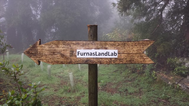
FURNAS LANDSLAB
PT 8/11 – MIT GREEN ISLANDS
WOODY BIOMASS/ Pomares de Uva-da-Serra
Português

FURNAS LANDSLAB
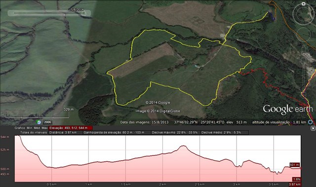
Este power-trail pretende divulgar o Laboratório de Paisagem das Furnas, que se insere na área de Paisagem Protegida das Furnas, do Parque Natural da Ilha de São Miguel. Este PT é constituído por 12 caches (11 caches tradicionais e 1 cache-enigma bónus). O PT é constituído pelo trilho do Pico do Ferro, o trilho do planalto e o trilho da Grená. Recomendamos que seja percorrido de forma circular, começando e terminando na zona das caldeiras da Lagoa das Furnas. Numa situação “normal” será percorrido em cerca de cinco horas.
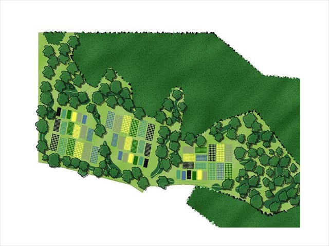
Na zona do planalto, poderão visitar: a Floresta Encantada, a Serpentina, Os Arboretos do Reinfforce, a ICCA (International Congress and Convention Association), o MIT GREEN ISLANDS – WOODY BIOMASS/ Pomares de Uva-da-Serra e o SATA Forest. Também poderá visitar o PTLogo.
MIT GREEN ISLANDSWOODY BIOMASS
Pomares de Uva-da-Serra
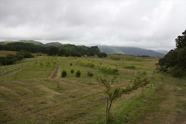
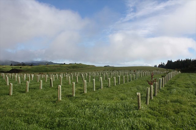
Este é um ensaio que tem como objetivo estudar o potencial de várias espécies arbóreas (nativas e não nativas) para a produção de biomassa. As espécies plantadas com diversas densidades e em diferentes tipos de solos, estão a ser estudas pelo Departamento de Biologia da Universidade dos Açores para avaliar os incrementos de biomassa útil anual. Na paisagem ganha-se ao manter o carácter permanente de povoamentos jovens, pois este tipo de plantações é mantido em rebentamentos de toiça, enquanto as florestas circundantes vão envelhecendo. A nível económico esta possibilidade permitiria uma maior independência energética dos Açores quanto a combustíveis fósseis.
A uva-da-serraé o nome dado ao mirtiloendémico, Vaccinium cylindraceum, anteriormente uma das espécies que ocupava várias áreas naturais de altitude, onde a água existe em abundância. Esta espécie arbustiva persistia até há poucos anos apenas em alguns locais remotos da paisagem das Furnas em tímidos grupos enfraquecidos. É uma espécie com flores bonitas e com a rebentação de Primavera avermelhada.
Foram plantados dois pomares (replicados em solos pobres e solos ricos) com 800 unidades genéticas identificadas, às quais nas suas imediações acrescem pequenas áreas com outros mirtilos plantados sem delineamento experimental. A intenção é acompanhar o crescimento de cada unidade genética e a respetiva produção de frutos quer em quantidade, quer em qualidade (sabor, dimensão e antioxidantes), procurando selecionar as melhores plantas para que se estabeleçam novos pomares produtores de frutos, com recurso a plantas selecionadas.
LABORATÓRIO DE PAISAGEM DA LAGOA DAS FURNAS
A Unidadede Paisagem da Lagoa das Furnas: é o extenso plano de água, complementado pela existência das caldeiras e fumarolas a Norte, que centralizam a composição desta paisagem e determinam a existência de elevadas potencialidades para o recreio e lazer. Ao longo da sua margem foram-se estabelecendo as atividades humanas de produção e de lazer, ocupando uma estreita faixa de contacto entre o plano de água e as vertentes abruptas que a limitam. Aqui localizam-se importantes valores culturais que testemunham a evolução desta paisagem e que constituem importantes elementos patrimoniais representativos da arte paisagística do séc. XIX: a Mata de José do Canto e a Mata da Grená. Posteriormente, assistiu-se à construção, nestas margens, de residências de veraneio com os respetivos jardins. As terras altas da Achada das Furnas integram esta unidade, que apresenta várias subunidades enunciadas na Fase B da elaboração do Plano de Ordenamento da Bacia Hidrográfica da Lagoa das Furnas.
A Área de Paisagem Protegidadas Furnas, com 3150 ha, situa-se no interior de uma caldeira que resultou do colapso da estrutura de um dos vulcões mais ativos de São Miguel, o vulcão das Furnas. A geomorfologia e hidrologia singular desta caldeira conduziram à classificação desta área como área de paisagem protegida. Destacam-se na paisagem, a lagoa das Furnas e os fenómenos de vulcanismo secundário, tais como os campos fumarólicos e as nascentes de águas termais.
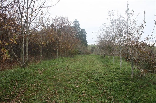
O Laboratório de Paisagemé o homólogo dos parques tecnológicos, mas vocacionado para o campo das Ciências Naturais. Em vez de laboratórios e escritórios num edifício, existem canteiros e talhões experimentais ao longo da paisagem. Os estudos e as experiências, conduzidas ao ar livre, abarcam disciplinas como a Silvicultura, a Agronomia, a Horto-Fruticultura, a Biologia, a Ecologia, a Bioengenharia, a Biotecnologia, a Psicologia Ambiental, o Paisagismo, a LandArt e o Turismo.
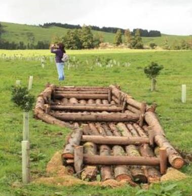
A CACHE:

A caixa tem um formato NÃO convencional.
Deve levar consigo material de escrita.
Por favor, não nem postem fotos que possam denunciar a cache.


FURNAS LANDSLAB
PT 8/11 – MIT GREEN ISLANDSWOODY BIOMASS / Pomares de Uva-da-Serra
ENGLISH

FURNAS LANDSLAB
This power-trail intends to promote Furnas Landscape Laboratory, which is included in the protected landscape area of Furnas, the Natural Park of São Miguel Island. This PT consists of 12 caches (11 traditional caches and cache 1-puzzle bonus). The PT consists of the Iron Peak Rail, the rail and the rail plateau of Garnet. We recommend that you traveled in a circular fashion, beginning and ending in the area of boilers of Lagoa das Furnas. In a "normal" situation is traversed in about five hours.
In the area of the plateau can visit: the Enchanted Forest, the Streamer, arboreta of REINFFORCE, the ICCA (International Congress and Convention Association), MIT GREEN ISLANDS - WOODY BIOMASS / Orchards Grape-of-Serra and the SATA Forest. You can also visit the PTLogo.
MIT GREEN ISLANDSWOODY BIOMASS
Pomares de Uva-da-Serra
This is a test that aims to study the potential of various tree species (native and non-native) for the production of biomass. The species with different densities and different soil types are being studied by the Department of Biology at the University of the Azores to assess the annual increments of useful biomass. The landscape is gained by maintaining the permanent young stands, as this type of plantations is kept in Blasting toiça, while the surrounding forests grow older. Economically this possibility would allow greater energy independence of the Azores as fossil fuels.
The grape-of-saw is the name given to endemic blueberry, Vaccinium cylindraceum, formerly one of the species that occupied several natural areas of altitude, where water is abundant. This shrubby species persisted until a few years only in some remote locations of the Furnas landscape shy weakened groups. It is a species with beautiful flowers and the surf reddish spring.
Two orchards were planted (replicated in poor soil and rich soil) with 800 identified genetic units, which in the vicinity added small areas with other blueberries planted without experimental design. The intention is to follow the growth of each genetic unit and the respective fruit production either in quantity or in quality (flavor, size and antioxidants), seeking to select the best plants in order to establish new fruit growers orchards, with plans to appeal selected.
LANDSCAPE OF LABORATORY OF POND FURNAS
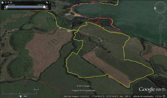
The Landscape Unit of Lagoadas Furnas is the extensive water plan, complemented by the existence of boilers and fumaroles the North, that centralize the composition of this landscape and determine the existence of high potential for recreation and leisure. Throughout its margin were being established human activities of production and leisure, occupying a narrow contact zone between the water level and the abrupt slopes that limit. Here are located important cultural values that testify to the evolution of this landscape and that are important representative assets of the landscape art of the century. XIX: Joseph corner of Forest and Forest Garnet. Later, saw the construction, these margins of summer residences with the respective gardens. The highlands of Pembrokeshire Furnas part of this unit, which has several subunits set out in Phase B of the preparation of the River Basin Management Plan Lagoa das Furnas.
The Protected Landscape Area of Furnas,with 3150 ha, is located in the interior of a crater that resulted from the collapse of the structure of one of the most active volcanoes of São Miguel, the Furnas volcano. The geomorphology and hydrology of this singular boiler led to the classification of this area as a protected landscape area. Stand out in the landscape, the lagoon of Furnas and the phenomena of secondary volcanism, such as fumarolic fields and of the thermal springs.
The Landscape Laboratoryis the same technology parks, but devoted to the field of Natural Sciences. Instead of laboratories and offices in a building, there are experimental plots and plots across the landscape. The studies and experiments conducted outdoors, cover subjects such as Forestry, Agronomy, the Horto-Fruits, Biology, Ecology, Bioengineering, Biotechnology, Environmental Psychology, the landscaping, the LandArt and Tourism.
THE CACHE:

The box has a NO conventional format.
You should carry written material.
Please do not to post pictures that can report the cache.