FURNAS LANDSLAB
PT 9/11 – SATA Forest
Português

FURNAS LANDSLAB

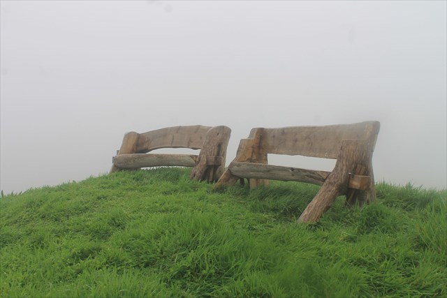
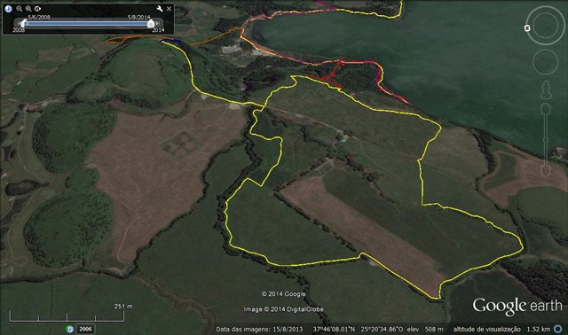
Este power-trail pretende divulgar o Laboratório de Paisagem das Furnas, que se insere na área de Paisagem Protegida das Furnas, do Parque Natural da Ilha de São Miguel. Este PT é constituído por 12 caches (11 caches tradicionais e 1 cache-enigma bónus). O PT é constituído pelo trilho do Pico do Ferro, o trilho do planalto e o trilho da Grená. Recomendamos que seja percorrido de forma circular, começando e terminando na zona das caldeiras da Lagoa das Furnas. Numa situação “normal” será percorrido em cerca de cinco horas.
Na zona do planalto, poderão visitar: a Floresta Encantada, a Serpentina, Os Arboretos do Reinfforce, a ICCA (International Congress and Convention Association), o MIT GREEN ISLANDS – WOODY BIOMASS/ Pomares de Uva-da-Serra e o SATA Forest. Também poderá visitar o PTLogo.
SATA Forest

Transportadora aérea regional SATA, foi criada a SATA Forestque tem vindo a ser plantada com o apoio dos colaboradores do grupo SATA. Numa das poucas pastagens das Furnas que não sofreu terraplanagens e que apresenta um micro relevo irregular, foi projetado com o apoio de ateliers consultores de arquitetura paisagista, um coberto arbóreo composto por grupos de diferentes espécies. O conceito é que cada destino da SATA seja plantado com uma espécie típica do mesmo, havendo uma distribuição espacial dos diversos destinos nesta pastagem de 12 hectares. Simbolicamente o primeiro destino a ser plantado foi a ilha de São Miguel, com uma das espécies arbóreas mais ameaçadas da flora nativa, a ginjeira-brava (Prunus azorica).
LABORATÓRIO DE PAISAGEM DA LAGOA DAS FURNAS

A Unidadede Paisagem da Lagoa das Furnas: é o extenso plano de água, complementado pela existência das caldeiras e fumarolas a Norte, que centralizam a composição desta paisagem e determinam a existência de elevadas potencialidades para o recreio e lazer. Ao longo da sua margem foram-se estabelecendo as atividades humanas de produção e de lazer, ocupando uma estreita faixa de contacto entre o plano de água e as vertentes abruptas que a limitam. Aqui localizam-se importantes valores culturais que testemunham a evolução desta paisagem e que constituem importantes elementos patrimoniais representativos da arte paisagística do séc. XIX: a Mata de José do Canto e a Mata da Grená. Posteriormente, assistiu-se à construção, nestas margens, de residências de veraneio com os respetivos jardins. As terras altas da Achada das Furnas integram esta unidade, que apresenta várias subunidades enunciadas na Fase B da elaboração do Plano de Ordenamento da Bacia Hidrográfica da Lagoa das Furnas.
A Área de Paisagem Protegidadas Furnas, com 3150 ha, situa-se no interior de uma caldeira que resultou do colapso da estrutura de um dos vulcões mais ativos de São Miguel, o vulcão das Furnas. A geomorfologia e hidrologia singular desta caldeira conduziram à classificação desta área como área de paisagem protegida. Destacam-se na paisagem, a lagoa das Furnas e os fenómenos de vulcanismo secundário, tais como os campos fumarólicos e as nascentes de águas termais.
O Laboratório de Paisagemé o homólogo dos parques tecnológicos, mas vocacionado para o campo das Ciências Naturais. Em vez de laboratórios e escritórios num edifício, existem canteiros e talhões experimentais ao longo da paisagem. Os estudos e as experiências, conduzidas ao ar livre, abarcam disciplinas como a Silvicultura, a Agronomia, a Horto-Fruticultura, a Biologia, a Ecologia, a Bioengenharia, a Biotecnologia, a Psicologia Ambiental, o Paisagismo, a LandArt e o Turismo.
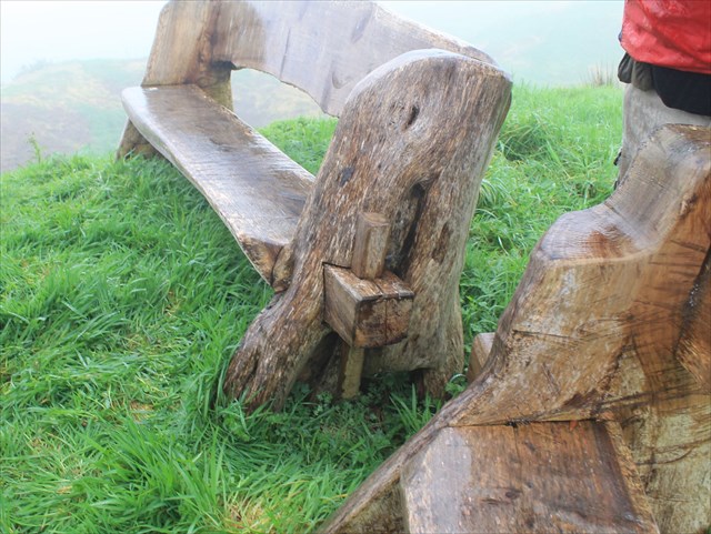
A CACHE:

A caixa tem um formato NÃO convencional.
Deve levar consigo material de escrita.
Por favor, não nem postem fotos que possam denunciar a cache.


FURNAS LANDSLAB
PT 9/11 – SATA Forest
ENGLISH

FURNAS LANDSLAB

This power-trail intends to promote Furnas Landscape Laboratory, which is included in the protected landscape area of Furnas, the Natural Park of São Miguel Island. This PT consists of 12 caches (11 traditional caches and cache 1-puzzle bonus). The PT consists of the Iron Peak Rail, the rail and the rail plateau of Garnet. We recommend that you traveled in a circular fashion, beginning and ending in the area of boilers of Lagoa das Furnas. In a "normal" situation is traversed in about five hours.
In the area of the plateau can visit: the Enchanted Forest, the Streamer, arboreta of REINFFORCE, the ICCA (International Congress and Convention Association), MIT GREEN ISLANDS - WOODY BIOMASS / Orchards Grape-of-Serra and the SATA Forest. You can also visit the PTLogo.
SATA Forest
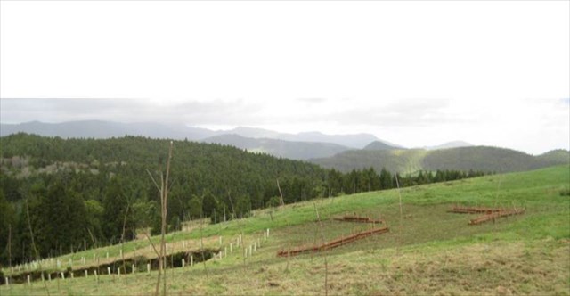
Regional airline SATA, SATA Forest was created which has been planted with the support of the employees of the SATA group. One of the few pastures Furnas not suffered earthworks and presenting a micro irregular relief, was designed with the support of workshops consultants landscape architecture, a tree cover consists of groups of different species. The concept is that each destination SATA is planted with a typical species of the same, with a spatial distribution of the various destinations in this pasture 12 acres. Symbolically the first destination to be planted was the island of São Miguel, with one of the most endangered tree species of native flora, the sour-brava (Prunus azorica).
LABORATÓRIO DE PAISAGEM DA LAGOA DAS FURNAS
The Landscape Unit of Lagoadas Furnas is the extensive water plan, complemented by the existence of boilers and fumaroles the North, that centralize the composition of this landscape and determine the existence of high potential for recreation and leisure. Throughout its margin were being established human activities of production and leisure, occupying a narrow contact zone between the water level and the abrupt slopes that limit. Here are located important cultural values that testify to the evolution of this landscape and that are important representative assets of the landscape art of the century. XIX: Joseph corner of Forest and Forest Garnet. Later, saw the construction, these margins of summer residences with the respective gardens. The highlands of Pembrokeshire Furnas part of this unit, which has several subunits set out in Phase B of the preparation of the River Basin Management Plan Lagoa das Furnas.
The Protected Landscape Area of Furnas,with 3150 ha, is located in the interior of a crater that resulted from the collapse of the structure of one of the most active volcanoes of São Miguel, the Furnas volcano. The geomorphology and hydrology of this singular boiler led to the classification of this area as a protected landscape area. Stand out in the landscape, the lagoon of Furnas and the phenomena of secondary volcanism, such as fumarolic fields and of the thermal springs.
The Landscape Laboratoryis the same technology parks, but devoted to the field of Natural Sciences. Instead of laboratories and offices in a building, there are experimental plots and plots across the landscape. The studies and experiments conducted outdoors, cover subjects such as Forestry, Agronomy, the Horto-Fruits, Biology, Ecology, Bioengineering, Biotechnology, Environmental Psychology, the landscaping, the LandArt and Tourism.
THE CACHE:

The box has a NO conventional format.
You should carry written material.
Please do not to post pictures that can report the cache.
