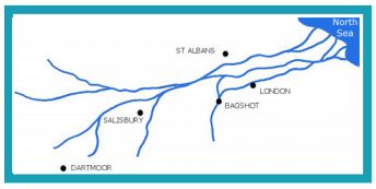
The Horsell Sand Pits are a very small part of the Bagshot Beds which were formed in the Upper Eocene era (around 33 to 56 million years ago) of the Paleogene Period. The “Great Bagshot River” flowed from south west England, across Salisbury Plain and through a huge part of southern England including Hampshire, Berkshire, Hertfordshire, Surrey and the London Basin and Essex where it flowed into the North Sea. The river deposited thick river sands forming the Bagshot Beds.
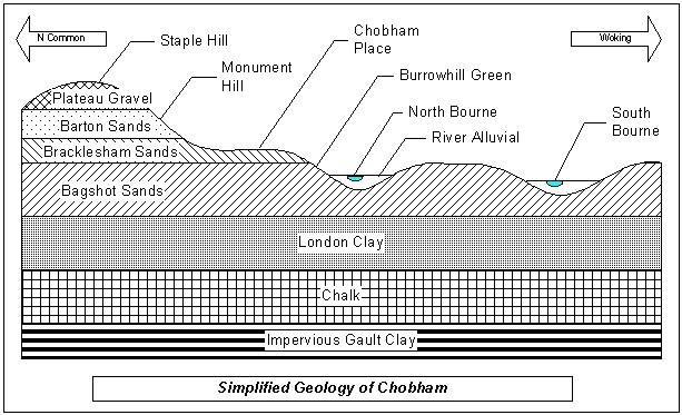
There are three recognised sub-divisions of the Bagshot Beds – the Upper (Barton) which are fine-grained, level bedded yellow sands; the Middle (Bracklesham) which are alternate layers of sand and clay, popular for brick making; and the Lower (Bagshot) which are mainly fine white, buff sands. The sand beds found on Horsell Common are part of the Lower “Bagshot” sub-division. The following diagram gives a visual explanation of the various layers found locally, being based on the area around Chobham, which is very close by:
From very early times much of southern England was covered with forest. Early inhabitants gradually removed the timber for fuel and building and used the land to grow crops and rear livestock. Once exposed to the weather, the sandy soil became poor and acidic and only low-growing plants such as heather and gorse that were able to survive in these conditions, were left. By the Iron Age, large areas like Horsell Common would have been open heathland.
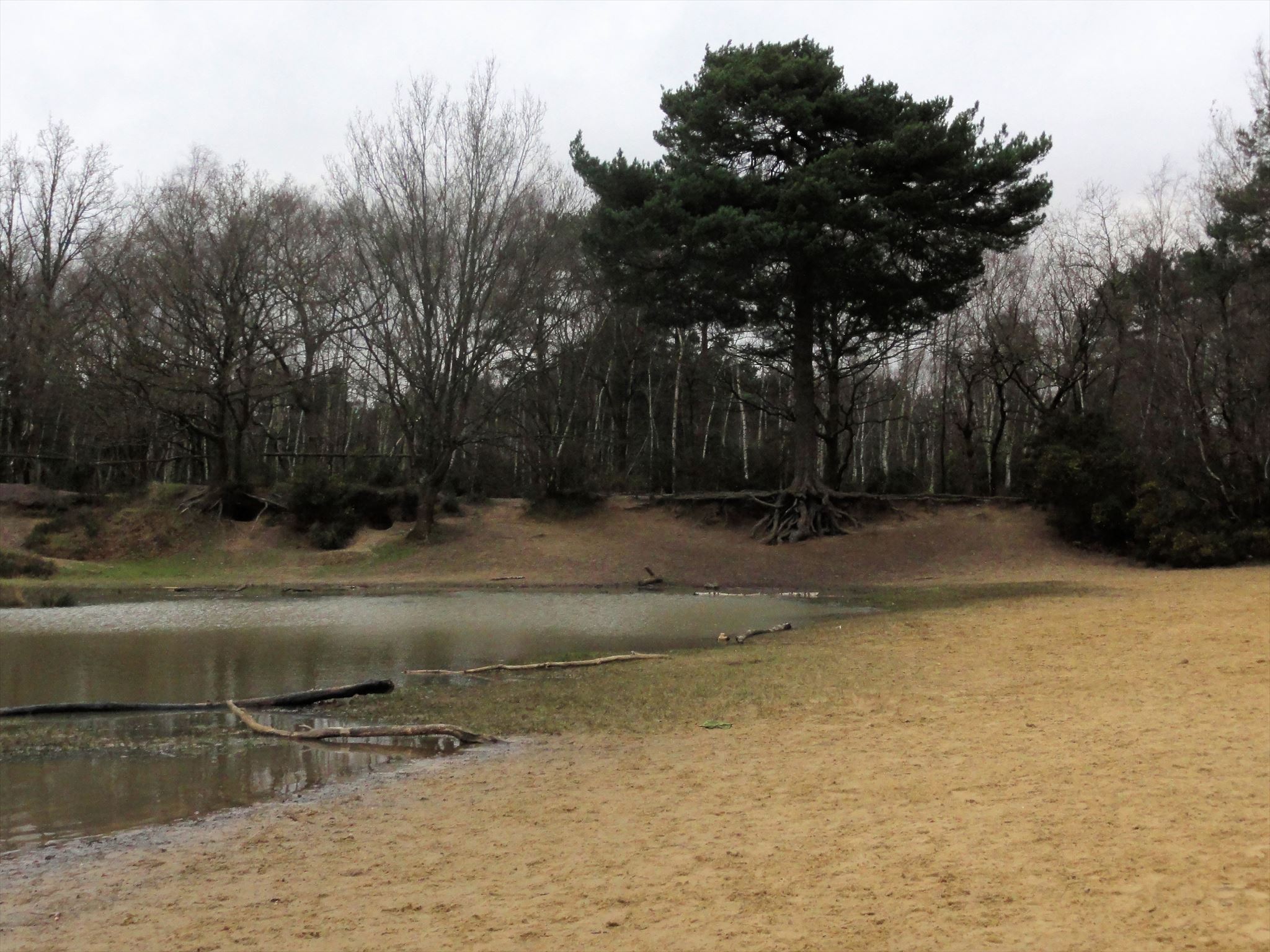
If you look carefully, you will notice that the sand in the middle, on the main slope of the Sandpit is different to the sand around the water and around the edges of the pit where the tree roots have exposed ‘new’ sand. This is because when excavation of the pit ceased in the 1960s it was partially filled in for safety reasons with sand from another area to create the slope. The best place to find Bagshot Sand is to look around the exposed roots of the large tree at the right hand end of the Sandpit (if you are standing on the beach, facing the water), but please do not cause further erosion by digging out sand from the roots.
Please visit the location given and e-mail the answers to the following questions to us through our profile page. You don't need to wait for our response before logging your find, but please do not post any of the answers in your log! If there are any problems with your answers, we will contact you.
- Describe the colour and texture of the sand around the roots of the large tree.
- Do you think this matches the description of the Bagshot Sand given above?
- How does this differ from the colour and texture of the sand in the main area of the Sandpit?
- Is the sandy soil good for growing crops?
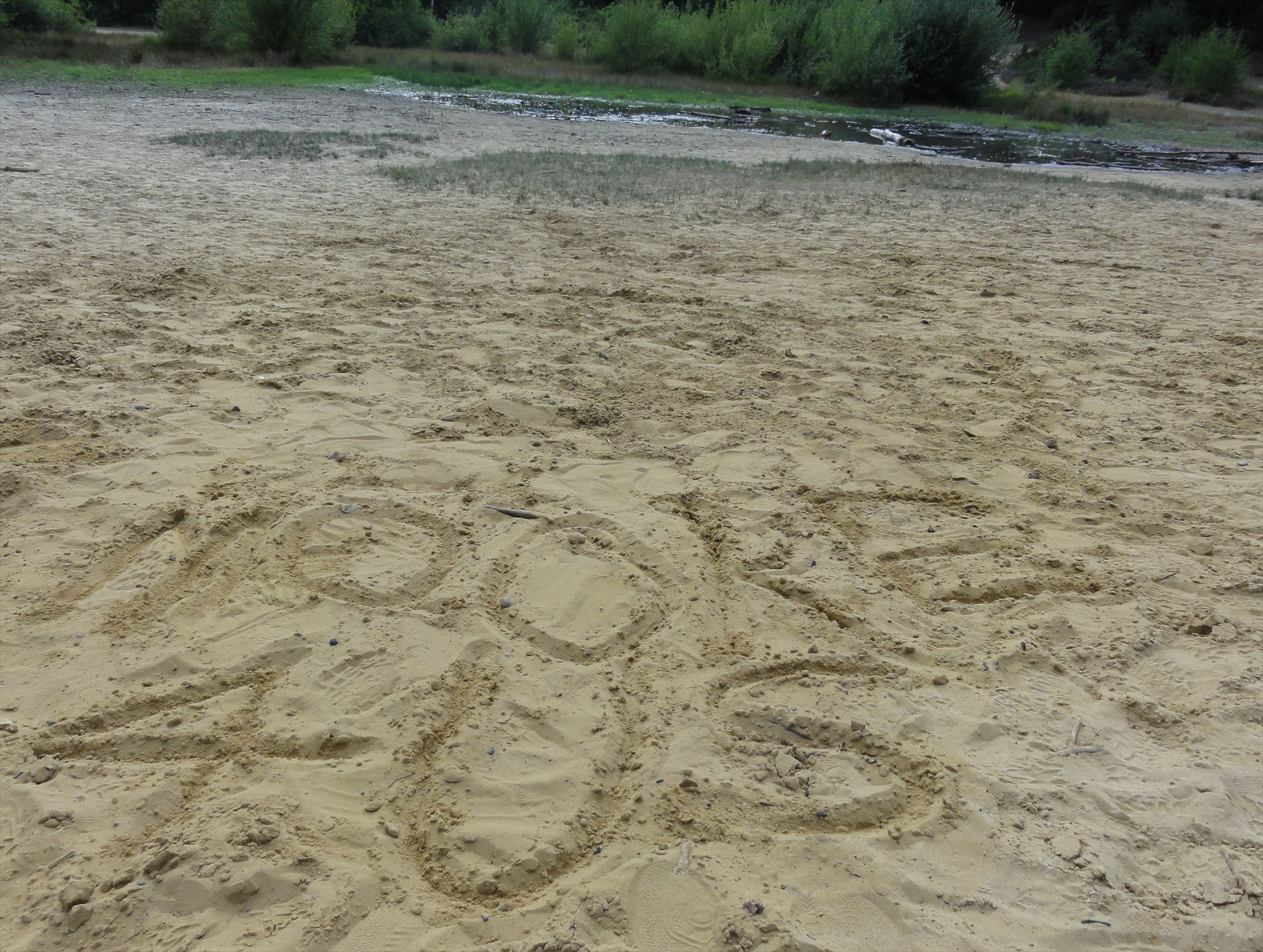
As an optional extra, in place of a physical logbook, you may like to include a photo of your geocaching name written in the sand (muggles allowing of course!).
Please make sure that young geocachers are properly supervised when near the water and that geo-dogs do not get too over-excited in the water and soak nearby muggles!
We would highly recommend allowing plenty of time to do this Earthcache so that you also have time to walk around and enjoy Horsell Common. There are also some traditional geo-caches to find nearby.
Horsell Common is designated as a Site of Special Scientific Interest (SSSI) and this cache has been created with the kind permission of the Horsell Common Preservation Society. Please therefore respect the area and keep to the defined paths where possible.
The information for this Earthcache has been gathered from several sources but our special thanks go to David Stokes for the use of the Chobham Diagram and to Iain Wakeford for the use of the Bagshot River diagram.