The purpose of this earthcache (and EVERY earthcache I’ve authored) is to provide children (and adults like me who know very little about the environment) with an opportunity to increase their knowledge-base and, like me, to develop a deeper appreciation for the world we live in. The lessons and related questions are brief, easy to answer and easy to remember for a lifetime!
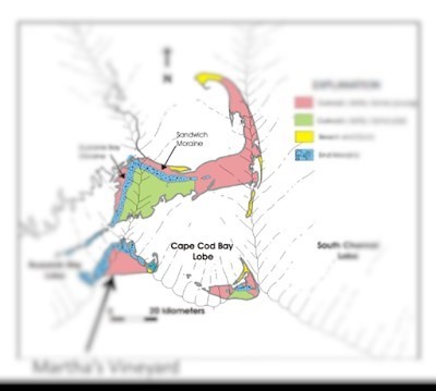
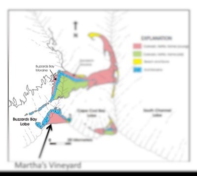
The Wisconsin Glacial Stage is the best known and most recent of the glaciers that affected North America and helped establish its landscape. At one point in time, ice covered most of Canada, the Upper Midwest and New England as well as parts of Montana and Washington state. Nantucket, Martha’s Vineyard and other Massachusetts’ islands such as the Elizabeth Islands and Rhode Island’s Block Island were formed by moraines (sediment ridges) left by the retreating glacier. The current landscape of Martha’s Vineyard was created at the junction of two glacial lobes (or ‘fingers’): The Buzzard’s Bay Lobe and the Cape Cod Lobe. The pictures below highlight both lobes, and where they meet on the Vineyard; near the formation of the ‘V’-shaped inlet of Vineyard Harbor in Tisbury.
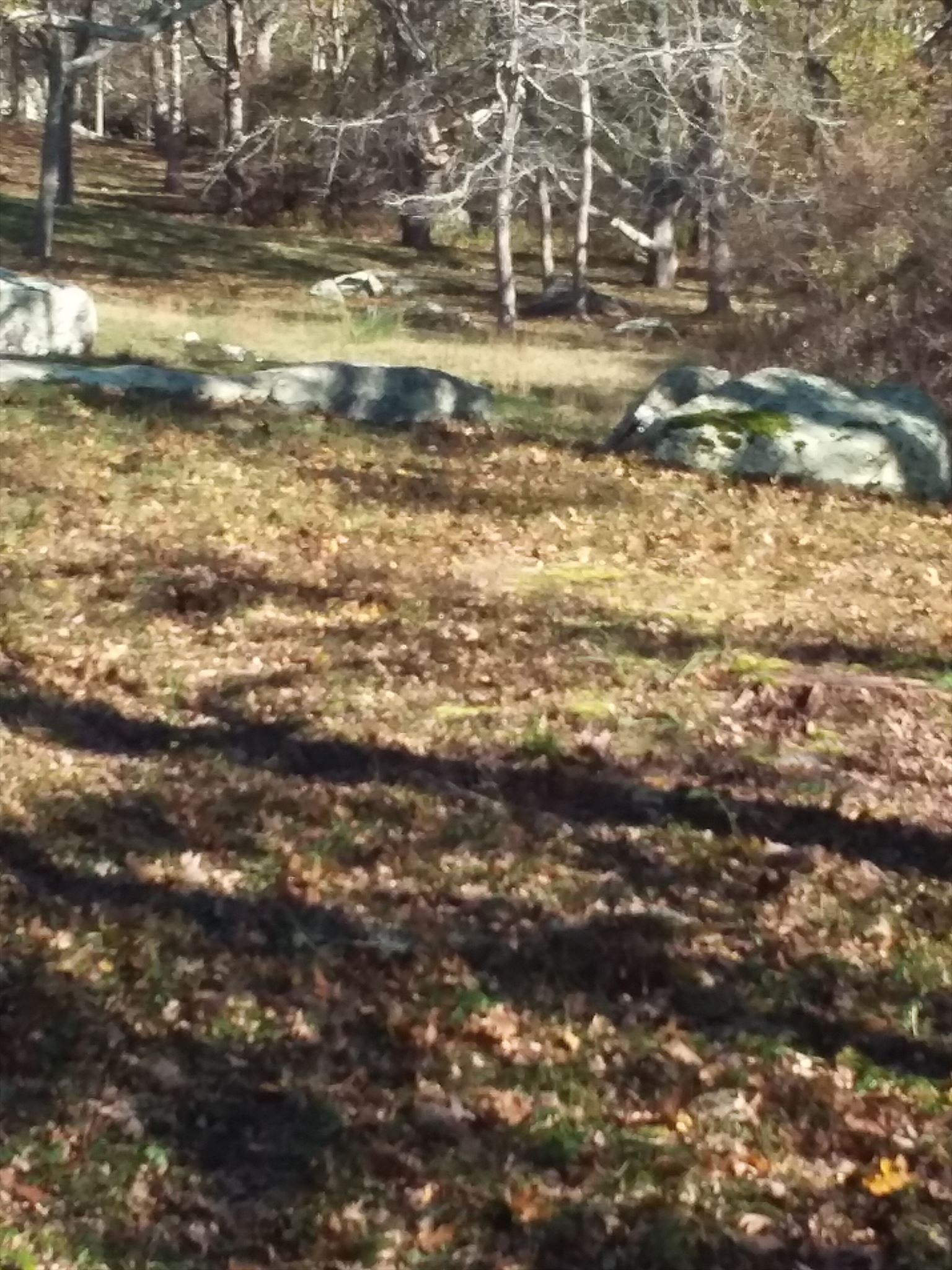
Rock debris and glacial till (sand and clay) pushed south by the great sheets of ice were left behind after the glacier retreated. Throughout the island, but more pronounced along its western side (The Buzzard’s Bay Lobe side), are moraines (small hills formed from glacial deposits) and boulders strewn about over the landscape. Once you’ve arrived at the posted coordinates, you will notice a number of large boulders in a field. These boulders were left by the Glacier and are referred to as ‘glacial erratics’. A glacial erratic is a piece of rock that differs in size and type native to an area that were carried by the glacier over distances of many hundreds of miles.
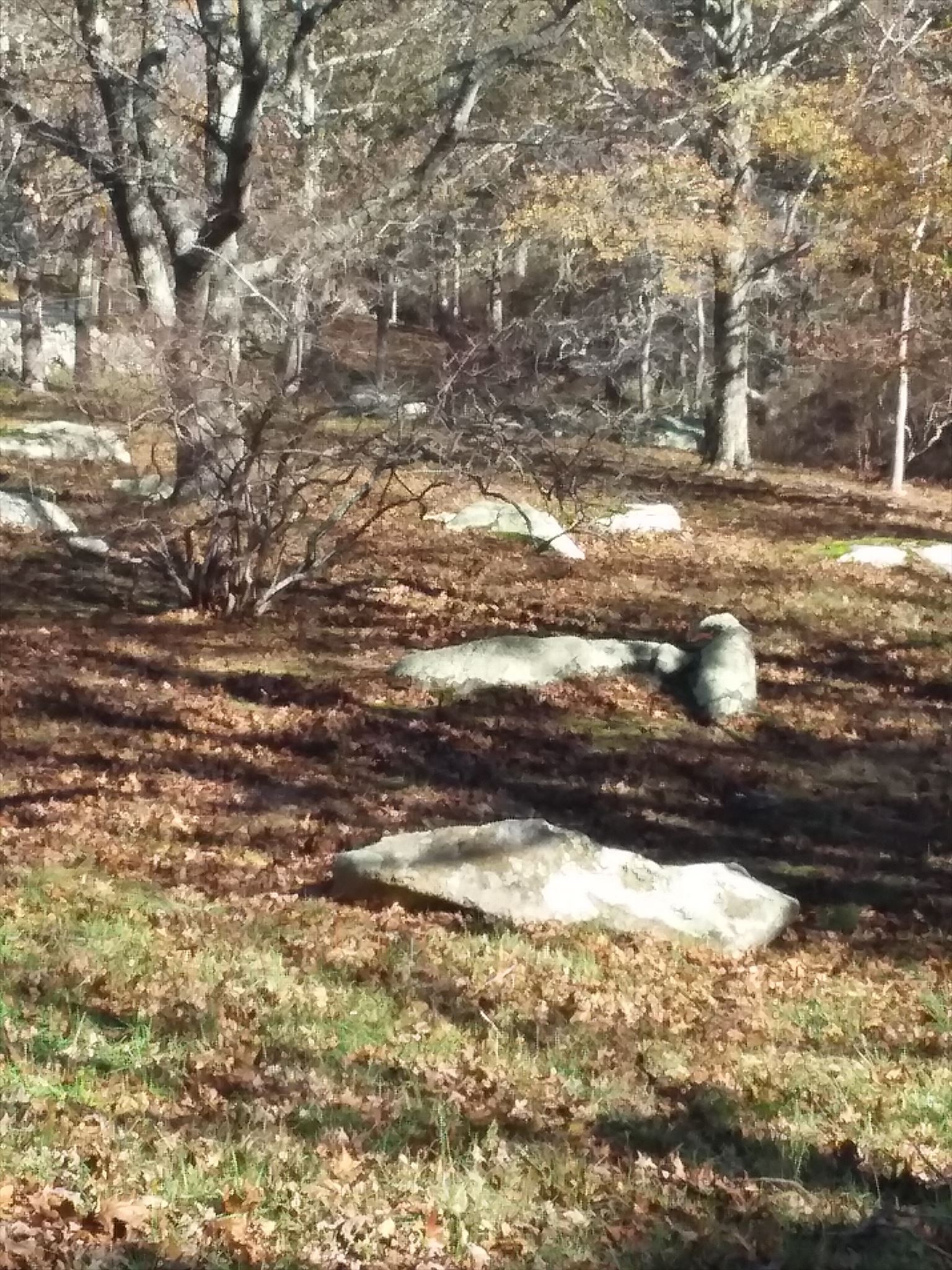
Erratics can range in size from pebbles to large boulders such as Waskosim’s Rock located near this cache’s coordinates. (Waskosim's Rock once served as a benchmark for establishing the boundary between lands of the native Wampanoags and property claimed by English settlers.)
Please answer the following. Do not include the answers in your log, but send them separately to me. Those of you who answer correctly will get the smiley! Rock on!
- In the field of geology, what does the term ‘erratic’ commonly refer to?
- At the listed coordinates there is a particular glacial erratic that has 2 unique features that set it apart from all of the other boulders in the field. What are they?
- Roughly how long ago was the Wisconsin Glacial Stage that moved south from Canada and formed modern-day Martha’s Vineyard?
- What were the names of the two ‘finger’s or lobes of the Wisconsin Glacier that formed Martha’s Vineyard?
Related EarthCaches on the mainland:
- Brrr.... Harding's Beach and Glaciers GC3BNDF by Teamdsjwk
- The Wisconsin Connection GC6J7F4 by Groopsoop
- Doane Rock GCZDAZ by Geo Squad
- Cape Cod Kettle Ponds GC19J06 by Koneko
- Abram’s Rock EarthCache GCB192 by 4Swans
Be sure to also visit nearby GC24BHJ (Up Island—without a pencil). Your trek to the cc will include passing by several examples of glacial erratics.
| I am a proud |
 |
Resources:
Wikipedia (Glacial Erratics)
Shultz, Christine. Home of the Moraines: The Unsettling Geology of Martha’s Vineyard. Martha’s Vineyard Magazine. December 1, 2005.
The Making of Martha’s Vineyard. New York Times. Online.
Moore, Adam. Ecstatic for Erratics. Vineyard Gazette. January 21, 2010