Welcome to The Spit in Scituate Massachusetts!!
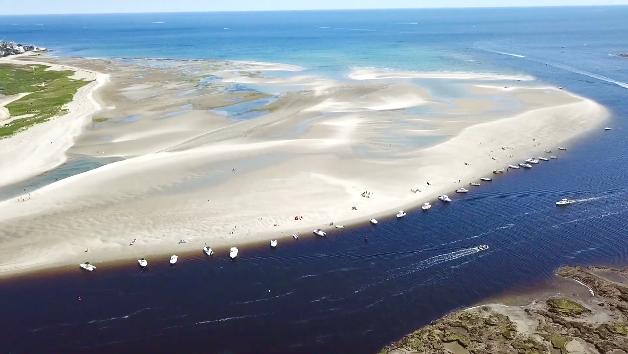
Formally known as Rivermore Beach, this sandspit is one of the most popular beaches in Scituate during the Summertime. The Spit is most commonly accessed by boaters from the North and South River, Scituate Harbor, and other locations. Many people also enjoy kayaking, canoeing, paddleboarding, or sailing out to the Spit. This mostly rock free sandy beach allows you to park and even beach almost any type of boat. Rivermore Beach is the only beach in Scituate that allows boats and other watercraft to park along the beach. It is also the only beach of its size in Scituate without a designated parking area or lifeguards.
Above the high tide mark, the spit has grassy dunes home to the endangered Piping Plover. Their nesting areas are fenced off seasonally so please do not walk through the dunes.
There is limited sandy beach during high tide, so low tide is always the best time to come to the Spit. The beach expands nearly four times its area during low tide, and if you walk Southwest from its high point, the low tide level is nearly 2,000 feet from the high tide mark.
Prior to 1898, a road from Scituate’s mainland use to travel through what is now the Spit to fourth cliff, Humarock, which is part of Scituate. The Portland Gale (1898), caused the breakage of land between the North River and the Atlantic. During this extreme storm, third and fourth cliffs became separated by land, and Humarock became a peninsula. The mouth of the river grew years afterwards, eventually into a very well developed channel to the North and South Rivers. Now from Humarock you need to drive through Marshfield to get to the rest of Scituate.
Logging Requirements:
To log a Found it on this virtual you must please:
Visit the cache during LOW TIDE and take a picture of yourself or a picture that is personal to you or your geocaching account at the coordinates.
Your picture should preferably be a picture (or selfie) of you or your group at the posted coordinates. A picture of your gps or another geocaching item that is personal to you or your geocaching account is also acceptable.
The picture must be:
Personal
From the posted coordinates
During low tide
Uploaded with your log
And must have the background in the distance such as fourth cliff, the windmill, the length of the spit, etc. A picture angled with only the sky in the background or just the sand on the ground is not acceptable.
Thank you!!
To travel to this cache, you must look at a tide chart to plan your trip. There are plenty of online tide charts you can use. During high tide the cache is located in the middle of the water. The cache is easily accessible 90 minutes before or after low tide. So if low tide is at noon, anytime between 10:30am and 1:30pm should give you plenty of beach to walk on.
There are quite a few different ways to get out to the Spit.
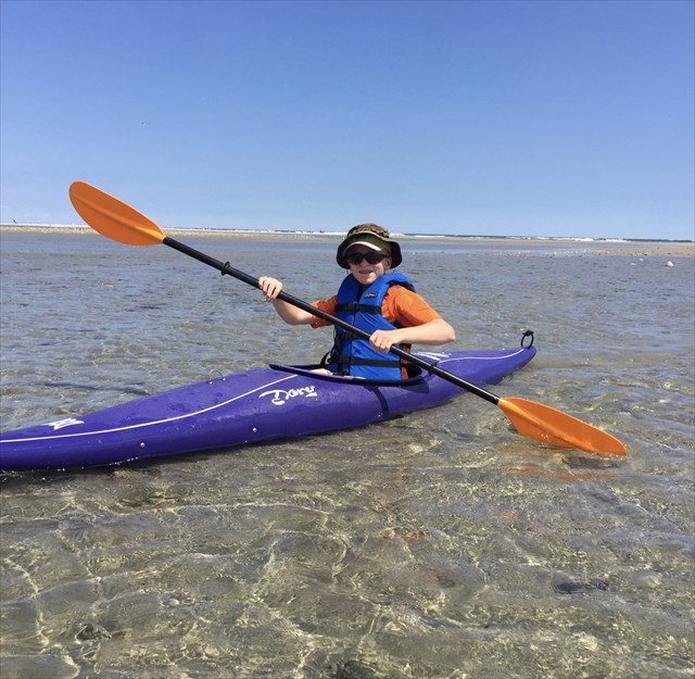
My favorite way is to launch a kayak from the Driftway boat launch. When planned with the current, this should be about a 30 minute paddle. Although it is possible to kayak against the current, it can be more difficult.
If you don’t want to kayak, you could also ride a bike from the driftway launch to the boardwalk trail at Third Cliff. Ride on the bike trail on the driftway, turn right, and turn onto Moorland Road. Although there is no public parking at the trailhead, you can still find a place to park your bike and walk out to the cache.
The easiest way out to the Spit, if you have someone who can drop and pick you up, can be to get out on the public access point by the boardwalk trail. There is unfortunately no parking.
My other favorite way is to start from Peggotty Beach. If you want a fun and scenic long walk, you can park at Peggotty and walk along the seawall most of the way out to the spit. You do not have to walk along any roads or private yards. Although the sea wall is in good shape most of the way, this walk can still be challenging or dangerous for some because of the rocks. Peggotty Beach has limited free parking spots, the rest of the lot is sticker required.
If you don’t have a Beach sticker, you can park at Cole Parkway and walk to Peggotty. Please keep in mind that this is a very long walk (6 miles roundtrip) and you should plan on a few hours if heading out this way.
If you still want to park and walk from Peggotty, but don’t want to walk the sea wall, you can still walk from the Beach to the boardwalk trail by the roads. From Peggotty Beach you can use Town Way to Gilson Road, and Collier Road.
Although the distance on the map may be tempting, please DO NOT EVER attempt to SWIM to the posted coordinates from Fourth Cliff or Trouant Island. Extreme currents and heavy boat traffic at the mouth of the river makes swimming a dangerous situation. Multiple people have died at the mouth of this river.
Although you can easily walk out here by land, you still may have to wade in the water to get out to the cache. Although the Spit is always changing, there is usually a tidal pool in the middle somewhere with a stream going to the river. You may have to cross the stream, or you might be able to go around it. Every year the formation of the sandspit significantly changes, so some years there might not be a stream at all and you can keep your feet dry all the way out.
Enjoy your day out to the Spit and be sure to bring plenty of water and sunscreen!!
Have fun!!
Congratulations to bogeyscache for the First To Find!
Virtual Rewards 3.0 - 2022-2023
This Virtual Cache is part of a limited release of Virtuals created between March 1, 2022 and March 1, 2023. Only 4,000 cache owners were given the opportunity to hide a Virtual Cache. Learn more about Virtual Rewards 3.0 on the Geocaching Blog.