Nesfield . . . Nice!
This multi-cache will take you around the delightful historic village of Nesfield and should take around 30-40 minutes to complete.
It became placeable after the 3/1/22 archiving of fat bloke's GCX9RM Nesfield Post which was hidden nearby on 23/7/06 garnering an impressive 362 finds and 8 FPs during its nearly 16-year life.
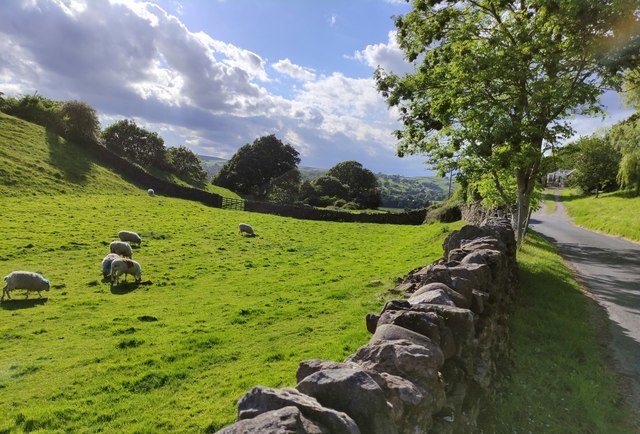
To reach the cache location: there is no public parking in the village itself so you will need to park at the nearest location available - in the off-road space @ N 53 56.213 W 1 51.426 taking care not to obstruct the 3 field access gates, and then walk the 500m along the lane to reach the starting point.
To Find the Cache:
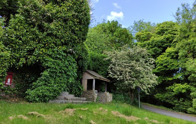
Step 1: at the published coordinates, you will be standing by the quaint old postman's shelter where a plaque states that the original 1926 structure was restored in 200A by Nesfield residents for your enjoyment.
Step 2: proceed a short distance up the lane to N 53 56.486 W 1 51.487 the location of telegraph pole numbered 2B0 near the round road mirror.
Step 3: follow the lane up to the left to N 53 56.502 W 1 51.520 outside a fine residence with a decorative circular cobbled feature on the ground in front of the entrance gates. In the centre of this are two letters - the alphanumeric (A=1 B=2 C=3 etc) value of the 2nd letter = C
Step 4: now walk up and onto the lovely small triangular village green where @ N 53 56.521 W 1 51.534 there is a well-weathered wooden memorial bench. On the plaque, you will see that Geoffrey's unusual surname has D letters in it
Step 5: continue westwards across to where @ N 53 56.525 W 1 51.564 you will see a potentially life-saving yellow box on the wall. A blue panel on its door illustrates a total of E steps to be followed
Step 6: carry on up Briggate to N 53 56.583 W 1 51.633 where you will be standing outside a lovely old cottage above the door of which is a plaque with the initials WR and the year 17F0
Step 7: proceed a little further up Briggate to N 53 56.593 W 1 51.635 where you will be outside another delightful cottage which has a plaque above the entrance with its name and the image of a bird which has G letters in its name
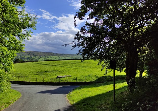
Step 8: now retrace your steps down the hill - admiring the wonderful views to the east and the south towards Castleberg and beyond - and back at the junction, take the lane to the right which goes down to the main Gill Lane. Follow this west a short distance to the familiar red box @ N 53 56.543 W 1 51.629 - an old style telephone kiosk.
Go inside and note that the last digit of the well-presented phone number associated with this box = H. The same number is shown at the foot of the BT poster - with an incorrect spelling of the village name!
Step 9: now turn around and head back east along the lane to N 53 56.509 W 1 51.589
where you will see a stone inscription on the end of a stone wall near the entrance gate of this historic building. There are J words in this inscription.
The cache is hidden at:
N 53 56.EB(J-G) W 1 51.(D-F+4)(A-C)(H+5)


Nesfield is a small village, 3.2km north-west of Ilkley on the north bank of the River Wharfe, and lies in the civil parish of Nesfield with Langbar, Harrogate district, North Yorkshire. Historically in the West Riding of Yorkshire, it sits on the southern edge of the Nidderdale Area of Outstanding Natural Beauty.
Prior to the Norman Conquest the manor of Nesfield was held by Gamelbar, a Saxon who held many manors in Wharfedale and the Nidd Vale. Afterwards, it is recorded in the Domesday Book as belonging to Lord William Percy and as having two ploughlands - a measure of land used in the northern and eastern counties of England after the Norman conquest, based on the area able to be ploughed in a year by a team of eight oxen.
Its name derives from a mixture of Old English and Old Norse, Neates-feld, which means open land where cattle were kept. The name has been recorded in different forms at least a dozen times, being Nacefeld in the Domesday Book, Nesfeld(e) in Qwhorfdale in the 15th century, and even Nesfeild (with the i and e reversed) in the 17th century.
Other sources state: [Its name is] Anglo-Saxon in origin and means ‘field by the cliff' as ‘nes’, ‘nace’ or naze’ means cliff or very steeply sloping land.
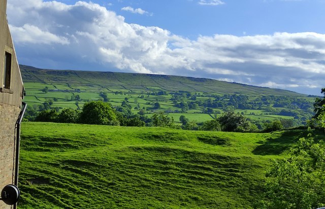
However, the history of the settlement predates the Domesday Book as immediately to the south-west of the village is the remains of Castleberg Hillfort (see here and here), an Iron Age or Roman fortified location. Many artefacts have been found on the mound including a copper key almost 2 feet (0.61 m) long (thought to be the key for gates to the Roman compound), urns and human bones.
However, this is all conjecture and there is no evidence to support the idea that Castleberg was part of the Roman Empire in the area, although Ilkley (Olicana), was known to have had a Roman settlement/camp.
The site is 120m above sea level, and is thought to have attracted early settlers as the ground around Castleberg falls away from the raised patch of land in all directions, so being naturally defensive.

At the 2011 Census Nesfield had a population of 180. In 2015, North Yorkshire County Council estimated the population to be 170.
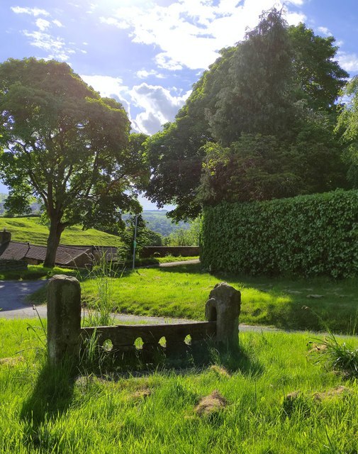
The Grade II listed stocks at the east end of the village date back to the 18th century. A church, known as Christ Church, able to seat 120 people was consecrated in the village in August 1892 on land donated by the Duke of Devonshire. Due to a lack of attendance, it was demolished in 1955.
Besides agriculture, the other main industry in the village was a bark mill, which only operated during the 19th century using horse or donkey power to grind up oak bark for use in tannery.
A suspension bridge across the River Wharfe, erected in 1896, connects the village via West Hall to Addingham on the south side of the river.
See here for a fascinating comprehensive 2011 Conservation Area Appraisal for Nesfield which covers key aspects of the village, including history and architecture.
