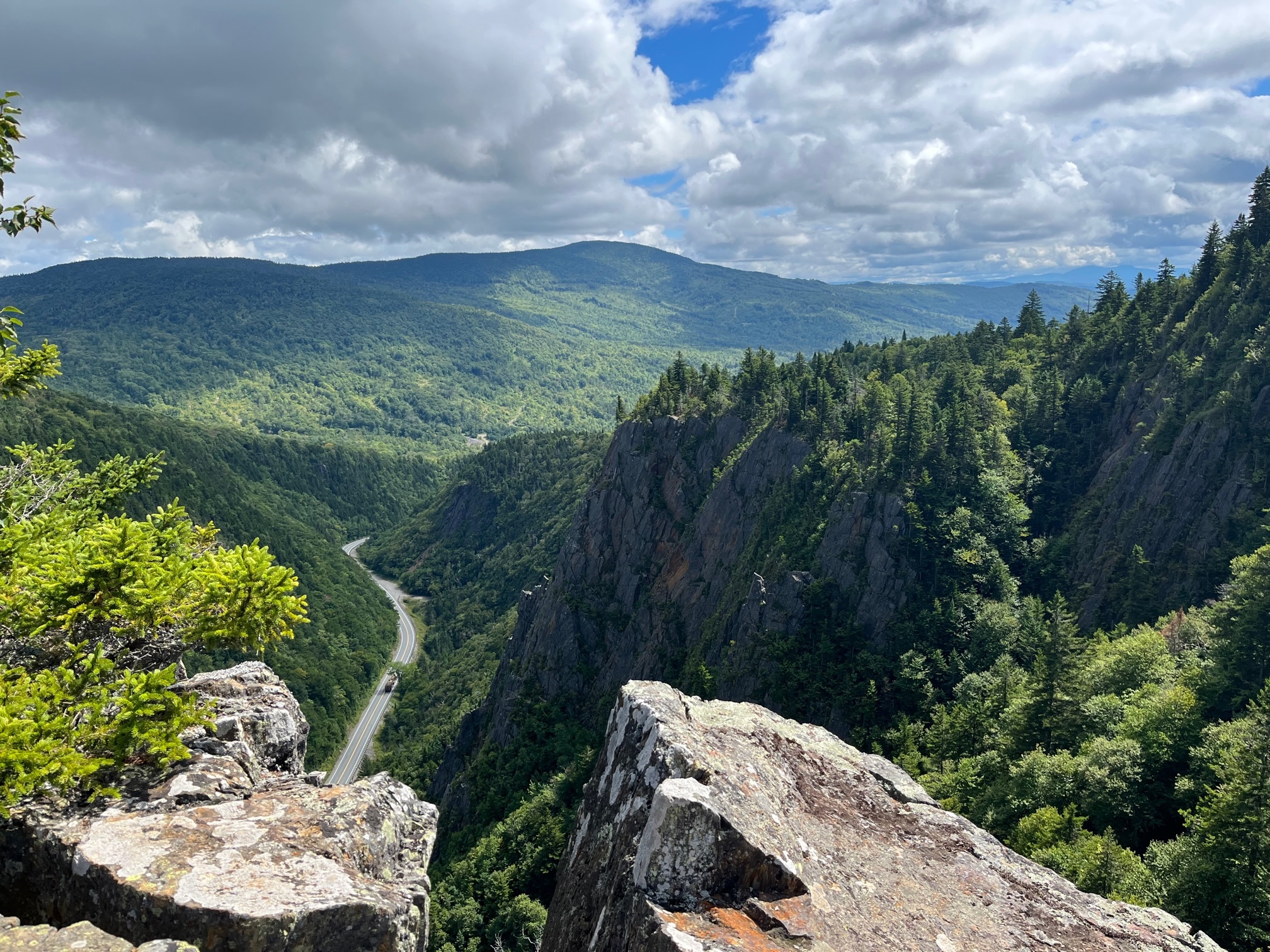
Table Rock is located within Dixville Notch State Park in the Great North Woods region of New Hampshire. The tiny community at the base of the notch is famous for gathering at midnight on primary day to cast the first ballots in the New Hampshire primary as well as the U.S. presidential election. The tradition started in the 1960 election, and all elligible voters gather at midnight in the ballroom of The Balsams. The voters cast their ballots and the polls are immediately closed once all the registered voters have voted, often within minutes and the results are immediately broadcasted around the country. The high rocky pinnacles which rise on the south side of Dixville Notch are like no other place in New Hampshire. It is a rugged and wild area on the side of Mt. Gloriette and the tallest of these crags is known as Table Rock.
Beginning roughly 3 million years ago, there was an Ice Age where there were colder, shorter summers, which prevented winter ice buildup from melting each year. As the global temperatures dropped, the Laurentide Ice Sheet formed and moved from Canada south into what is now New England. The entire White Mountains were covered in ice sheets that could reach more than a mile high. The Laurentide Ice Sheet had a huge impact in shaping the mountains by carving U-shaped valleys (in contrast, rivers carve v-shaped valleys), which began to appear as the glacier retreated approximately 18,000 years ago. Retreating ice left behind glacial erratics (rocks made of different materials from more northern locations), long straight scratches in the bedrock called striations, and concentric gouges, scars where moving ice gouged the bedrock with rocks that were imbedded in its ice.
While glaciers shaped this region long ago, there is another process that is continuing to this day and while it might not be as prominent, it plays just as important of a role. Weathering is the process by which rocks, soil, and minerals are broken down through contact with Earth's atmosphere, water, and biologic resources. There are three types of weathering, physical, chemical, and biological. Physical weathering is primarily caused through frost wedging, when water seeps into cracks within the rock (usually found along zones of weakness within the rock), and when the water freezes, it expands. This process continues until eventually a piece of the rock breaks away. Another example of physical weathering is exfoliation. This occurs when cracks develop parallel to land surfaces, and it almost looks like "layers" of the rock are being broken apart. Chemical weathering takes place when rain water reacts with minerals within the rock. In most cases, the water is slightly acidic. Lastly, biological weathering takes place when tree roots grow in between cracks within rocks, and as the root grows, it breaks apart the rock. Algae and lichen that live on rock may also produce chemicals that break down the rock so they can obtain the nutrients needed to survive.
Please use extreme caution in this area as there is a steep drop off on either side. All observations can safely be made from the start of the viewpoint.
Logging Requirements:
- Looking around, what evidence of glacial activity are you able to see?
- What form of weathering do you think is most prominent here?
- While here, you may notice that there are many cracks that appear to run vertically. Why do you think this is the case and how do you think this influenced the formation of Table Rock?
- Upload a photo taken from the viewpoint at Table Rock. You don't have to be in the photo though it is strongly encouraged.