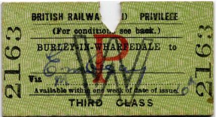
SideTracked - Burley in Wharfedale
This short multi cache belongs to the SideTracked series. More information can be found here. It is placed in recognition of a Eeee Bi Gum and Er Indoors previous cache of the same name, which was placed on 7/9/2008 and archived on 3/4/24 after 162 finds.
After parking at N 53 54.536 W 1 45.212 or further along Station Approach - or even, if you can find space - in the station car park - head for the station, onto the platform.
Step 1: turn left and head south down the Up platform to N 53 54.463 W 1 45.170 where you will see a yellow plate on the wall with the underlined number 20A on it.
The fascinating Railway Signs and Signals of Great Britain web site - amazing what you come across on the web! - does not seem to have this sign (which looks new) but it is believed to be the distance in miles from the Datum (see below) and to mark the transition between the ILK1 and ILK2 lines.
Step 2: continue to the end of the platform where from N 53 54.453 W 1 45.161 you will be able to see that the number on the signal ahead of you is L39B8.
Step 3: looking at the fence in front of you, you will see a blue and white Network Rail sign for the station on which you will note the engineers line reference (ELR) of ILK1 identifying the line as the Ilkley Branch (ILK) Apperley Junction to Burley and the distance from the Datum (St Pancras via Cudworth) expressed in miles and chains as 207m 7C chains*.
* As the majority of railways were built in the 19C, for convenience older units of measurement have continued to be used rather than converting all records to modern standards.
Step 4: retrace your steps back along the platform and make your way up the footbridge steps, where at the top @ N 53 54.494 W 1 45.200 you will see a small identifying plaque. The number after ILK = D
Step 5: continue across the bridge, which is soon to be refurbished to bring it up to the required standard and allow the overhead rail cables to be detached from the underside of the bridge. Descend the other side to N 53 54.485 W 1 45.212 where you will be standing in front of a Northern network map with a key below for locations.
On this you will find that Leeds has the map code HE.
Step 6: walk along the Down platform as far as N 53 54.476 W 1 45.194. Looking directly across the tracks from here, attached to the opposite platform wall, you will see a white plate with a small red square, a sliding block and some 3 lines of figures on it.
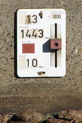
This is a Datum Plate used to assist in rails maintenance and to ensure they are in the precisely correct position. The top figure is the plate number (in this case 7) the middle figure is the distance to the running edge of the nearest rail and the lower is the cant (here it is 65mm) - this is the difference in elevation (height) between the 2 rails, which helps a train steer around a curve, keeping the wheel flanges from touching the rails, minimizing friction, wear and rail squeal. In UK the maximum is about 150mm.
The block can slide up and down and is set at the precise level of the running edge. The small red block indicates that there is some small leeway when doing track geometry work. With green block ones the work must not change any values.
With this plate the distance to the running edge is 78F mm.
The cache, a small camo-taped, screw-capped pot is hidden at:
N 53 54.BAE W 1 45.D(F-5)(C-4)

Burley-in-Wharfedale railway station lies on the Wharfedale Line which is like a two pronged fork, one line runs from Leeds, initially on the Airedale Line, before leaving this at Apperly Bridge, on a single line to Esholt Junction where it joins the Bradford line, and then runs on to Guiseley the 1st station for Leeds trains.
The other line starts at Bradford Foster Square, calling at Frizinghall, Shipley (where it crosses The Airedale Line), and Baildon stations. It then joins the Leeds branch to form the handle of the fork running via Guiseley, Menston, Burley in Wharfedale, and Ben Rydding before terminating at Ilkey.
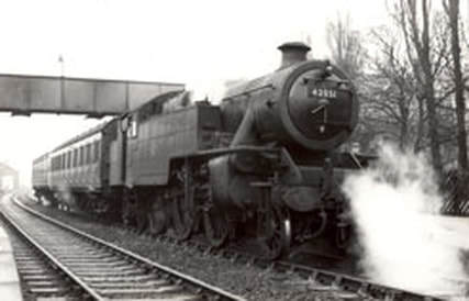
The line was originally owned by the Midland Railway from Leeds to Burley-in-Wharfedale. At this point the line became joint property, with the North Eastern Railway, and was known as the Otley & Ilkley Joint Railway (O&IJt). The line originally carried on from Ilkley, this Midland line served Addingham, Bolton Abbey and Embsay to Skipton.
The section from Embsay to Bolton Abbey has been reopened by enthusiasts and operates steam locomotives as the Embsay and Bolton Abbey Steam Railway. A branch also left between Menston and Burley calling at Otley and Pool before joining the Harrogate Line at Arthington. The Otley By Pass follows the line of this former track. High Royds Hospital also had its own branch line.
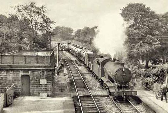
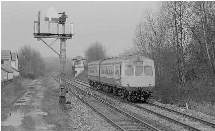
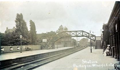
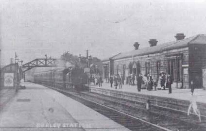
The station was opened in 1865 and was once the junction for the line to Leeds via Otley. This route closed in 1965, as a result of the Beeching Axe. The station building still stands, but is now privately owned. Since October 1968, the station is unstaffed.
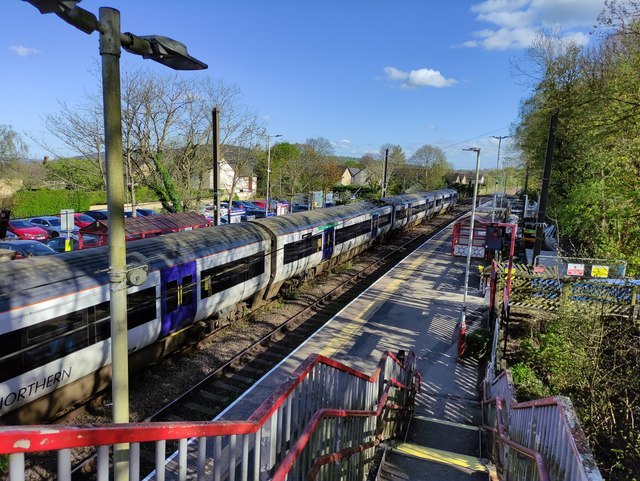
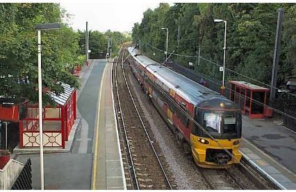
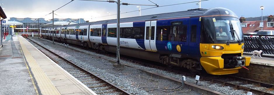
The line was electrified between 1994 and 1995, and is mainly served by four-British Rail Class 333 electric multiple units (EMU) operated by Northern Rail.
In March 2022, tactile paving was installed along both platform edges and there are plans for the platforms to be extended to allow for 6 carriage trains.
Although unstaffed, the station has a self-service ticket machine in place to allow passengers to buy before boarding; this can also be used to collect advance purchase tickets. Waiting shelters are provided on both platforms, which are linked by footbridge (step-free access is however possible to both via nearby streets). Train running information is offered via CIS displays, automated announcements and timetable posters.
The Burley Community Library has extensive online historical information on the station and the line with numerous fascinating photos.