As the walk is closed at the moment - please submit a photo of anything with you in it to prove that you were here....
Still a great spot to visit
Mangapohue
Natural Bridge
The gps co-ordinates are for the car
park.
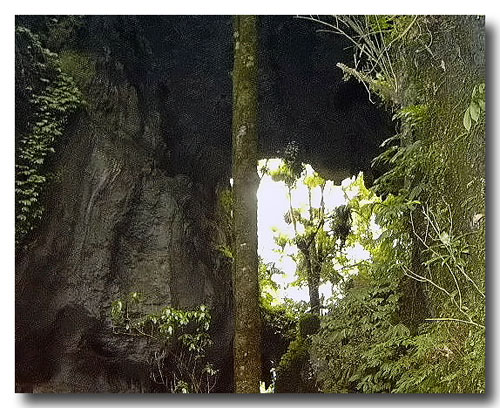
Situated 25 kms west of Waitomo Village, the
Mangapohue Natural Bridge is a 17metre high limestone arch which
spans the Mangapohue stream. It is all that remains of an ancient
underground river system that has collapsed over time. The
stalactite studded ceiling is evidence of what was once a giant
underground cavern. The 25 minute walk takes you over a trail where
you will see fossils 30 million years old. Glowworms appear at
night, and if you're extra lucky, long tailed bats....
Follow the track in until you come to the
bottom of the main stair case and you will see a display board, on
this board is information about the cave.
Your mission is to email me (do not include it
in your log) the background colour on the right hand side of this
board and also include a photo of you holding your gps somewhere
within the cave system (include the photo with your log) for proof
of having visited here.
Sorry but as of 1st December
2007, no logs will be accepted without photographic proof of your
visit due to a few from around the world who see fit to couch-cache
spoiling it for everyone....