
Deutsche Version
Die Suche nach dem Cache führt Dich in eines meiner Lieblingswandergebiete – die Sächsisch-Böhmische Schweiz. Durch das Zusammenwachsen des sächsischen und des böhmischen Teils hat sich die ursprünglich von mir geplante Route etwas verkürzt. Abhängig davon, welchen Weg Du wählst, liegt die zu absolvierende Wanderstrecke ungefähr (!) zwischen 25 und 33 km. Mit etwas Eile (speziell an kurzen Wintertagen) ist es möglich, die Suche an einem Tag zu schaffen. Willst Du Dich allerdings auch links und rechts des Weges ein wenig umsehen, was durchaus lohnenswert ist, solltest Du eine Übernachtung einplanen, preisgünstige Möglichkeiten dazu sind vorhanden. Wenn Du die preisgünstigste wählst, sieh zu, dass Dich die grünen Schergen nicht erwischen ;-) Wenn Du Dich nicht für die etwas grenzwertige Abkürzung (s.u.) entscheidest, ist es möglich, die ganze Tour auf markierten Wegen (teils besser: Pfaden) zu gehen. Ich empfehle die Mitnahme einer aktuellen Wanderkarte der Region, auch weil der GPS-Empfang auf Grund des Geländeprofils nicht immer der beste ist. Unbedingt notwendig ist auch die Mitnahme eines Reisepasses oder Personalausweises.
Dein Auto kannst Du auf einem regulären, leider gebührenpflichtigen Parkplatz abstellen (N 50° 53,543’ E 014° 13,770’) oder Du fährst bis zur nächstgelegenen S-Bahn-Station und benutzt anschließend die Fähre über die Elbe.
Begib Dich zum Punkt P1.
N 50° 53.586
E 014° 14.096
Als geschichtsinteressierter Mensch weißt Du sicher, seit wann die Grenze zwischen Sachsen und Böhmen besteht (ABCD). In welchem Jahr begann der Bau der Straße nach Schandau, die Du auf Deiner Anreise evtl. benutzt hast (EFGH)? Außerdem kannst Du Dich, falls Du nach dem Finden des Caches vom Wandern noch nicht genug hast, über ein paar Alternativtouren und deren Dauer in Stunden informieren, z.B. zum Vorderen Raubschloss (J), dem Hinteren Raubschloss (K), dem Carolafels (L) und dem Zeughaus (M). Nachkommastellen sind Rentnerbonus und werden ersatzlos gestrichen.
Damit steht Dein nächstes Ziel (P2) fest.
N 50° 5(B-A).H(F-C-A)G
E 014° (J-L)M.KC(H-C)
Weil später sowieso noch jede Menge gerechnet wird und Du möglicherweise dran scheiterst, die Schilder zu finden, kannst Du für P2 auch einfach die folgenden Koordinaten ins GPS klickern.
N 50° 53.730
E 014° 15.552
Wenn Du es erreicht hast, bist Du möglicherweise ein wenig außer Puste, nimm Dir Zeit ein paar Infos einzuholen. Die Variablen A, B, C,... werden übrigens an jedem Punkt neu belegt, also nutze nicht aus Versehen irgendwann die alten. Apropos alt, die ältesten Buchen in der Umgebung sind über ABC Jahre alt. Die Jahreszahl DEFG steht mit Holz im Zusammenhang, die Zahl HJKL/MN mit den Eidgenossen.
Begib Dich jetzt zu P3.
N 50° 5K.(E-A)FG
E 014° N(E-F).JGM
Du findest hier A verschiedene Größenangaben in Quadratkilometern. Ordne sie aufsteigend nach ihrer Größe den Variablen BC, DE, FGH und JKL zu. Bilde außerdem die Summe der Quersummen dieser Zahlen (MN) sowie die Hälfte der Quersumme ihrer Summe (PQ). An dieser Stelle solltest Du Dich außerdem entscheiden, inwieweit Du mit Variante 1 eine dem Namen des Caches entsprechende Wegabkürzung (durchaus doppeldeutig) benutzt, oder ob Du mit Variante 2 völlig auf dem Boden des Gesetzes bleibst. Um mich vor eventuellen Klagen zu schützen, empfehle ich natürlich ausdrücklich letzteres.
|
Variante 1: Gehe zu Punkt P4.
N 50° 5M.H(C-Q)N
E 014° PB.(F*A)QC
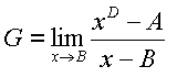
Du solltest an einem Wegweiser landen. Addiere die Nenner aller vier Bruchangaben, subtrahiere 8, damit erhältst Du A. Nimm außerdem die einzige Angabe, die in Minuten dargestellt ist (BC) sowie den Ganzzahlteil der höchsten Stundenangabe (D). Da Du Dich jetzt sicher warmgerechnet hast, bilde folgenden Grenzwert:
Gehe zu P6.
N 50° 5(G-2).(C mod A)D4
E 014° 1(A*D).G(G-A)0
|
Variante 2: Gehe zu Punkt P5.
N 50° 5E.DQK
E 014° JQ.AME
Du stehst nun vor einem Wegweiser mit gelben Schildern und schwarzer Schrift. Bilde von den Ziffern der Entfernungsangaben der acht Orte die iterative Quersumme. Beginne von Oben nach Unten.
Gehe zu P6.
N 50° D(F-E).(G-H)(D-A)E
E 014° 1(C+E).C(B-G)(F-H)
|
Sieh Dich hier an P6 noch ein wenig um, und Du kannst die Koordinaten des Caches bestimmen. Du findest drei Jahreszahlen (ABCD kleiner als EFGH kleiner als JKLM) und NP vertikale Geländerstützen.
Damit Du am Ende noch eine kleine Kontrollmöglichkeit hast: A+B+C+D+E+F+G+H+J+K+L+M+N+P = 59
Nun auf zum Endspurt zum Cache.
N 50° 5L.(N+P)GH
E 014° CD.NM7
Erfolgreich? Dann brauchst Du ja nur noch den ganzen Weg zurückzulaufen...
English Version
The search for the cache brings you to one of my favourite hiking areas – the Elbe Sandstone Mountains. Depending on the way you choose you have to hike about 25 or 33 km. If you hurry up a bit you can do it in one day, otherwise you find places to stay overnight on your way. If you don’t choose the shortcut (see below) you can go the whole time on well marked trails. I recommend to take along a hiking map, on one hand you can avoid senseless detours, on the other hand the reception of your GPS unit can be bad due to the profile of the terrain. On your way you have to find numbers for some waypoints from information panels. Unfortunately some panels are written in German only. If you can’t read them try to find someone who can help you. Usually lots of people go hiking in that area. It’s absolutely necessary to take along a document which allows you to cross the Czech-German border.
You can leave your car at a billable parking site (N 50° 53.543, E 014° 13.770). Alternatively you can go by railway to the nearest station and cross Elbe river by ferry.
Go to P1.
N 50° 53.586
E 014° 14.096
Here you can read since when the border between Bohemia and Saxony exists (ABCD). When began the construction of the road to Bad Schandau (EFGH)? If you still want to go hiking after caching you find information about some other nice routes. Take the durations (in hours without decimal places) of the hikes to Vorderes Raubschloss (J), Hinteres Raubschloss (K), Carolafels (L) and Zeughaus (M).
Go to P2.
N 50° 5(B-A).H(F-C-A)G
E 014°(J-L)M.KC(H-C)
Since you might have trouble to find the signs, and since there i extensive calculation later on you could also use the following plain coordinates for P2.
N 50° 53.730
E 014° 15.552
May be you are a bit short of breath when you reach it. Take time to collect some information. The variables A, B, C,... are defined new at every point. Don’t use the old definitions by accident. Apropos old: the oldest beech trees ("Buchen") in the surrounding are more than ABC years old. The year DEFG is associated with a wooden thing, year HJKL/MN with Swiss.
Go to P3.
N 50° 5K.(E-A)FG
E 014° N(E-F).JGM
Here you find A different figures (in square km). Assign them in ascending order to the variables BC, DE, FGH and JKL. Calculate the sum of the cross sums of the numbers (MN) and the cross sum of the sum of the numbers divided by 2 (PQ). At this point you should decide if you use a shortcut (option 1, it’s not really legal) or if you don’t risk to get confronted with the long arm of the law (option 2). Especially non-natives should take the second option and walk some extra kilometres.
|
Option 1: Go to P4.
N 50° 5M.H(C-Q)N
E 014° PB.(F*A)QC
You should come to a signpost. Add the denominators of the four given fractions, subtract 8 from this sum to get A. Take the only figure given in minutes (BC) and the integer part of the highest figure given in hours. After this nice warm-up calculate the following limiting value:
Go to P6.
N 50° 5(G-2).(C mod A)D4
E 014° 1(A*D).G(G-A)0
|
Option 2: Go to P5.
N 50° 5E.DQK
E 014° JQ.AME
You are now standing in front of signposts with yellow signs and black writing.
Form the iterative checksum of the numbers of the distances to the eight places.
Start from top to bottom.
Go to P6.
N 50° D(F-E).(G-H)(D-A)E
E 014° 1(C+E).C(B-G)(F-H)
|
Look around on this place to calculate the position of the cache. You find three numbers of years (ABCD less than EFGH less than JKLM) and NP vertical poles of the railing. To give you the possibility to check your result you can calculate a checksum:
A+B+C+D+E+F+G+H+J+K+L+M+N+P = 59
And now the final spurt to the cache!
N 50° 5L.(N+P)GH
E 014° CD.NM7
Did you succeed? Then you’ve just to go back...