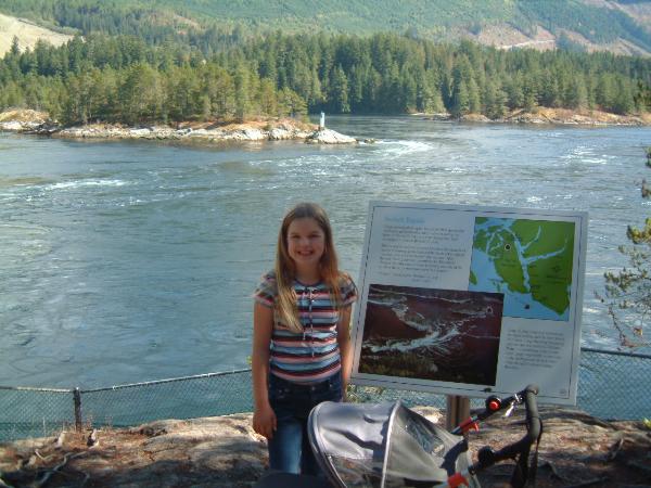
The word Skookumchuck means "strong water" or "turbulent water" in the first nations Chinook language. Skookumchuck Narrows is located within Skookumchuck Narrows Provincial Park. The "Narrows" are at the narrow end of an inlet that drains Sechelt Inlet into Jervis Inlet. It is estimated that 200 billion gallons of water flows through the narrows twice each day. Due to the constriction, the obviously named Skookumchuck Rapids can reach speeds of 14 knots in spring and summer.
Boat tours are available for the brave or you can reach one of two viewing areas by walking trail from Egmont through a typical northwest coastal forest. The two viewing areas afford excellent views of the narrows. While there you will likely see boats waiting on either side of the narrows until the rapids abate. While flowing, you should see large standing waves and huge whirlpools within the narrows which dwarf almost any boats that are in the area including the kayakers that frequent this spot to practice their maneuvers on the waves.
As of November 20, 2006 to log this Earthcache:
You must e-mail me some unique bit of information regarding the site that you learnt while there. This can be done by answering any of the following questions: what is the flow rate of the rapids during your visit and what height are the waves? Hint: You can make a rough estimate of speed by watching some floating object in the water and measure its distance in feet or metres over a few seconds. Posting a photo is not required but appreciated. I will monitor logs and check my e-mails for appropriate information. Unfortunately, any log that does not meet the requirements will be deleted. Thanks for visiting an Earthcache!