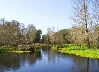
The first stage coords will take you to the end of Mainline Road at the Withlacoochee River. There you'll find a power pole with numbers and letters on the south side. One of the lines has three numbers, no letters. Call those three numbers as they appear from left to right A B C. The second stage coordinates are
N 28° 26. A, 1, 7 W 82° 09. C, B+1, 9.
Ammo can tucked against a spreading oak.
They created a long causeway, nearly .8 mile from the east side for this bridge. The bridge has been gone a while, it used to connect the lumber town of Lacoochee with the "hard road" of 471. Big lumber mills in Lacoochee once. If you come in from 471, you'll pass by the nearly invisible ruins of Sturkey, a company town when Cummers Lumber owned most of this land.
Green Swamp West is closed to recreational users during Special Opportunity hunting seasons, EXCEPT for hiking on the Florida Trail.
This cache was placed by a member of the
Florida Geocaching Association