 This cache was first used for a Grade 10 math class as a practical trigonometry exercise. We decided to move it into a more realistic setting for wildlife tracking: a wildlife management area (WMA) adjacent to Riding Mountain National Park where three radio telemetry research programs tracking elk, deer and wolves are currently underway or recently completed.
Here's the scenario:
Tim, a wildlife biologist for the park is doing some ground telemetry to determine the location of a collared cow elk called Sneaky who likes to sneak out of the park in the spring to have her calves in a secluded out of the way place. Tim would like to determine that location in order to figure out what type of habitats elk like to have their calves in so they can be protected. He is also concerned that elk leaving the park may interact with cattle or other domestic livestock and share diseases like Bovine TB which many agencies in the area are trying to control.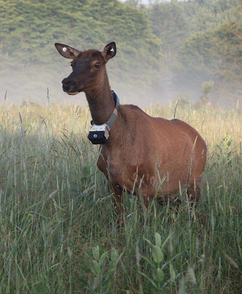
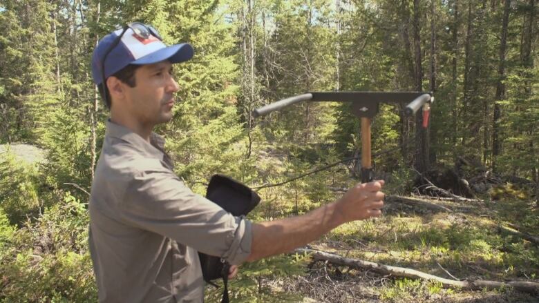
To discover the location Tim travels to three locations and using a radio antenna determines a bearing toward the strongest signal which sounds like a series of beeps. With just two or three locations Tim can figure out where the elk is without even seeing her.
In this geocache, at each of the three locations is a metal tag with the bearing to the final cache. Important to note that the bearings are from grid north, which is slightly different from true north, and quite a bit different from magnetic north in this area. At the first tag there are also coordinates to the second tag, and at the second, coordinates to the third. To mix things up a bit, researchers generally use UTM coordinates instead of Lat/Long so the coordinates on the tags are in UTM Zone 14U NAD 83 projection, so be sure your GPS is setup properly prior to entering any points.
There is a map attached to help out with navigation and it could be used to plot and graph the bearing lines, but the most accurate solution will be with a bit of trig, with the most useful equation being the sine law. Note the area immediately east of the lake that looks like an open field is actually a rather significant swamp.
The final cache is a winter friendly ammo can with a FTF certificate, leather billfold/card holder, deck of cards, some nonpermanent tattoos and some other goodies. There is parking at 435070 5610867 just east of the Onanole Campground. There is a good chance of seeing wildlife in this area, as it is a wildlife management area, and logically there is also a good chance of seeing hunters here as well during hunting seasons (this area is in GMA23), so be aware, wear bright clothing and when traveling in the area during hunting seasons (Late August - Late January) try to go on a Sunday when hunting isn't allowed. Wildlife you might see include (by descending order of probability): birds (some 200+ species), red squirrels, whitetail deer, snowshoe hares, moose, elk, lynx, black bears, porcupine, fisher, wolves and cougars (the last two are very remote chances). Vista points with binoculars early in the day or towards dusk increase your odds dramatically.
Have fun tracking down Sneaky!