 |
Deutsche Version (English version below): |
Die in verschiedenen Regionen Deutschlands vorkommenden Binnendünen und Flugsandfelder sind durch den Wind hervorgebrachte Ausprägungen, die überwiegend während der eisfreien Kaltzeiten des Pleistozäns, also vor etwa 10 000 Jahren entstanden sind.
Nach dem schrittweisen Rückzug der festländischen Eisbedeckung war die blank gehobelte Bodenoberfläche frei von Vegetationsstrukturen. Somit war die Kraft der Winde nahezu ungebremst. Leichte, feinkörnige Bodenpartikel wurden von den Luftströmen erfasst, oft kilometerweit verfrachtet und an anderer Stelle wieder abgelagert.
So entstanden im Laufe der Zeit vielerorts Flugsandflächen und Dünen, die bei starken Winden auch in der Lage waren zu wandern. Zu dieser Zeit lagen die Temperaturen im Jahresdurchschnitt um 5 bis 8 Grad tiefer als heute. Außerhalb der vegetationsfreien Schotter- und Sandflächen wuchsen flachgründige Gräser und Zwergsträucher. Große Teile der Landoberfläche waren von Moosen überdeckt.
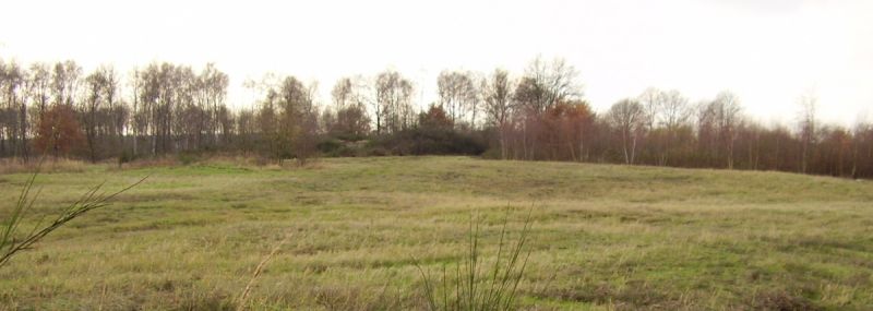
Blick auf die Landschaft
An obiger Koordinate findet sich eine Infotafel (leider wurde die Tafel zerstört; ein Foto der ursprünglichen Tafel findest Du hier) über Binnendüne. Um diesen Earthcache zu loggen, erfülle bitte folgende Aufgaben:
- Schreibe mir eine E-Mail mit den Antworten auf nachfolgende Fragen:
- Welche Beobachtungen vor Ort zeigen die Existenz sowie den Verlauf der Binnendünen?
- Warum sind die Binnendünen hier nicht so stark ausgeprägt?
- Schaue Dich um und fertige eine Karte der Umgebung an. Dabei soll erkennbar sein, wo die Binnendüne verläuft. Sende mir anschließend Deine Karte per Mail an GCZT9H (at) sags-per-mail.de
- Mache bitte freiwillig ein Foto von dir vor der Infotafel (bitte NICHT so, dass die Tafel lesbar ist!). Falls du alleine bist, reicht auch ein Foto von deinem GPS mit lesbaren Koordinaten.
Weitere Infos zum Thema können auf folgenden Links gefunden werden:
Wikipedia-Artikel über Binnendünen
WEBGEO Lernmodul über Dünen
 |
English version: |
In physical geography, a dune is a hill of sand built by eolian processes. Dunes are subject to different forms and sizes based on their interaction with the wind. The "valley" or trough between dunes is called a slack. A "dune field" is an area covered by extensive sand dunes. Large dune fields are known as ergs.
At this earthcache you can find a special dune type. It is a kind of "interior dune".
Formation of dunes:
In the process of formation dunes there is a need of obstacles e.g. vegetation, pebbles etc. to trap the moving sand grains. As the sand grains get trapped they start to accumulate, this is the start of dune formation. The wind then starts to affect the mound of sand by eroding sand particles from the windward side and depositing them on the leeward side. Gradually this action causes the dune to “migrate” inland, as it does so it accumulates more and more sand. Dunes provide privacy and shelter from the wind.
In Central Europe the lot of dunes have their origin in the ice age. During this time period the temperature was 10 degrees cooler than today. Because of this the vegetation was different to what we see today. There were no trees and the vegetation was more a kind of tundra. This circumstances were a perfect "playing field" for the power of wind. Therefore silt and sand was transported over thousands of kilometers by the wind. So the first dunes formed up.
Overview
Perform the following tasks to log this earthcache:
- Write me an email with the following information:
- Which indicators do you find at the location about the existence of the dunes?
- Why are they not so high?
- Look around and a draw a map of the area. The map show the area which is covered by the dune. Please send the map afterwards to GCZT9H (at) sags-per-mail.de
- Take optional a photo of you in front of the dune. If you are there without any help, you can take a photo of your GPSr with readable coordinates instead. PLEASE DO NOT TAKE A READABLE PHOTO OF THE INFORMATION PANEL!
