The Changing Beach at Bluff Point State Park
and Coastal Preserve,
Part II:
Sand on the Move!
This is a companion EarthCache to Bluff Point Part I, which
looked at several beach processes and how they change the shape, or
morphology, of the beach. Waves, wind and tidal currents are the
main agents of change on a beach. The sum-total of changes on the
beach results in migration of the beach. That migration may be
landward or seaward, depending on the supply of loose granular
material (usually sand) to the beach and the processes that move
that material. An additional variable, sea level change, will
become increasingly important if the consequences of global warming
forecasts occur. As sea level rises, the beach must migrate
landward as the coastal zone becomes flooded. This Cache explores
historical records to document beach migration at Bushy Point
Beach. The EarthCache is located in Bluff Point State Park and
Coastal Preserve, Groton, CT.
Purpose: This EarthCache is published by the Connecticut
Geological and Natural History Survey of the Department of
Environmental Protection. It is one in a series of EarthCache sites
designed to promote an understanding of the geological and
biological wealth of the State of Connecticut.
Location: Bluff Point State Park and Coastal Preserve,
Groton, CT N41o20.156’, -
072o02.023
Date Listed: PARKING LOT
Waymark Code:
Listed by: CTGEOSURVEY
From I-95: Take exit 88.
Turn south (left if coming from I-95 north; right if coming from
I-95 south) onto SR 117 South. Turn right at the end
onto Route 1 South. Take a left at the first light onto Depot
Road. The drive into the park is under the railroad tracks
after the residential area. Park entrance is at the left side of
the parking area at the end of a rather bumpy drive.
Bluff Point Coastal Preserve is a great place to spend a morning
or afternoon or the entire day because there is so much to see and
do. It is an undeveloped state park with a bumpy access road and
limited facilities (rest facilities are found at the parking area
and at the end of the trail near the bluff). There are hiking and
biking trails galore, none very strenuous and some relatively
smooth allowing for family biking and access for those with
ambulatory difficulties. It is a long hike however…just over a
mile one-way. In addition, the beach is over a mile long. Be
sure to bring water, and expect to carry your trash out with you.
Follow the main trail to the beach. Note that there is a rest
facility just off the beach on the headland. There are no
facilities on the beach.
The Bluff Point-Bushy Point barrier-beach is a spit. A
barrier-beach spit is a more or less linear coastal landform
composed of a beach and sand dunes and is attached at only one end
to a headland, i.e. Bluff Point. It is formed by longshore sand
transport down the length of the beach on the spit. Prior to the
1938 hurricane, the beach connected to the glacial moraine deposits
that form Bushy Point proper. Now, at high tide, Bushy Point is an
island.
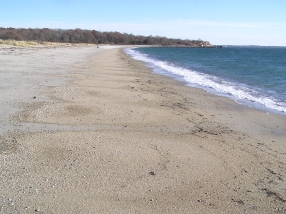
The Bluff -Bushy Point beach is a typical barrier beach. It
changes with the seasons. It is usually narrower and steeper during
the winter and spring and wider and less steep during the summer
and early fall. There may be one or several berms on the beach,
especially on the Bluff Point end. There are wind blow (eolian)
sand dunes on the Bushy Point end. Usually sand is found at the
Bushy Point end of the beach and gravel at the Bluff Point end of
the beach. It looks like the beach is not changing when seen on any
particular day. But careful study of historical documents and
photographs has allowed DEP coastal scientists to document landward
movement of the beach at a rate of about 1-1.5 feet/year.
To illustrate this movement, compare the three pictures below,
looking eastward along about the same stretch of the beach. The
beach looks like it always does. Yet, over the 15 years between the
oldest and youngest picture, the beach migrated possibly 20+ feet
northward. In different terms, the location of the students
pictured on the 1992 photograph is possibly 20 or more feet out to
sea in the 2007 photograph.
Bushy Point beach, looking eastward toward the Bluff Point
headland. Left April 2007, center September, 1999 center, and right
1992. The beach changes its width and grain-size characteristics
according to seasonal storms but otherwise looks much the
same.
The point to be understood here is that, although the beach is
migrating, it is a healthy looking beach! Without some geographic
marker, one does not notice changes to the beach on a year-to-year
basis. Change nonetheless occurred.
One place where the change became noticeable was at the western
tip of the beach. During the winter of 2003-2004 the tidal channel
between the end of the sand spit and a neighboring peat island was
filled with sand. The photograph below was taken at the tip of
the beach in 1999 and shows the tidal channel. Strong tidal
currents eroded the banks of the island across the channel. The
island is composed of peat and salt marsh mud. The oblique air
photo shows the channel was still open in 2003.
Activity 1. After following the trail from
the parking lot to the beach, find your way N
41o19.200’, - 072o03.044’
to the following location. This should place
you right in the middle of the channel illustrated above. When
you get there you will notice that your feet are still dry and that
you are standing on a pile of sand. This sand was
Left: Sand filling former tidal channel connecting former island
to the end of the spit. Notice that sand has covered the top of the
former island.
Right: Aerial photograph taken since 2006? (from GoogleEarth).
The tip of the spit has built westward, filling the tidal channel
and covering part of what used to be a peat island. The
configuration of the flood-tidal bars in the Poquonock River
estuary have changed. If you compare this with the 1990 aerial
photographic below will notice also that the estuary has
narrowed
deposited subsequent to the filling to the channel during a
storm in the winter of 2004. Oblique aerial photography taken
during 2003 (see above) clearly shows the channel open but aerial
photography taken in 2004 (below) show the channel filled with
sand. The recent Google Earth photograph shows sand covering part
of the former marsh island.
You will be able to confirm this observation by walking out onto
the “island”. The tip of the spit has migrated almost 250 feet into
the tidal channel, filling it in during the process. Tidal flow
shifted north of the island in response to the filling of the old
tidal channel and the point of land to the northeast of the former
island has also eroded, creating a broader channel than previously.
In time, as the beach migrates landward, the tidal marsh will be
buried by sand. With continued beach migration, the buried marsh
could become exposed on the sound side of the beach. This occurs at
some Connecticut beaches such as at Hammonasset State Park. The
best time to see this is in spring before sand migrates back on
shore. At some beaches, these relict peat deposits become
recolonized by tidal marsh plants.
Marine scientists from the Long Island Sound Resource Center (CT
Dept. of Environmental Protection and UConn) have carefully
examined an 1890 map, and using GIS technology overlaid the outline
of the Bluff Point-Bushy Point beach on more modern aerial
photography (below). This shows that the beach has migrated more
than a full beach width (>100 feet) landward.

2004 aerial photograph with outline of beach and tidal
marshes as show on map of 1890. Patton and Kent (1992) suggest that
this beach has been migrating at a rate of 1.0-1.5
feet/year.
Tidal flow has been diverted to the northeast side of the peat
island. Flood tidal flow formerly scoured the channel taking sand
from the tip of the spit into the Poquonock River estuary. This led
to the deposition of tidal-channel sand-bars (technically a
fold-tidal delta) in the estuary. Longshore transport still brings
sand to the end of the spit where it gets deposited. But the tidal
flow has shifted northward and sand does not get into the current
channel at this time. Thus, because the supply to the tidal channel
bars is diminished, they will begin to wash out. Compare the 1990
aerial photograph below with either of the aerial photographs taken
this century. The subaqueous sand bars look less well defined in
the most recent aerial image than in the 1990 image. It also looks
like the sand has been transported farther into the estuary in the
more recent photographs. We must consider that if the most recent
pictures were taken during high tide, the apparent lack of
definition of the sand bars may be an artifact of the actual bars
being partially obscured by the water depth. If the 1990 photograph
was taken during low tide, the sand bars may have been exposed and,
therefore, appear better defined in the image.

1990 aerial photograph with outline of 1890 beach shown in
yellow. Notice definition of tidal channel bars. Tidal bars appear
as well defined lobes of sand in this photograph. The large lobe in
the center appears on the 1970 photograph but the northeasterly
lobes do not. The most inland lobes appeared on the 1986
photographs. The 2006 photographs (Google Earth) show the lobes
less well defined. The lobes may be washing out because their
supply of sand has been diminished by the diversion of the tidal
channel. This observation may be an artifact of when in the tidal
cycle the pictures were taken: at low tide the lobes appear better
defined than at high tide.
Activity 2. You find the co-ordinates, because
they change seasonally.
Notice the reflection of waves visible offshore in the 1990
photograph. Two wave trains are visible, one coming from the
southwest and the other coming from a more southerly direction. The
southwesterly waves are probably due to winds that were blowing in
Long Island Sound. The waves coming from a more southerly direction
may originate in the Atlantic Ocean. The waves interact by
constructively and destructively interfering with each other. This
results in points on the beach that experience higher waves and
points right next to them that experience lower waves. Higher waves
are caused by a wave from one wave train being in phase with a wave
from the other train. The result on the beach is a rhythmic
scalloped beach. We refer to such a beach as cusped.
|

|
|
Left. Cusped (weakly developed) beach along stretch near the
Bluff Point end of the beach. The cusps form because of wave
interference. They are not usually found on the Bushy Point end of
the beach because waves formed by southwesterly winds are shielded
from the beach by Bushy Point. Nor are they found too close to
Bluff Point because the beach is shielded from the Atlantic Ocean
swell by Bluff Point.
Right. Weakly cusped beach, November 2007 looking toward Bluff
Point. Incipient cusps formed during the previous out-going
tide.
Activity 3.You find the coordinates because they change
seasonally.
The last observation to make is that somewhere on the beach
there will be an area (areas), usually on the uppermost part of the
beach just below sand dunes, (PLEASE STAY OFF THE SAND DUNES!)
where the surface sand is a purplish-pink or gray in color. During
some conditions black streaks will form by the same process in the
tidal zone. If one digs a shallow trench in the beach one almost
always encounters old buried layers of purplish-pink sand. The
color is caused by concentrations of sand grains composed of the
mineral garnet. Along with the garnet, there may or may not be
concentrations of a black mineral that is magnetite and/or
ilmenite. Both black minerals are magnetic, which you can prove to
yourself by taking along a small magnet and running it through the
sand. Children usually love this activity. If you collect the
minerals off the magnet and place them on a piece of paper. The
children can make them move on the paper by moving the magnet
around under the paper.
Partially concentrated heavy mineral layer is shown in the left
photo. Lighter sand grains of a previously deposited storm deposit
have been partially blown away, leaving a concentrate of purplish
pink garnet grains. About 4 inches of a sneaker is shown for scale.
The middle photograph shows a concentrate of garnet sand grains in
the upper left being covered by a high tide berm in lower right.
Note 35 mm film case on right for scale. Student points to
succession of heavy mineral layers exposed by digging a trench in
the beach. Note buried beach layers have nearly same slope as the
beach face (surf-zone to right).
Most of the sand grains on the beach are composed of feldspar
and quartz; both relatively low in density (~2.6 g/cm3).
Garnet (~4 g/cm3) and the black minerals (~4.5 g/cm3) are denser.
For the same size sand grain, garnet and the black minerals are
heavier. Heavy mineral concentrations (pink and black) occur where
less dense (lighter) sand grains blow away, leaving more dense
(heavier) sand grains behind. Storm waves deposit both light and
heavy minerals together. After the storm, wind transports the
lighter minerals into the dunes, leaving a concentration of the
heavier, harder to move mineral grains. The same process can occur
by water waves (particularly in the tidal zone) and river currents.
Gems, concentrated in this way, are found in some African beaches.
Many of the gold deposits out west are found in stream gravels
where the lighter quartz and feldspar grains were washed away,
leaving heavier gold nuggets behind. They are referred to as placer
deposits (pronounce that with a short “A” as in plaque rather than
the long “A” in place).
|

|

|
Objects that protrude up into the flow of wind near the sand
surface create turbulence that saps the wind of its carrying
capacity. The sand grains undergoing transport by the wind are then
deposited behind the protruding object. Both pictures show that the
grains that are deposited in the “wind shadow” are light colored
grains suggesting that they are the only grains in transport at the
time. Commonly heavier garnet and magnetite grains are left behind
and form the beginnings of a “heavy-mineral” layer. Note that
larger grains of quartz and/or feldspar are left behind also. Shell
on right is about 3” (7.6 cm.). Shadow deposit is streak of light
colored minerals to right of shell. Bush on left sticks up about 6”
into the wind and a much larger deposit of light colored sand has
accumulated behind it. Note that the crests of wind ripples are
composed of light colored minerals whereas the pink and gray heavy
minerals accumulate in the ripple trough. Footprint at left of
picture is 12.5” (~32 cm.).
Additional information about beaches in Connecticut can be found
in
Patton, P.C., and Kent, J.M., 1992, A Moveable Shore: the fate
of the Connecticut Coast. Duke University Press, Durham, N.C.,
143p.
How do people log this Earthcache? People will need to
provide (1) a picture of the filled tidal channel at the end of the
spit (include a companion in the picture for scale), and (2) a
picture and coordinates of either a heavy mineral concentration or
beach cusps (include a companion in the picture for scale).
Difficulty: 1
Terrain: 2 because of length. Site is accessed after a
long walk on mostly flat terrain. The main trail used to be an
automobile road before the 1938 hurricane destroyed a beach cottage
community. Walking on soft beach sand can be tiresome. PLEASE STAY
OFF THE SAND DUNES!
Type of land: State Park
Earthcache category: Beach dynamics -coastal
feature.