This cache placed with permission and
cooperation of the Crestwood Parks Department....'nuff
said!
Parking is best at the small lot by the mulch (N38 33.239 and
W90 21.837) or at the upper lot next to the recreation center (N38
33.327 and W90 21.982) Total walking distance, .6 miles R/T, is
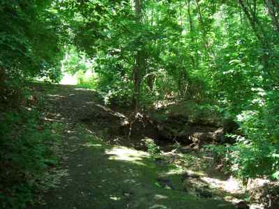
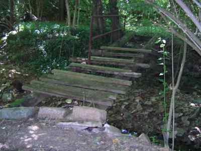
about the same from either spot. The first WP (top of cache page)
will take you to the West end of an old footbridge (now washed
away) that crosses the creek. It is located on the old Sophier
property where the couple raised hybrid plants and flowers. As you
walk thru the old property, you'll see the remains of their gardens
and work. Come back in the Winter and there's even more to see with
the rock gardens and plants along the old driveways. Follow the
directions below because the property borders some private property
and homes so enter through the park.
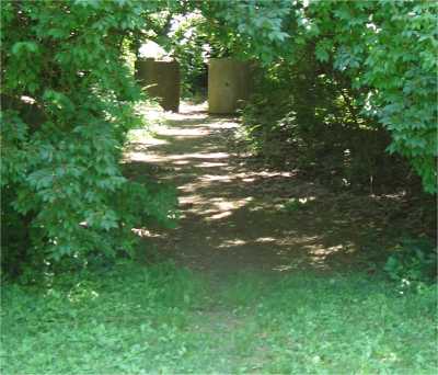
Take the large trail behind the shed at the
mulch lot and walk between the large concrete pipes, near WP5 of
the Crestwood Cache course. You will reach an old washed out
driveway. Turn right up the driveway and it will turn into
woodchips and you will see a large flat open area (where the house
was) with a street barricade on your left. Look close on your right
and you'll see a faint trail into the woods that leads to the
bridge. At the West end of the bridge, continue following the trail
at a heading of 237 magnetic degrees for 125 feet.
*** May 26, 2006
***
The bridge has washed away (or was destroyed) but the location is
obvious where it crossed the creek.
Here you will find an old car frame. Attached to car is a 2005
Dodge Caravan car key stamped with the N and W minutes (MM.MMM).
For the location of the final, replace the last 5 digets of the N
and W coordinates above with these numbers. As a bonus, if you find
the Dodge that the key fits, it's yours!
At WP1 point you are very near houses and private
property. Do not exit the woods here or follow the old gravel
driveway. Follow the trail back out to the mulch lot and proceed
from there.
WP2, or the final, is located in one of the sinkholes in the
park. 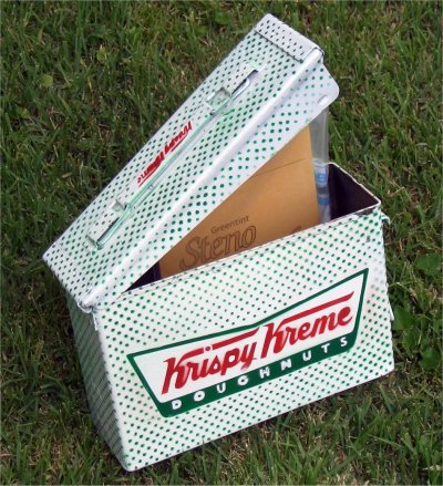 Getting a good reading in the summer is
very difficult so the coords should take you to a small (1 inch
diameter) tree about 2/3 way down into the sinkhole. There is a
trail that circles the sinkhole so you may want to walk around it
to find an easy way to the bottom. Hanging about 5 or 6' high on
the tree is a tag with a hint for the cache location. The final
cache, a white, full size ammo box with green dots and the red
Krispy Kreme logo, is located in this sinkhole.
Getting a good reading in the summer is
very difficult so the coords should take you to a small (1 inch
diameter) tree about 2/3 way down into the sinkhole. There is a
trail that circles the sinkhole so you may want to walk around it
to find an easy way to the bottom. Hanging about 5 or 6' high on
the tree is a tag with a hint for the cache location. The final
cache, a white, full size ammo box with green dots and the red
Krispy Kreme logo, is located in this sinkhole.
When finished with the cache, please replace EVERYTHING
as you found it.
Park hours are 6AM until 11PM.
