"The Cove" Earthcache at Mine Falls Park EarthCache
"The Cove" Earthcache at Mine Falls Park
-
Difficulty:
-

-
Terrain:
-
Size:  (other)
Please note Use of geocaching.com services is subject to the terms and conditions
in our disclaimer.
Mine Falls Park is the home to The Cove, an excellent example of an oxbow lake. This cache will take you to the Educational Overlook Deck where you will be able to learn about the formation of an oxbow lake and partake of an excellent view of The Cove.
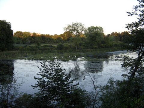
Mine Falls Park, a 325-acre park located in the heart of the City of Nashua, includes forest, wetlands, and open fields which are criss-crossed by a variety of nice trails. The park is the home to The Cove, an excellent example of an oxbow lake. This earth cache will take you to the Educational Overlook Deck at "The Cove" where you will be able to learn about the formation of an oxbow lake and partake of an excellent view of The Cove.
Educational Information:
- The Course of New England Rivers
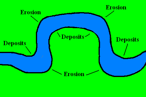
Most New England rivers start in steep, mountain areas as a stream with rapidly-flowing cold water. Such a stream flows down a mountain valley and merges with other streams to form a small river. As the small river flows further downhill, tributaries (smaller rivers or streams) flow into the river, increasing the amount of water in the river. The rapidly flowing water erodes (wears away) soil from the banks to carry it downstream. Eventually, the river reaches areas where the surrounding terrain flattens out and the river widens.
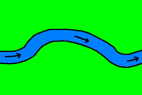
In flat areas, the flow of the river slows down, allowing the soil carried in the river to settle out in a process called deposition. The speed of the flow in the river varies wherever the river goes around a corner, causing the river to meander (follow a winding path) as it crosses areas that are mostly flat. Sometimes a long meander is cut off from the river's regular flow of water, and a crescent-shaped lake is formed. Such a lake is called an oxbow lake due to the distinctive curved shape that results from this process. The sequence of steps leading to the formation of an oxbow lake is illustrated below:
- The Formation of an Oxbow Lake
- A gently meandering river flows through an area of relatively flat terrain.
|
 |
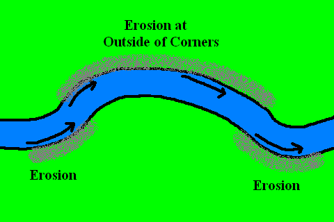
- Water flows at different speeds as it goes around bends in a meandering river. On the outside banks of corners, the river water moves the fastest, causing lateral erosion and undercutting.
|
 |
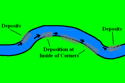
- Meanwhile, on the inside banks of corners in the river, the water flows more slowly, leading to sediment settling out of the water and building up on the inside banks. This process is called deposition.
|
 |
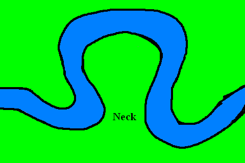
- Gradually, the inside banks are filled in with accumulated deposits, and the outside bends extend further and further, forming a wide loop in the river.
|
 |
- The loop continues to bend further and further, until a thin strip of land called a neck is created at the beginning and the end of the meander.
|
 |
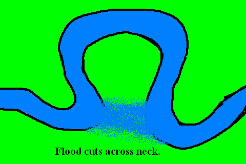
- Eventually, the narrow neck is cut through by either gradual erosion or during a time of flooding. (Spring flooding is commonplace in New England when rivers rise due to snow melting near the river's source.) When this happens, a new straighter channel is created, diverting the flow of the river from the loop into the new channel.
|
 |
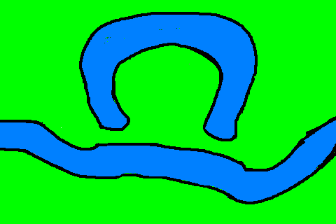
- Deposition finally seals the cut-off from the river channel, leaving a horseshoe-shaped oxbow lake. The water in the oxbow lake is no longer refreshed by the river, transforming the habitat from one supporting river life to one that is hospitable to pond life.
|
 |
| |
|
- The Oxbow Lake in Mine Falls Park
The Oxbow Lake here in Mine Falls Park probably formed as described above. In order to log this earth cache, you will need to do the following:
- Visit the Oxbow Lake at Mine Falls Park. The primary parking area for the cache is at N 42 45.615 W 071 29.447. Follow the marked trails to the "Educational Overlook Deck" at the listed coordinates.
- Read the "Formation of a Landform" sign next to the Educational Overlook Deck. The sign describes how oxbow lakes are formed. You will need to read the sign carefully to find verbatim answers to the following two earth science questions:
- Over what "period of time" did the cove form? (This answer should be two words.)
- After flooding, there are "portions of something remaining." What is the something? (This answer should be four words.)
Email the cache author with the answers to the above two questions before posting your find.
- Other Resources:
For further information on how oxbow lakes develop, you may wish to see the following resources:

Additional Hints
(Decrypt)
Svyy va gur OYNAXF:
1) "... bire [BLANK] [BLANK] crevbq bs gvzr."
2) "... cbegvbaf bs [BLANK] [BLANK] [BLANK] [BLANK] erznvavat."