The Great Wall of China is not the only structure visible from
space. You now stand on the point of a panoramic view. The ground
which is situated in front of you looks like a moonscape. But
everything is changing and the owner of this land is taking steps
to counteract nature.
North Bohemian browncoal coalfield was formed in the Miocene. It
is situated between the Krusne Mountains (divided by breakage from
its older formations), the Doupovske Mountains and the Ceske
stredohori. These brown coal reserves were locally exploited from
15th century. Expansion of mining was started in 19th century, due
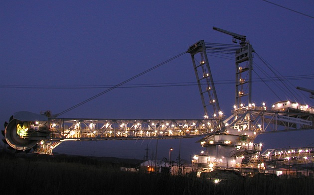
to the industrial revolution. The part which you see is opencast
Libous. Approx. 14 mil tonnes of brown coal per annum is mined here
in present days.
No matter what do you think about this place, it´s an
opportunity to see something rare and learn more about Earth
shaping.
Please attach the photo of you on this place to the log and
answer following questions via my profile.
1) what method of coal mining is used in this area?
2) what is the brown coal of Tusimice coalfield used for?
3) you can see two settlements from the viewpoint, what are
their names? Estimate, or measure their distances for better
imagination of total area.
THERE ARE ONLY TWO SMALL (and nasty) PARKING PLACES IN THE
DIRECTION FROM KARLOVY VARY, DON´T CROSS THE WAY. IF YOU GO FROM
CHOMUTOV, BETTER TURN ROUND IN PRUNEROV PETROL STATION AND USE
THESE TWO PLACES.
Vitejte v severnich Cechach
Nachazite se na vyhlidce s vybornym vyhledem na dul Libous,
jeden z mnoha v Severoceske hnedouhelne panvi. V miocenu se v panvi
mezi Krusnymi horami, Doupovskymi vrchy a Ceskym stredohorim
vytvorily slusne zasoby hnedeho uhli. Tyto byly sporadicky tezeny
jiz od 15. stol. S rozmachem prumyslu v 19. stol vsak zacaly byt
tezeny opravdu masivne. Dnes se jen z tohoto dolu vytezi rocne cca
14 mil tun uhli. SD a.s. se ale snazi nasledky tezby mirnit a
postupne rekultivovat zasazena uzemi, coz je z tohoto mista take
patrne (vpravo).
A ted ukoly. Vasi fotku na miste kese prilozte k logu a napiste
mi odpovedi na nasledujici otazky:
1) jaky druh tezby se zde vyuziva?
2) jaky je majoritni odberatel uhli, k cemu je urceno?
3) Z mista kde stojite, jsou videt minimalne dve sidla. Ktera to
jsou a zkuste odhadnout jejich vzdalenost. Pomuze vam to pochopit
rozlohu teto "mesicni krajiny"
POZOR NA PARKOVANI JSOU ZDE POUZE DVE MALA (a dost otresna)
MISTA VE SMERU OD KARLOVYCH VARU. POJEDETE-LI OD CHOMUTOVA,
PREJEDTE SOURADNICE CCA O 1KM A OTOCTE SE ZDE U BENZINKY.
NEPRECHAZEJTE ZDE SILNICI JE TO VELMI NEBEZPECNE!!