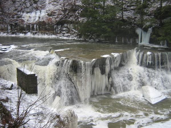
 The Great Falls of Tinkers
Creek
The Great Falls of Tinkers
Creek
Tinkers Creek is named after
Captain Joseph Tinker, the principal boatsman for Moses
Cleaveland’s Survey Crew, who died in the fall of 1797 in a
boating accident on the return to New England. Tinkers Creek is the
largest tributary to the Cuyahoga River suplying 1/3 of the water
that flows out to Lake Erie. Tinkers Creek flows through four of
Ohio’s counties. The Headwaters of this system begin near
State Route 43 in Sugar Bush Knolls.
Tinkers Creek, This Gorge and the
Great Falls are the result of the Wisconsinian Glacier as it
retreated thousands of years ago. The Rock walls before you were
formed by a catastrophic global flood.. The Combination of sand and
pressure worked together to form this sandstone. Prior to this,
erosion caused dips and valleys in the underlying shale. Looking at
the Great Falls the harder sandstone can be seen on top of the
softer shale.
The continuous flow of water is
causing the softer shale to erode at a faster pace than the harder
sandstone. This is causing the sandstone to collaps under its own
weight and fall to the base of the falls. This process is causing
the falls to recede upstream, this is similar to Niagara
Falls.
To Claim this as a
find.
1) Upload a picture of you with the Great Falls in the
Background.
2) Email the answer to the
following questions to Team RAGAR.
What type of sandstone is
this?
What type of shale is
this?
List two types of Mills that used
to exist nearby.
|
This cache hidden
by a member of:


|