GB 6 - Serra das Olelas (Castelo Branco) Traditional Geocache
GB 6 - Serra das Olelas (Castelo Branco)
-
Difficulty:
-

-
Terrain:
-
Size:  (large)
Please note Use of geocaching.com services is subject to the terms and conditions
in our disclaimer.

BTTHAL é uma equipa, formada por um conjunto de
colegas e bons amigos, funcionários do HAL (Hospital Amato
Lusitano) de Castelo Branco, profissionais de Enfermagem da (UCIP)
Unidade de Cuidados Intensivos Polivalente e da Equipa VMER/INEM
(Viatura Médica de Emergência e Reanimação do INEM) deste Hospital.
O grupo tem por base a prática de BTT, no entanto abraça uma
variedade de actividades desportivas outdoor, como é o caso do
Geocaching. Possuidores de dois blog’s na web
(http://btthal.blog.com e http://btthalonboots.blogspot.com), aconselhamos a visita dos mesmos onde são
relatadas e documentadas com fotografia as diversas
actividades da
equipa.
BTTHAL is a team, formed by
a number of colleagues and good friends, officials of the HAL
(Hospital Amato Lusitano) of Castelo Branco, professionals in
the Nursing (UCIP) Intensive Care Unit of and Team VMER /
INEM (Emergency Medical Car) of this Hospital. The group is
based on the practice of mountain biking, however embraces a
variety of outdoor sporting activities, such as
Geocaching. We
have two web blog's (http://btthal.blog.com
and
http://btthalonboots.blogspot.com), you
are advised to visit them where they are reported and
documented with photography the various activities of the
team.
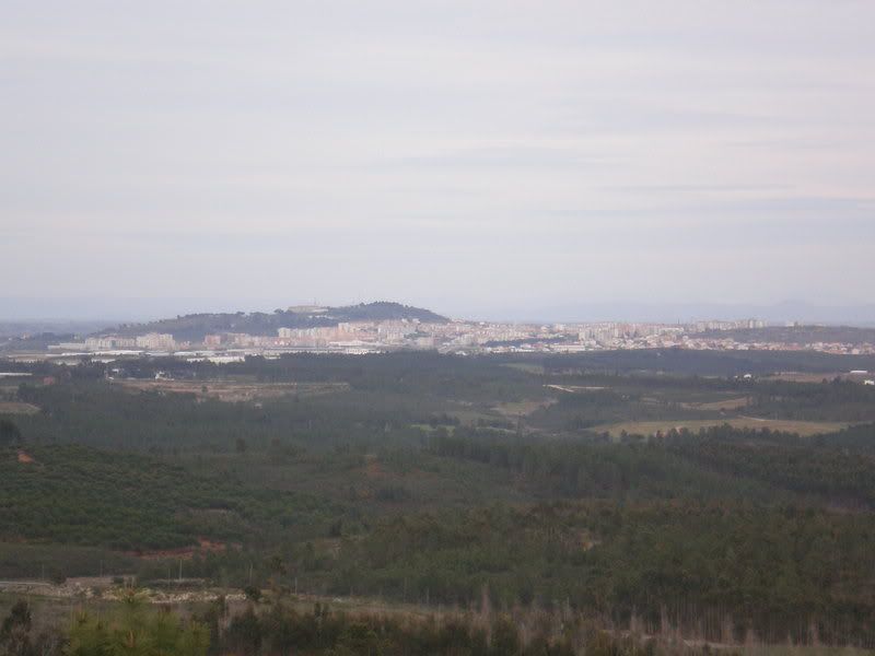
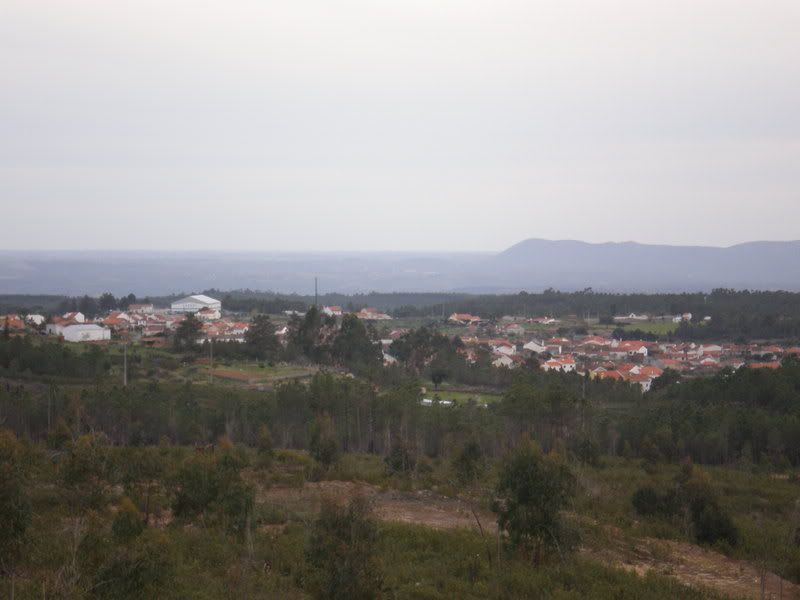
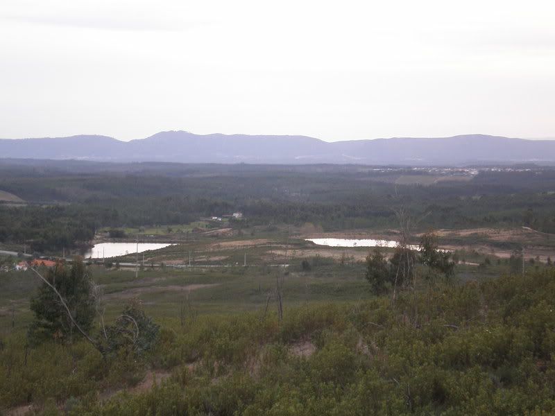
OLELAS: Bem menos famosa que a Serra
das Olelas e da aldeia a que se
associa o nome, situada nos arredores de Lisboa, e
seguramente bem menos rica em termos arqueológicos
(povoamentos milenares) e de riqueza geológica (grutas), não
será contudo menos interessante esta elevação montanhosa
junto à aldeia do Retaxo - Castelo Branco, sem dúvida
merecedora de uma digna visita por parte dos amantes da
natureza. Actualmente algo despida de vegetação, predominando
na suas vertentes a vegetação rasteira, com algumas manchas
de eucaliptos e pinheiros, alberga no seu topo um restaurante
chamado de "Serra das Olelas", dotado de uma piscina, campo
de tiro aos pratos e esplanada. Devido à vista previligiada
acolhe ainda uma torre de vigia florestal, que na época
cálida contribui para o esforço de prevenção e detecção
precoce dos incêndios florestais. Sobejamente conhecida pelos
praticantes de BTT devido à agrura das suas subidas, esta
serra beirã recompensa quem ousa trepar lá acima com uma
vista fantástica que os seus modestos 482 metros de elevação
permitem abraçar. A norte alcança-se uma vista fantástica
sobre o complexo montanhoso da Estrela. Rodando para leste
vislumbra-se ao longe a cidade de Castelo Branco e mais à
direita a extensão de montes e vales do Rio Pônsul e do Tejo
Internacional. No oposto pode-se vislumbrar toda a formação
rochosa de cristas quartzíticas sobranceiras a Vila Velha de
Rodão (Serra da Vila e Serra das Talhadas), somente quebradas
pelas passagens dos rios Tejo e Ocreza (Portas de Rodão e
Portas de Almourão). No sopé da elevação brilham os telhados
e as paredes brancas das aldeias dos Maxiais e Benquerenças
(mais a norte) e Cebolais, Retaxo, Sarnadas e Represa (mais a
sul).
OLELAS: Less famous than
Sierra Olelas located on the outskirts of Lisbon, and
certainly far less rich in archaeological terms (ancient
populations) and geological wealth (caves), is not less
interesting, this elevation mountain near the village of
Retaxo - Castelo Branco certainly worthes a dignified visit
by the nature lovers. Currently a bit stripped of vegetation,
mainly predominates the low vegetation, with some patches of
eucalyptus and pine trees, has in its top a restaurant called
"Serra das Olelas", with a swimming pool, shooting camp,
restaurant and terrace. It hosts still a guard tower, which
at the summer contributes to the effort of prevention and
detection of forest fires. Well known by the mountain bikers
due to their rude rises, this inlander mountain reward those
who dare climb up there with a fantastic view that their
modest elevation of 482 meters allow embrace.The northern
reaches is a fantastic view of the Estrela mountainous
complex. Running east to the far there is the town of Castelo
Branco and more to the right extension of the hills and
valleys of the River Ponsul and Tejo International. In the
opposite can be see the whole formation of rocky crests near
Vila Velha de Rodão (Sierra Vila and the Sierra Talhadas),
only broken by passages of the river Tejo and Ocreza (Portas
de Rodão and Portas de Almourão). In the foothills of the
elevation shine the roofs and white walls of the villages of
Maxiais and Benquerenças (further north) and Cebolais,
Retaxo, Sarnadas and Represa (in the south).
A CACHE:
Para quebrar a monotonia das
micro-caches, multi-caches, enigmas, somas e subtracções,
optamos por criar uma cache simples, no entanto algo atípica
pois queremos que permita a troca de objectos de maiores
dimensões. Igualmente teremos um logbook maior, onde
esperamos que o geocacher deixe para além do seu log, um
desenho elucidativo daquilo que observa, da paisagem ao seu
redor, do que o marca em termos de visão de conjunto.
Confuso? Passamos a explicar melhor - Se aquilo que o marca é
a linha de montanhas, desenhe umas montanhas... se aquilo que
mais apreciou foi uma flor, desenhe uma flor, se uma ovelha
se cruzou no caminho, desenhe-a! - Este será sem dúvida o
desafio que lançamos a todos os visitantes desta cache. A
quietude do local vai permitir sentar-se, apreciar a paisagem
e desenhar!
THE CACHE: To break the
monotony of micro-caches, multi-caches, puzzles, sums and
subtractions, we chose to create a simple cache, however
atypical because we want something that allows for example
the exchange of larger objects. Also we will have a greater
logbook, where we hope that the geocacher leave beyond its
log, a drawing clear what notes, the landscape around her,
than the mark in terms of the whole. Confused? We explain
better - If what marks you is the line of mountains, draw
some mountains ... If you liked a flower, draw a flower, if a
sheep is crossed on the way, draw it! -- This is undoubtedly
the challenge we launched to all visitors to the cache. The
stillness of the place will allow sit up, enjoy the scenery
and draw!
CONSELHOS:
Apesar de ser possivel (e desejável)
alcançar o topo da serra das Olelas com um automóvel, o
percurso final até à cache deverá efectuar-se a pé e daÍ
aconselhamos o uso de roupa e calçado apropriado e máquina
digital para mais tarde recordar!
ADVICE:
Although it is possible (and desirable) reach the top of the
mountain of Olelas with a car, the route to the final cache should
take place on foot and give advise the use of appropriate clothing
and footwear, digital camera for later
recall!
Additional Hints
(Decrypt)
N inpvan qb Gégnab é srvgn qr 10 rz 10 nabf! / Gur Grgnahf inpvar vf znqr 10 va 10 lrnef!