Berliner Urstromtal: Püttberge EarthCache
Berliner Urstromtal: Püttberge
-
Difficulty:
-

-
Terrain:
-

Size:  (other)
Please note Use of geocaching.com services is subject to the terms and conditions
in our disclaimer.
Hallo Geocacher
Das ist der erste Earthcache in Berlin.
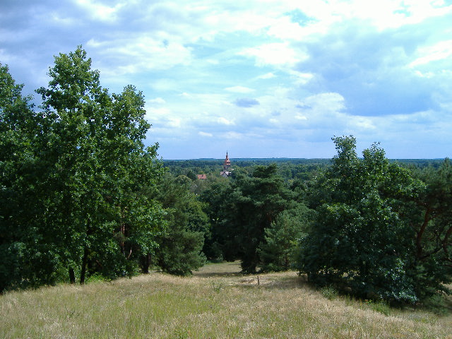
Blick von der Düne
Beschreibung:
Die Püttberge sind Erhebungen von bis zu 68 Metern Höhe im Osten Berlins im Bezirk Treptow-Köpenick. Sie sind Dünen innerhalb des Berliner Urstromtales. Mit einer Relativhöhe von mehr als 30 m gelten sie als die mächtigsten Dünen in Berlin und Brandenburg.
Sie sind im Berliner Urstromtal zu finden, das als Folge der abtauenden Eismassen der letzten Eiszeit, der Weichselvereisung, entstanden ist. Der flache, sandige Talboden stellte das Material, aus denen der Wind am Ende der letzten Eiszeit die Püttberge aufgeweht hat. Das Urstromtal wird heute noch von kleineren Flüssen genutzt. Südlich der Püttberge verläuft die Spree, die den Müggelsee durchfließt.
Die Püttberge bilden beachtliche Erhebungen von bis zu 68 Metern Höhe und ca. 30 - 40 Metern Höhe über dem Urstromtal. Ihre Entstehung ist auf Aufwehung von Sanden im Urstromtal zurückzuführen, dieser Flugsand konnte während vegetationsloser oder -armer Perioden über das mehrere Kilometer breite Urstromtal geweht werden. Ähnliche Flugsanddünen findet man in Berlin im Tegeler Forst.
Wietere Informationen findet ihr bei Wikipedia unter "Püttberge" und "Berliner Urstomtal".
Beantworte bitte folgende 3 fragen.
1. Von welchem Typ von Düne bestehen die Püttberge?
2. Aus welchem Gestein besteht die Düne?
3. Auf den Püttbergen wachsen Pflanzen, nenne mir 3 Pflanzen die hier wachsen.
Antworten bitte per E-Mail.
Englisch:
The Püttberge are collections of up to 68 meters height in the east of Berlin in the district Treptow Köpenick. They are dunes within citizens of Berlin the Urstromtales. With a relative relative of more than 30 m they than the most powerful dunes in Berlin and Brandenburg are considered.
They are to be found in the citizen of Berlin Urstromtal, which as consequence of the abtauenden ice masses of the last ice age, for which Weichselvereisung developed. The flat, sandige valley soil placed the material, from those the wind at the end of the last ice age those Finery mountains up-blew.
The Urstromtal is used today still by smaller rivers. South the finery mountains runs the Spree, which flows through the Müggelsee. The Püttberge form considerable collections of up to 68 meters height and approx. 30 - 40 meters height over the Urstromtal.
Their emergence is to be due to Aufwehung of Sanden in the Urstromtal, this flight and could during vegetation or - poor periods over several kilometers the broad Urstromtal to be blown.One finds similar flight and dunes in Berlin in the Tegeler forest.
As typical for dunes, is Podsol, a sour, bleached soil, on which adapted planting such as Kiefern and grasses can grow.
You find all information under wikipedia during the input of “püttberge” and “Berliner Urstromtal”.
Answers the following asks.
1. Which type of dune do the finery mountains exist?
2. Of which rock does the dune consist?
3. On the finery mountains plants grow, call me 3 plants those grow here.
Answers ask by E-Mail.
Additional Hints
(No hints available.)