When you think of wetlands you do not think of geology, however geology is a very important part of understanding wetland dynamics. There are three characteristics that make wetlands unique – vegetation, soils, and hydrology. Vegetation consists of plants that have adapted to wet conditions. The soils are developed from the water-saturated materials located in the wetlands. Hydrology is very important for the continued existence of wetlands as it as it is imperative to maintains an environmental friendly flow of water through the wetlands to the local lakes.
During the mid 1850’s Florida’s General Land Office Survey collected information related to the suitability of the area for cultivation. Deputy surveyor John Westcott’s hand drawn maps and notes described Circle B Bar Reserve property as a mix of open prairie, pineland, and swampland. The property was dotted with creeks, ponds, and hammocks.
In the early 1900s, most of the land where Circle B Bar Reserve is today was very wet and productive as a wetland. The topographic maps from back in the 1920s show most of the area being completely underwater. In the 1950s, mining and other agricultural activities were common in these wetlands. The area now known as Circle B Bar Reserve was drained and transformed to be pasture land for cattle. Water was pumped from the land to a central canal running through the middle of the reserve and the water from the canal flowed directly into Lake Hancock. Because of this, runoff from treated sewage and agricultural land usage the water quality of Lake Hancock was severely degraded.
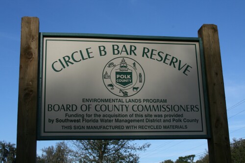
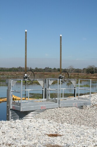
In 2000 the Southwest Florida Water Management District and Polk County in a joint effort purchased this 1,267-acre property. The purpose of this joint effort is to help protect the floodplain of Lake Hancock and also to restore the Banana Creek marsh system. Soon after the purchase the pumps that drained the property were shut down. In 2006 part of the central canal system was filled in to help restore the original flow of water from Banana Creek to flow across the surface of the land instead of a canal. The wetland is divided into four cells by roads, berms, and some of the remaining canal. There are large pipes under the roads which allow water to move from one cell to another to provide continuity. As the water flows over the land and from one cell to another it is naturally filtered before it is discharged into Lake Hancock.
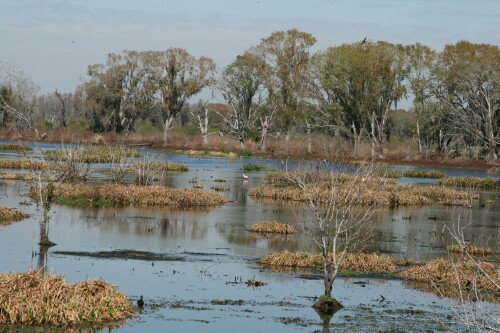
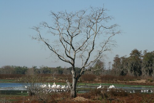
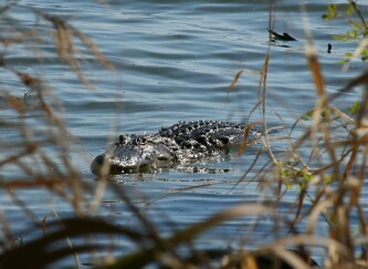
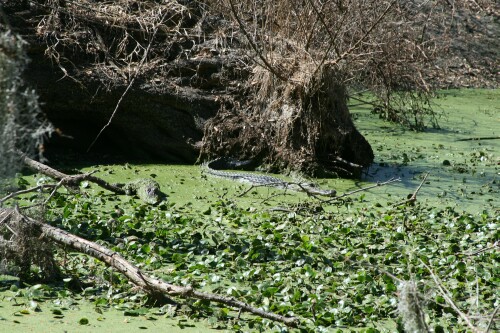
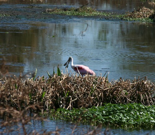
The current wetland is very much like what it was like back in the mid 1900s. With the increase in the amount of saturated land there has been a dramatic rise in the amount of wildlife in the area. This wildlife includes many wading birds, amphibians, reptiles, insects and nesting bald eagles.
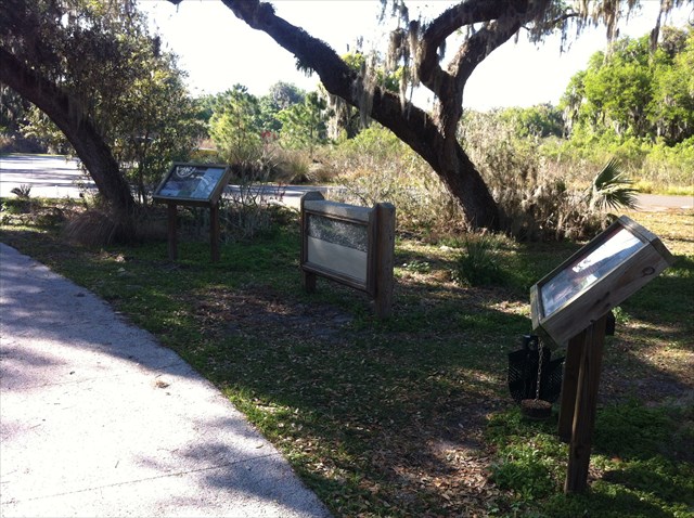
 Wetlands not only get their water from ordinary rain water but also from surface water runoff. As the Discovery Center was built this was taken into account. The designers of the Discovery Center, roadways into the Reserve, and the even the walkways utilized geoweb, geoblock, flexipave, and pervious concrete. Utilizing these materials will help preserve this Reverve for many years in the future.
The Reserve is open daily, year-round, from 6:30 A.M. to 6:30 P.M. Standard Time and until 8:30 P.M. during Daylight Savings Time. Dogs are no longer allowed in the preserve because of the number of alligators present. Also, April is the mating season for gators and they appear to be more active. This area may become wet during the rainy season. Don’t forget the insect repellent and water. Be careful and enjoy the area. Be advised that there are always risks associated with visiting nature preserves.
Please sign in at the visitor’s desk in the Discovery Center, and note that you're there to Geocache. Polk County's Environmental Lands Program is receptive to caching. Signing in shows that you appreciate this. Please be respectful of this property, its vegetation & wildlife. Make sure you grab a map of the reserve at the Discovery Center.
To receive credit for this Earthcache you must post two pictures in your found log and email your answers to questions 3 and 4 to the email address located in my profile page. DO NOT post your answers in your log. Failure to complete all four questions completely will result in your log entry being deleted.
1. Before heading out to trails locate the display above describing the different types of construction used by the designers of the Discovery Center, roadways, and paths. Find one of the areas described and take a picture and post with your log. Currently the display is between the Discovery Center and the parking lot.
2. Post a photo of you and your GPS at the control pipes located at the four corners of Heron Hideout, Marsh Rabbit Run, Eagle Roost, and Alligator Alley. (Located at FCNRS Waypoint)
3. At the four corners of Heron Hideout, Marsh Rabbit Run, Eagle Roost, and Alligator there is a measuring stick in the water showing the depth of the water for the cell on the SW corner. Email me the level at the time of your visit. (Located at FCNRS Waypoint) If you are not able to make out the numbers on the measuring stick take a picture of it and upload. Email me that you are uploading the pictures.
4. After visiting the four corners make your way down Marsh Rabbit Run to Wading Bird Way. There is a measuring stick in the water SW of the control pipes. Email me the level at the time of your visit. (Located at WADE Waypoint) If you are not able to make out the numbers on the measuring stick take a picture of it and upload. Email me that you are uploading the pictures.
While you are at the Circle B Bar Reserve be sure to check out all the caches that are in the area.
You can get a online trail map and location map from Polk County's Official Website for Circle B Bar Reserve
Information included in the cache was obtained from Circle B Bar Reserve Discovery Center and Southwest Florida Water Management District displays as well as research on wetlands. All photos were taken by the g8orRaiders.

This cache was placed by a member of the
Florida Geocaching Association