Aitutaki, the Tilted Atoll
You will see, why Aitutaki looks as it is today, the
difference to other atolls, and you will climb the Maunga
Pu, the highest point of the prehistoric volcano.
An atoll is a ring of coral reefs, which encloses a lagoon. The
lagoon is generally shallow and warm, the reefs protrude mainly
just a few meters from the sea. The name "atoll" comes from
"atolhu" from the language of the Maldives. The small coral islands
that make up the atoll are called "motu", a Polynesian word for
"island". The largest atolls can be found in the Maldives, a
country that consists only of atolls.
 |
 |
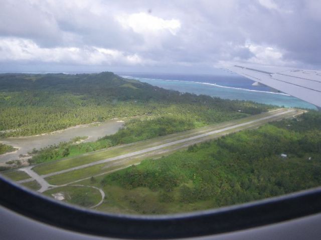
| Maunga Pu, seen from
departing flight |
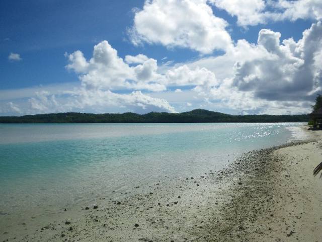
View from the lagoon
(Samade) |
Since corals need relatively warm water, atolls can be found
only in tropical regions between about N28° and S25°. Because of
their size there is usually no natural fresh water.
Very often, the reefs are the foundations of sandbanks, where
palm trees and other vegetation are the starter on the way to form
"real" islands.
One of Aitutaki's southern motus, "Honeymoon Island", is a nice
example for such a newborn place. Pictures and maps from the early
20th century are showing just shallow, but open water, where you
can find a pitoresque little island today. Locals are gently
supporting the growth of the islands by planting coconut trees on
the beaches.
Origin of atolls
The origin of the atolls was explained by Charles DARWIN
during his voyage on the HMS Beagle: Along the shallow
coastal area around a volcano there are coral reefs, where the
water has an optimal depth. If the water is too deep, too less
light penetrates to the ground, if it is too shallow, the corals
rise from the water at low tide. So over thousands of years a ring
is formed around the volcano.
While (and if) the volcano decents, the corals grow up and maintain
a constant depth, while the base is reaching deeper and
deeper.
The volcano may disappear completely in the sea, while a
ring-shaped atoll remains, or the reef encloses the island, like in
Rarotonga or Aitutaki.
In some cases, the earth's crust rises (or the sea level drops) and
elevates the inner area above the sea level. This forms a "risen
atoll", like the island of Niue.
An alternative explanation, in the absence of an existing island
(volcano), comes from the Austrian marine researcher Hans
HAAS.
According to his theory, a bank of corals is growing in shallow
water. The interior of the coral bank is supplied with less oxygen
(compared to the outer regions) due to the poor circulation, are
thus "weaker" and may die. If the ground rises, the remaining ring
of corals form the atoll.
Environmental fragility
Changing Climate
Atolls are very vulnerable to climatic changes. Rising sea
levels, as caused by the global warming, could flood most atolls.
The rising CO2-concentration of the atmosphere overacidifies the
sea water near the surface. The emerging calcium hydrogen corrodes
the lime and threatens the stability of the reef.
Nuclear Tests
After the Second World War remote atolls were used for atom bomb
test. The Bikini Atoll (Marshall Islands) was the scene of U.S.
tests, the Mururoa Atoll (South Pacific) suffered as a test area
for France until the 1990s.
What is special with Aitutaki?
Aitutaki is an "Tilted Atoll": the volcano "got stuck" at
its northern end. While the southern part of the island has dropped
below sea level, the northern part is still reaching up 120m from
the sea.
On the western beginning of the walk onto the Maunga Pu one
can clearly see the tilted structure of the massif.
You can compare the origin of a "standard" atoll with a "tilted"
atoll from the following picture (the names below some of the
pictures are examples for island/atolls of the respective type)
Regular Atoll

A: a reef is growing at a certain, optimum depth around the
volcano
B an C: the volcano descents (or the sea level rises) over a long
period
D: the volcano has completely disappered below the oceans
surface
Tilted Atoll

E: like (A), a reef is growing
F: the left part of the volcano (Aitutaki's south end) is
descending, but the right side remains
G: while the left/south part has completely submerged, the right
part is still forming a mountain
Please note, that two of Aitutaki's motus have volcanic
origin. The pictures are generalized.
In general, the reef is not forming a perfect, closed perimeter,
but is often divided into smaller 'motus'.
Your Tasks
To log this Earth Cache, you have to fulfill two tasks. Both are
physical, but in different meanings.
 |
 |
| West coast trailhead onto
the Mangua Pu |
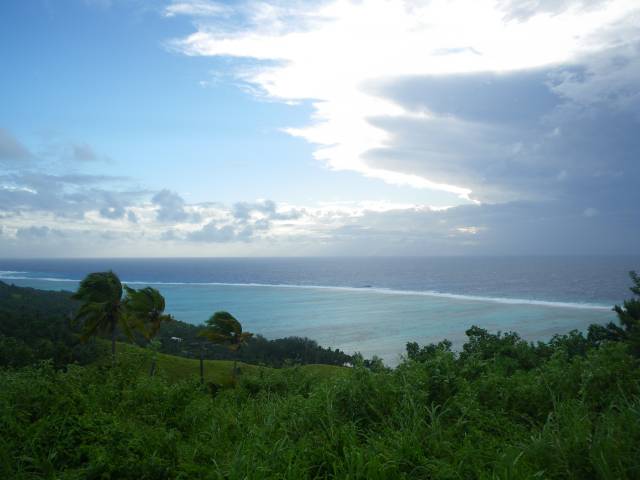
Reef on western side of
Aitutaki,
seen from the peak of MaungaPu |
- Visit the highest point of the island, the Maunga Pu. If
you want please take a photo of you and your GPS receiver,
so that the sourrounding area is recognizable, and feel free to
post this picture with your online log
Do not attempt to go there by driving a scooter!
- Measure the overall, average tilting angle of the formation. I
do not care about "the perfect number", but I want to see how you
measured. Measure localy with some improvised water-level or plumb
line, or in a wider area by using the altimeter of your GPSr at two
different, representative locations. Or bring your
pocket-theodolite. Be creative, but document your approach with a
photo! Feel free to add a sketch of your "construction". If you are
not afraid of someone "stealing" your approach, then also add these
pictures to your online log.
I highly appreciate weird concepts, as long as they are based on
classic physics.
Again, the focus is on the measuring arrangement, and not on the
number or precision of results. The geological structure to be
measured is only a small part of the massif.
Send me a short description of your measurement and the result
via my user profile. Please do not log your visit without my
permission.
Some Points of Interest
- The Peak of Maunga Pu, the highest place on Aitutaki
(119m)
S18 50.32166 W159 46.81633
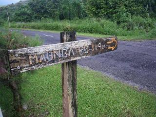
- The western start of the path to the Maunga Pu (recommended
starting point)
S18 50.214 W159 46.93167
- A good place along the path to take a measurement
S18 50.432 W159 46.808
Some Links of Interest

Update April 4th, 2011, according to GSA guidelines from
Jan. 1st, 2011: no photo of yourself required to log online. Please
add photos of your "measuring equippment".