 <>
<>
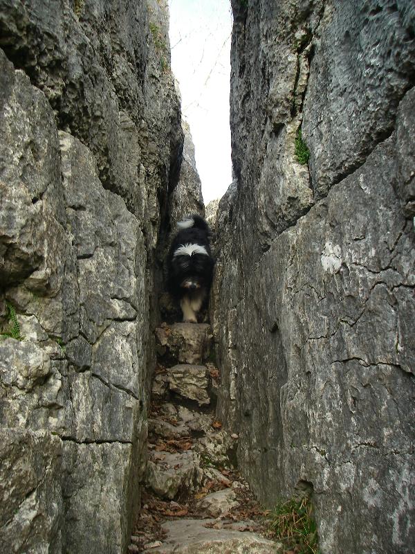
Fairy Steps is a
local beauty spot, lying approximately one
kilometre southwest of Beetham, a small village just off the
A6.
The steps themselves were created many years ago as a
“Coffin
Route” to carry the deceased of Arnside and Hazelslack
to
Beetham, there they would be buried in the grave yard of (at
the
time) the areas only church.
The climbing is
located on two impeccable parallel limestone
escarpments, both of which are under the cover of deciduas
woodland. For this reason the rock can stay wet for some time
after rain, but once dry offers a bouldering paradise.
The formation of
the two limestone pavements in the UK and Ireland began with the
scouring of the limestone by kilometre thick glaciers during the
last ice age. The weight of the ice removed the soil that lay over
the limestone, and also fractured the limestone along existing
horizontal surfaces of weakness known as bedding planes. Fractured
rocks were stripped away leaving level platforms of limestone on
which a thick layer of boulder clay (glacial till) was deposited as
the glaciers retreated. Wind blown material was then deposited on
top of the boulder clay.
This external
material is particularly important for soil formation, as limestone
does not weather down into soil which would mean if there had been
no glacial deposits, there would have been no soil development.
From the flat limestone surfaces, the characteristic features of
limestone pavement have been formed by water in the glacially
deposited soil exploiting cracks and fissures in the rock such as
bedding planes and joints (lines of weakness in the rock generally
running at 90o to bedding planes).

![]()
past the entrance of Hazelslack Farm, which itself is 3km East
of
the seaside village of Arnside. Cross a stile in the wall
directly
opposite the farm entrance and follow the track through a
yard
with a small damson orchard on the right. Carry on through
two
fields to the edge of the woods. Go through the gate and
follow
the well worn bridleway for a further 3/4km to the Lower
Steps.
In order to claim this
Earthcache please undertake the following
tasks.
1) Walk up the
Fairy Steps and take a picture of yourself standing between the two
limestone pavements.
2) From the
limestone pavements at the top, estimate the width of the gap
between them formed by the carving of the steps.
3) What is a
gryke?
All answers
should be emailed to me by viewing my profile. Photographs should
accompany logs.