Haughmond Quarry
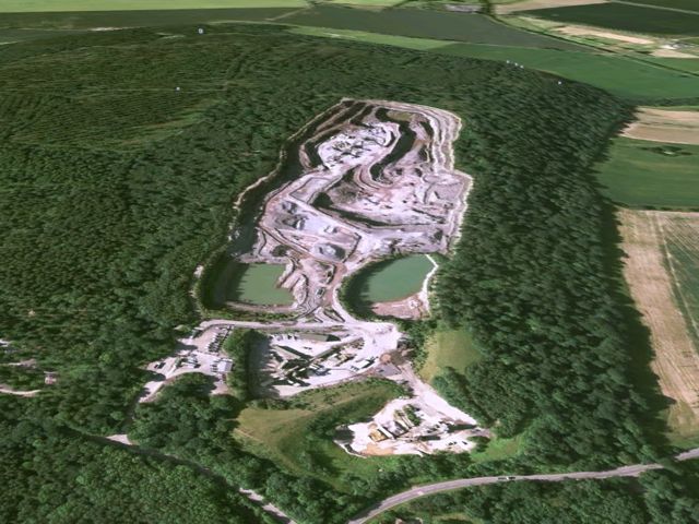
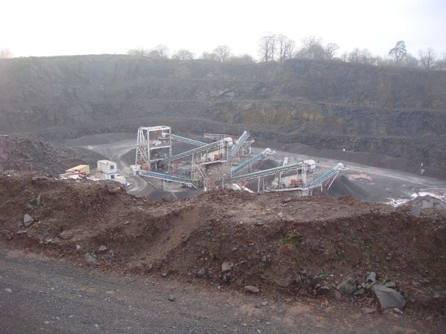
Haughmond Quarry is hidden from the road by the surrounding woods that cover the top of Haughmond Hill, just to the east of the county town of Shrewsbury. As part of a Geodiversity scheme the quarry owners have put a viewing platform at the edge of the woods, which affords an impressive overview of the quarry itself.
How was Haughmond Hill formed?
In the late Precambrian period, huge pressures within the earth caused the horizontal layers of conglomerate and greywacke to be folded so that they ended up almost vertical. These rocks formed hills, which were then eroded over a long period.
Shropshire had been covered by sea which retracted during the late Ordovician Ice Age. Exposure lead to erosion followed by deposition as sea levels rose when the ice melted. By the mid-Silurian period the area was covered with warm tropical sea in which coral reefs thrived and Wenlock Limestone was deposited.
Shallow seas became deltas covered with lush tropical swamps, inundated occasionally by the sea and rivers. Mines nearby at Uffington would eventually work the coal that formed during this period.
An arid desert climate led to the erosion of exposed highlands and deposition of New Red Sandstones found in the North and East of Shropshire. The Grinshill Sandstone, that had been hardened and discoloured by later chemical processes is now exploited for building.
The final shaping of the landscape was by ice that covered much of Shropshire 18,000 years ago. Moving ice sheets rounded off the landscape and deposited it's load of eroded material as hummocks in the valleys. This completes the formation of Haughmond Hill as it is seen today.
The Location
The co-ordinates above take you to the start of the walkway up to the viewpoint overlooking Haughmond Quarry. We've been specifically asked to make these the co-ordinates so there is no doubt that you DO NOT need to enter the quarry itself to do this cache. From the stated co-ordinates, simply follow the obvious walkway up to the viewpoint overlooking the quarry.
Parking is at the main Haughmond Hill Forestry Commission car park. From there, follow the Bardon Geo Trail marker posts to the stated co-ordinates.
The cache requires a visit to the viewpoint overlooking the quarry. At no time should you stray off the path or enter any part of the quarry.
Many thanks to Thomas Clifford, Geologist at Aggregate Industries and Georgina Sharpe at Forestry Commission West Midlands for their kind permission to set this Earthcache.
To Log This Cache
Please email the answers to the following questions to us via the link to our profile at the top of the cache page.
- What direction are the rock beds in the quarry and why? (Hint: look at the end wall of the quarry)
- Name the two main rock types found at Haughmond.
- What lead to the deposition of the two main rock types found at Haughmond?
- How many years ago did the Silurian period end?
- As an optional extra, post a picuture of yourself at GZ.
You may log your find after you have emailed us the answers. You do not need to wait for our reply.