This cache is part of a series (initiated by BakRdz) intended to showcase Wisconsin's Rustic Roads (WRR). The Wisconsin Legislature established the Rustic Roads program in 1973 to preserve what remains of Wisconsin's scenic, lightly traveled roads. For a current listing of Wisconsin Rustic Roads, check out this web page.
These caches are usually hidden in the right of way at a spot of notable beauty with no bushwhacking required. Please be respectful of private property, protected lands, and the overall history of the area. Take your time, mind your speed, and most of all, enjoy your journey along the road less traveled.
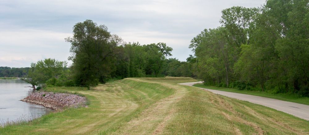
This particular cache is hidden along Levee Road on the Columbia County portion of Rustic Road 049. The 9.8-mile drive takes you on paved surfaces between County T in eastern Sauk County and Highway 33 near the city of Portage. The levee for which this road is named parallels the road on the north side for most of the Columbia County portion. At the cache site, you will be able to pull over and climb to the top of the levee to view the Wisconsin River. Be careful crossing the road.
The eastern portion of Levee Road also runs through the Pine Island Wildlife Management Area. There are many parking areas where people can leave their vehicles while they hike, fish, hunt, and otherwise explore this Wisconsin River area. We have also included a waypoint below for a scenic spot where you can pull over and look south across the interstate to the hills there.
The Sauk County portion of Levee Road is tree-lined and more populated with buildings. This is where conservationsist Aldo Leopold had his "shack" and lived the tales in his "A Sand County Almanac". You can visit the Aldo Leopold Reserve and walk where he once walked. Click here for more information.
NOTE: When we were looking for spots to place this cache, we ran across quite a bit of poison ivy near the road and the parking areas. The cache spot we chose has no visible sign of this plant, but be careful when venturing into other parts of this area. That stuff is tall and it is thick here!
This is a public hunting area, so take precautions if you search for this cache during hunting season, although the cache itself is in a safe area.
The Geocache Notification Form 2500-118 has been submitted to Sarah Kehrli at the Poynette office of the Wisconsin DNR. Geocaches placed on Wisconsin Department of Natural Resource managed lands require permission by means of a notification form. Please print out a paper copy of the notification form, fill in all required information, then submit it to the land manager. The DNR Notification form and land manager information can be obtained at: http://www.wi-geocaching.com/hiding