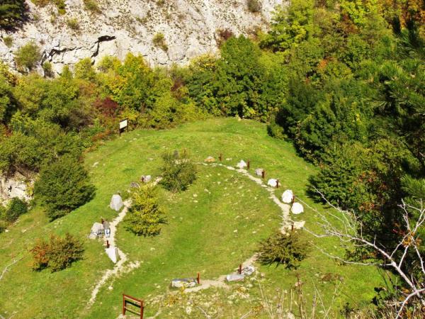

Geoparc is located in a quarry near the rear entrance to the Cave at Turold. On an artificial circular earthworks in the shape of a horseshoe closed 17 units with a stick of rock from different parts of our country. Were selected to represent the widest range of typical representatives of our geological history. Can be found in order, as stated in geology textbooks. First, volcanic, then established, and finally transformed. For each block of rock is a table with his description. Polished surfaces on the portion of each sample gives us an idea of what it looks like the stone when the artificial processing.
And here are my educational questions:
To log this Earthcache take a photo you with GPS before the infoboard (give in the log) and answer the following questions and send it to my email address geogaldra@gmail.com with a subject "Geoparc":
1.What is gneiss rock - geologic category?
2.What is lime rock - geologic category?
3.What is basalt rock - geologic category?
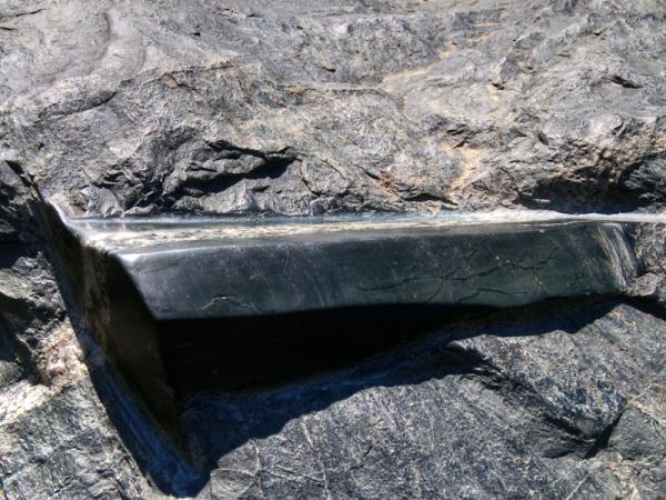
4.Find the stone at picture number 2, send me how it name is and how long is the glossy area at the stone.

Geopark se nachází se v Zadním lomu poblíž vstupu do jeskyne Na Turoldu. Na umelém kruhovém náspu ve tvaru uzavrené podkovy se tycí 17 bloku hornin z ruzných cástí naší republiky. Byly vybrány tak, aby reprezentovaly co nejširší škálu typických zástupcu naší geologické historie. Jsou umísteny v poradí, jak se uvádí v ucebnicích geologie. Nejprve vyvrelé, potom usazené a nakonec premenené. U každého skalního bloku je tabulka s jeho popisem. Vyleštené plošky na cásti každého vzorku nám dávají predstavu, jak vypadá dotycný kámen, když je umele opracován.
Nyní otázky:
K zalogování této earthcache poridte foto GPS nebo sebe pred infotabulí a napište mi odpovedi na následující otázky (ne do logu) na ?????????.rula@gmail.com s predmetem "Geoparc", kde ????????? je název kamene v otázce c.4:
1.Do jaké geologické kategorie spadá rula?
2.Do jaké geologické kategorie spadá vápenec?
3.Do jaké geologické kategorie spadá cedic?
4.Najdi vystavený kámen z fotografie c.2 a napiš jak se jmenuje a zmer délku vyleštené plochy na kameni.
Zalogujte se až po obdržení odpovedi (napiš do ní svuj NICK) a nezapomente doplnit do logu kód. Logy bez kódu budou ihned smazány.
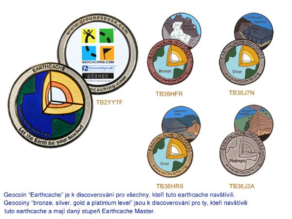
TB2YYTF TB36HFR TB36J7N TB36HR9 TB36J2A

