Durness Boudinage EarthCache
-
Difficulty:
-

-
Terrain:
-

Size:  (not chosen)
Please note Use of geocaching.com services is subject to the terms and conditions
in our disclaimer.
The North West Highlands have some of the most varied geology and
spectacular scenery in Scotland. In the far north-west are the
Lewisian gneisses, which are nearly 3000 million years old. Over
their long history, they have been heated and compressed deep
beneath the Earth's surface. Thick layers of red Torridonian
sandstones which form spectacular mountain landscapes, were laid
down upon the Lewisian gneiss by ancient river systems some 1000
million years ago.
Capping some of the Torridonian mountains are rocks, originally
lime-rich mud and worm-burrowed beach sands, that were deposited
during Cambrian and Ordovician times, between around 550 and 450
million years ago.
Minor structures are those found in handspecimen or outcrop. They
often provide important information about the conditions of
deformation and help unravel larger-scale structures. Boudinage is
one of the minor structures associated with folds and faults -
common to structures formed in the upper parts of the continental
crust.
Boudinage, (from French boudin, “sausage”), cylinder
like structures making up a layer of deformed rock. Seen in cross
section, the cylinders, or boudins, are generally barrel-shaped but
may be lenslike or rectangular. They commonly lie adjacent to each
other and are joined by short necks to give the appearance of a
string of sausages (hence their name). The thickest boudins are
about 20 m (65 feet) thick, and the thinnest about 1 cm (0.39
inch).
Boudinage results from the stretching of a firm but flexible
stratum, as during slip or flexure-slip folding. The exact method
of formation is not clearly understood. Generally the boudins lie
parallel to the fold axes, but occasionally two sets of mutually
perpendicular boudins may occur in the same stratum, one set
parallel to the fold axes, the other perpendicular to them.
Adjacent weak strata may flow into the necks of the boudins, or the
necks may be filled with recrystallized minerals such as quartz,
feldspar, or calcite. Boudinage occurs in a variety of rock types
and is one of the more common structures found in folded
rocks.
Durness and the surrounding area are part of the North West
Highlands Geopark and contain many interesting and different
geological features. Durness Tourist Information Centre is very
helpful and has lots more information about local geology on
display. This is the most north westerly village in mainland
Scotland and one of the few remaining places of any size that you
can only access by single track road.
The above information was compiled from the following
sources:
• Wikipedia, the free encyclopedia
• www.britannica.com
• www.northwest-highlands-geopark.org.uk
• www.undiscoveredscotland.co.uk
• www.scottishgeology.com
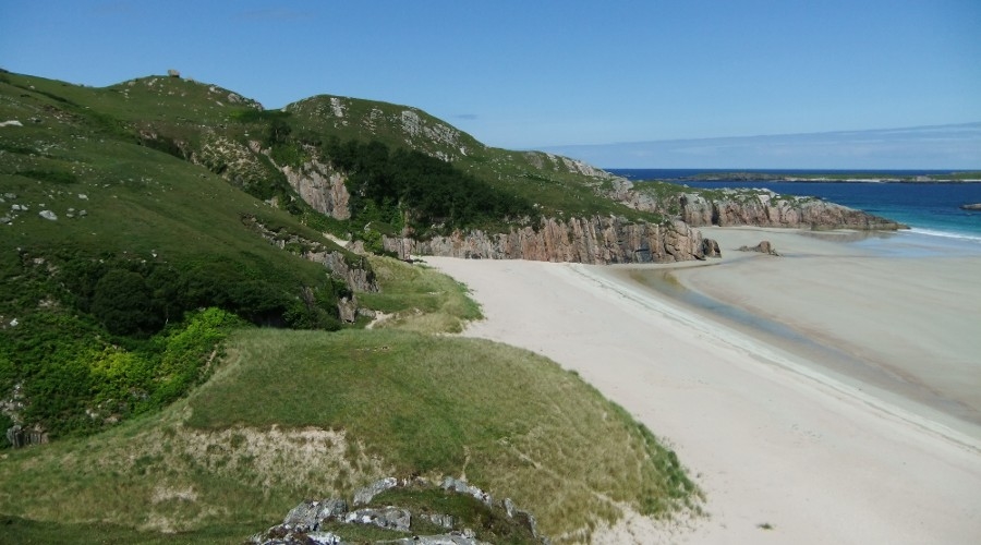
Parking available at N 58° 32.883 W 004° 40.575 from here cross the
road and go down onto the beach and head for the coordinates.
In order to log this cache please email your answers to these
questions via our profile.
1. Describe the unique rock formation that you see here, please
include colour shape size and number of boudins in your
answer.
2. This feature has been formed from different rock types. Which
rock type do you think is surrounding the boudins?
3. At the top of this cliff face, further up the hill towards the
road is another large geological feature which you can see as you
approach the cache site. What is it?
4. Please add a photo of yourself and / or your gps in this
beautiful location if possible, although this is not a requirement
for logging the cache.
Please feel free to log this cache without our confirmation; we
will contact you if your answers are different to those we were
expecting.
Additional Hints
(No hints available.)