Town name: Deward
Population: 0
Reason for Becoming a Lost Town:
Timber ran out, sawmill was moved, railroad was removed.

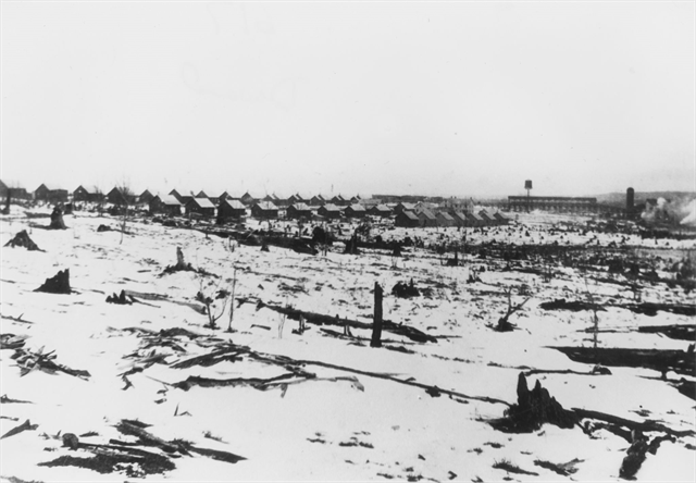
Town of Deward with Sawmill in background, circa 1910.
Photo courtesy of Charles Conn Slide Collection, Clarke Historical Library, Central Michigan University.
Town History:
In 1886, lumber baron David E Ward built a logging railroad between Frederic and East Jordan to harvest vast stands of white pine. In 1901, his children, with a huge incentive to get the timber harvested, determined it was more economical to ship finished lumber than unfinished logs. They created the town of Deward, named for their father, in sections 7 and 8, township 28 N, range 4 W, in Crawford County, on the upper reaches of the Manistee River. They built one of the largest and most modern sawmills in the country and upgraded the rail line to a common carrier headquartered in Deward, and renamed it the Detroit and Charlevoix. The town grew around the mill and railroad operation, and boomed for the next decade. The population peaked at around 800. According to the book Michigan: A History of the Wolverine State (Willis Dunbar), Deward had a company store, a church, a community hall, but no saloons. Photos of Deward, then and now, can be seen here. An article about Deward and a slideshow about Deward are from the Petosky News. Additional information is available at the Historical Museum (Depot) in Grayling. 1912 the timber in the area had all been harvested, and the mill was dismantled and moved. In 1930, the (then Michigan Central) railroad abandoned the rail line. By 1932 all residents had left the area as well. See the bottom of page 7 of this document for a panoramic view of Deward in 1942.

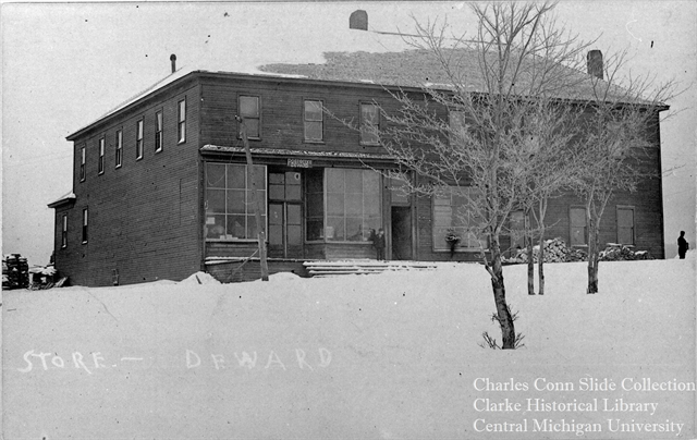
Deward Company Store and Post Office, circa 1910.
Notes of Interest:
All that remains today are small parts of the mill foundation, depressions, parts of foundations and rotting materials where other buildings stood, and railroad grades. The town site and several square miles of the surrounding countryside have been included in the Deward Management Area or Deward Tract. The area allows limited access to motor vehicles, only on roads marked as open and camping only within 50 feet of these open roads. Access to the river is available near the old mill site. Wildlife viewing locations are identified throughout the preserve. A DNR map of Deward Management Area shows the 4700 acre tract of land along the upper reaches of the main branch of the Manistee River.
