Qui c'est le plus grand ??? EarthCache
Qui c'est le plus grand ???
-
Difficulty:
-

-
Terrain:
-
Size:  (other)
Please note Use of geocaching.com services is subject to the terms and conditions
in our disclaimer.
Le terrier Randoin...
 C’est à Pouligny que se situe le point culminant du département de l'Indre : au "Terrier Randoin" (457m)
Celui de Vijon (commune à - de 1 km) étant inférieur de quelques mètres seulement (443m).
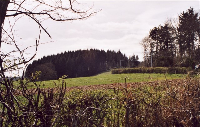
Le Terrier Randoin (ou colline du Fragne) se trouve dans le département de l'Indre, en région Centre-Val de Loire, avec son altitude de 457 mètres.
Il se situe sur le territoire de la commune de Pouligny-Notre-Dame, dans le Sud du département, à seulement un kilomètre au nord de la limite du département de la Creuse. Il appartient aux premiers contreforts septentrionaux du Massif central. . .
 La borne géodésique...
Le Terrier Randoin (terrier : en ancien français, tertre, colline ; Randoin : nom de personne d'origine germanique, Randwin, de rant = bouclier + win = ami) ; est appellé aussi signal du Fragne ou colline du Fragne (frâgne : frêne).
Géographiquement, il est situé en bordure du Massif central, dans une zone constituée de roches dures (granit, gneiss, micaschistes) qui a été légèrement soulevée lors de la formation des Alpes à l'ère tertiaire ; les reliefs aux roches les plus dures ont été mis en valeur par l'érosion différentielle.
La borne géodésique...
Le Terrier Randoin (terrier : en ancien français, tertre, colline ; Randoin : nom de personne d'origine germanique, Randwin, de rant = bouclier + win = ami) ; est appellé aussi signal du Fragne ou colline du Fragne (frâgne : frêne).
Géographiquement, il est situé en bordure du Massif central, dans une zone constituée de roches dures (granit, gneiss, micaschistes) qui a été légèrement soulevée lors de la formation des Alpes à l'ère tertiaire ; les reliefs aux roches les plus dures ont été mis en valeur par l'érosion différentielle.
Il est implanté dans le Boischaut du Sud qui est un plateau dans lequel les cours d'eau ont creusé des vallées. C'est un paysage de bocage humide et planté de beaucoup de haies d'arbres ; son sous-sol est en effet constitué de roches non poreuses et imperméables (granite, schistes, gneiss, argiles et marnes)...
POINT GEODESIQUE IGN
Selon les relevés de l’IGN du point le plus haut de chaque département, le département de l’Indre est classé 63e (entre la Dordogne 62e et la Meuse 64e) sur 110. Le point le plus haut est en Haute-Savoie avec le Mont-Blanc culminant à 4810 mètres et le point le plus bas, 24 mètres, aux Iles Eparses dans l’océan Indien près de Madagascar (plus précisément l'ile Europa territoire français depuis 1896).
*****************************
RAPPEL: PAS DE BOITE A TROUVER SUR PLACE...
POUR VALIDER LE FOUND-IT: REPONDEZ AUX QUESTIONS SUIVANTES:
1) Quest-ce-qu'un "contrefort" en terme géologique. ?
2) Quest-ce qu'une érosion différentielle ?
3) Le "Boischaut" est divisé en combien de parties et quels sont leurs noms ?
4) Quest-ce qu'un point géodésique ?
5) La borne est en quelle roche ? et sa forme ?
6) Photo optionnelle à la borne géodésique...
Loguez cette cache "Found it" et envoyez-moi vos propositions de réponses soit via mon profil, soit via la messagerie geocaching.com (Message Center), et je vous contacterai en cas de problème.
BONNE DECOUVERTE...
 The terrier Randoin ...
This is in Pouligny that is the culmination of the department of Indre "The Terrier Randoin" 457m, that of Vijon (common to - 1 km) is less than a few meters (443m).
Le Terrier Randoin (or Fragne Hill) is located in the department of Indre, in the Centre region, the Loire Valley, with its altitude of 457 meters.
It is located on the territory of the town of Pouligny-Notre-Dame, in the southern department, just one kilometer north of the boundary of the department of Creuse. It is the first northern foothills of the Massif Central. . .
The geodetic monument ...
The Randoin Terrier (Terrier: old French, mound, hill Randoin: personal name of Germanic origin, Randwin to rant = shield + win = friend); is referred to as Signal Hill or Fragne Fragne (Fragne: ash).
Geographically, it is located on the edge of the Massif central, in an area made of hard rock (granite, gneiss, mica schists) which was slightly raised at the formation of the Alps to the tertiary; the reliefs to the hardest rocks were highlighted by differential erosion.
It is located in the South Boischaut is a plateau where rivers carved valleys. This is a moist wooded landscape and planted many trees hedges; its basement is indeed made of non-porous and impermeable rock (granite, schist, gneiss, clay and marl) ...
POINT GEODESIC IGN
According to figures from IGN the highest point of each department, the department of Indre is ranked 63rd (Dordogne between 62nd and 64th Meuse) on 110. the highest point is in the Haute-Savoie Mont Blanc peak at 4810 meters and the lowest point, 24 meters to the Scattered Islands in the Indian ocean near Madagascar (specifically the island Europa french territory since 1896).
TO CONFIRM THE CACHE, ANSWER THE FOLLOWING QUESTIONS:
1) Quest is-a "buttress" in geological terms. ? ?
2) Quest is a differential erosion?
3) The "Boischaut" is divided into how many parts, and what are their names?
4) Quest is a triangulation point?
5) The terminal is what rock? and its form?
6) Optional Picture a Geodetic ...
phones Sign the cache "Found it" and send me your answers proposals either via my profile or via geocaching.com messaging (Message Center) and I will contact you in case of problems.
GOOD DISCOVERY...
Additional Hints
(Decrypt)
Nppèf cne yn Q26Q rager Cbhyvtal A.Q rg Fgr Féièer.