Lom Ve skále
[CZ] Lom Ve skále (v minulosti nazývaný jako Panský lom), poskytl podle své dochované velikosti materiál na většinu kamenných staveb v Lysé a blízkém okolí.
Není přesně doloženo, kdy byl otevřen. V historických dokumentech je prokazatelně uváděn od počátku 18. století. Kámen se zde lámal nepřetržitě až do 70. let 20. století. Traduje se, že terénní prohlubeň na rozhraní anglické a francouzské části zámeckého parku (asi 100 m od kaple), je pozůstatkem původního lomu, z něhož byl postaven tehdy zdejší hrad.
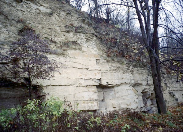
Ve stěně lomu Ve skále, vysoké až sedmnáct metrů, je obnaženo střídání uložení dvou typů svrchnokřídových sedimentů – písčitých slínovců a spongilitů (křemitých vápenců). Písčité slínovce jsou měkčí, tence odlučné a zčásti představovaly hlušinu. Hlavním předmětem těžby byly pevnější partie slínovců a především tmavošedé až lehce modrošedé, masivní, pevné spongility. Jde o horniny značně podobného složení jako slínovce, avšak silně zpevněné jehličkami křemenných hub (spongilií). Místní kameníci měli pro jednotlivé horniny vlastní svérázná označení – polohám spongilitů říkali dolní, střední a horní kvarc. Slínovcům říkali opuky.
Uvedené horniny jsou usazeninami moře, které ve svrchní křídě pokrývalo značnou část dnešní rozlohy Čech. Řadíme je k jizerskému souvrství, jehož většina vznikla v období zvaném Střední Turon.
[EN] The quarry In the Rock - Lom Ve skále (formerly also called Manor quarry = Panský lom) has provided material to most of the stone buildings in Lysá nad Labem and to many buildings in its surrounding.
It is not exactly documented when the quarry was opened. In the historical documents, it has been proven that the mining began in the 18th century. The stone has been collected here continuously until the 1970s. It is rumored, that the place at the intersection of the English and the French part of the Chateau Park (about 100 m from the chapel) is a remnant field of the original quarry which stone was used to built the former castle in Lysá nad Labem.
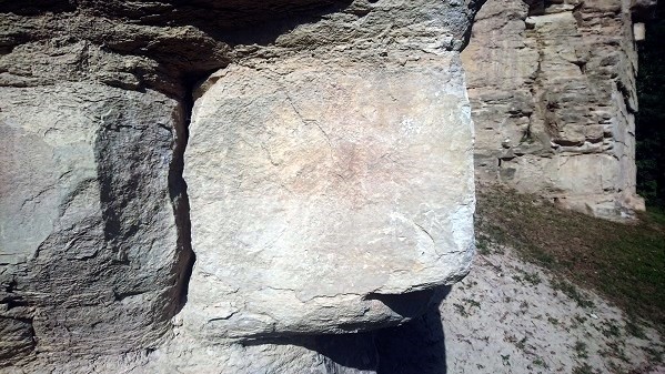
The wall of the quarry In the Rock, up to seventeen meters high, is exposing alternating positions of two types of Late Cretaceous sediments - Sandy marlites and spongilites (quartzite limestone). Sandy marlites are softer, thinner, and partly degraded. The main object of mining was the stronger part of the marlites and, above all more important, dark gray to light blue-gray, massive, solid spongilites. These are rocks of a similar composition to the marlites, but heavily reinforced with needles of quartz mushrooms (sponges). Local stonemasons had their own distinctive names for their rocks - the positions of the spongilites were called "horní, střední a dolní kvarc". The marlites were called "opuky".
The rocks are sea sediments, which in the Late Cretaceous covered a large part of today's area of Bohemia. We group them into the Jizerské formation, the majority of which originated in the period known as the Central Turon.
|