The southernmost tip of the African continent is at Cape Agulhas and not at Cape Point as many people believe. The official position of the tip is found approximately 1 km west of the Cape Agulhas Lighthouse. The tip's exact location is marked by a simple yet dramatic cairn, which was erected in 1986. At the end of the 15th century the early Portuguese seafarers christened this tip Cabo das Agulhas - Cape of Needles and refers to the needle of the compass which at this point shows no real deviation between true north and magnetic north. A truly magic and desolate place, where suddenly one begins to understand the difficulties the early seafarers must have faced.
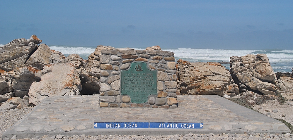
As determined by the International Hydrographic Organisation, the two mighty oceans - Indian and Atlantic - meet at the most southern tip of the continent of Africa - Cape Agulhas. However the meeting point of the two ocean currents, the warm Agulhas Current and the cold Benguela Current, is a totally different issue, and must not be confused with the meeting of the Oceans. The point where these currents meet fluctuates considerably, and is constantly on the move along the southern and south western Cape coast, most often occurring somewhere between Cape Agulhas and Cape Point. Contrary to what one may think, this meeting produces no fireworks, clashing cymbals or dramatic crashing of waves!
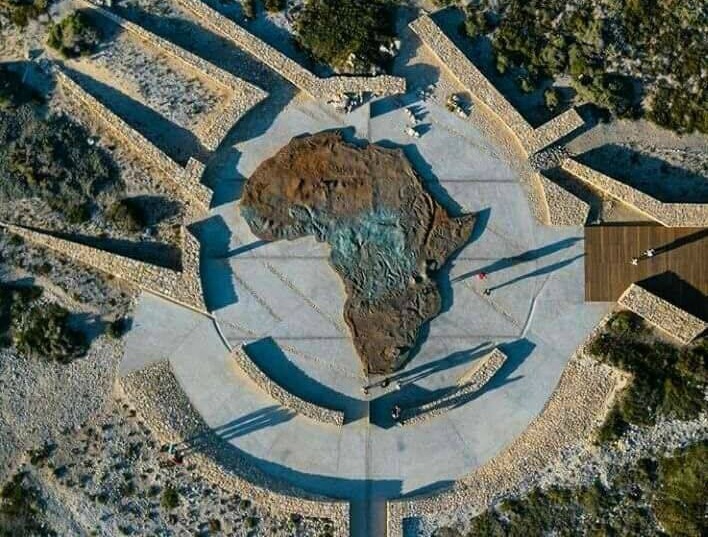
About 50m from GZ you can find a huge map of Africa. The raised profile is hand-crafted from reinforced concrete and stained metal powders to achieve oxidised colour and texture.
In order to log this cache you need to do one of the following :
1) At GZ take a picture of your caching name written on your hand/paper or showing your GPS with the Indian Ocean/Atlantic Ocean sign in the background. The sign must be visible.
or
2) Stroll over to the map of Africa and take a picture showing your GPS/shoes/feet at the Southernmost point.
RULES
1) Logs without a picture will be deleted within a reasonable amount of time after the date of logging.
2) If you are caching in a group every cacher in the group has to have his/her own picture. No group or duplicate photos will be allowed.
DO NOT SEND YOUR PICTURES TO ME.
Virtual Rewards 2.0 - 2019/2020
This Virtual Cache is part of a limited release of Virtuals created between June 4, 2019 and June 4, 2020. Only 4,000 cache owners were given the opportunity to hide a Virtual Cache. Learn more about Virtual Rewards 2.0 on the Geocaching Blog.