|
 |
 |
[PT] Clicar para descarregar o cartucho.
[EN] Click to unload the cartridge.
[ES] haga clic para descargar el cartucho. |
 |
|
 |
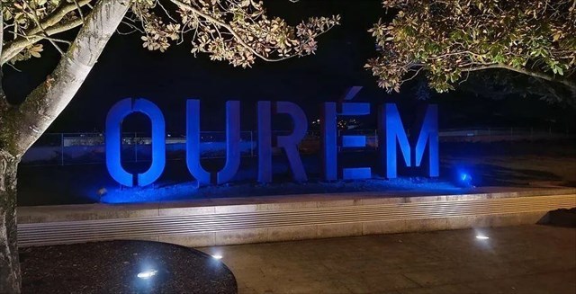
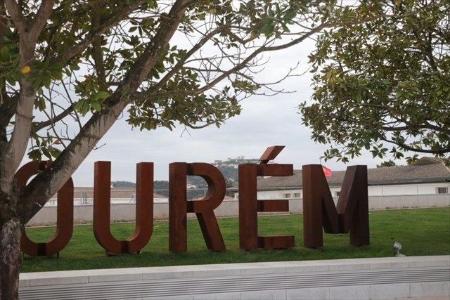
Passeio Cidade de Ourém |
|
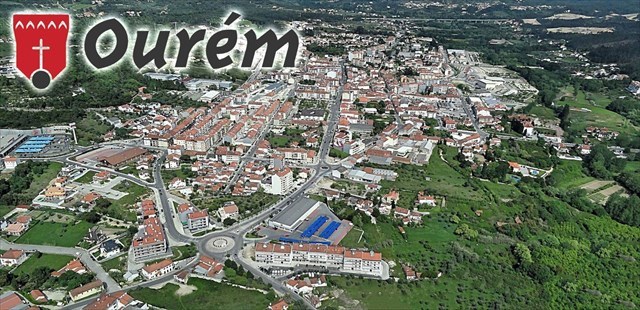
“Ourém, cidade e sede de concelho do distrito de Santarém, situa-se no centro do
país, na área do Vale do Tejo, a cerca de 40Km da costa atlântica e posiciona-se
entre a latitude 39º 30´ N e 39º 50´e a longitude 8º 30W e 8º 40´W. A área afeta
a este município desenvolve-se entre a vertente norte da Serra de Aire, a
plataforma de Fátima a oeste e o Rio Nabão a leste e abrange uma área de cerca
de 416,1Km². Fica ainda encravado pelos concelhos de Pombal, a Norte,
Alvaiázere, Ferreira do Zêzere e Tomar a nascente, Torres Novas e Alcanena a sul
e a poente pelos concelhos da Batalha e Leiria”.
O povoamento é caraterizado por ser disperso, com uma acentuada tendência
para a diminuição do número de habitantes das zonas rurais, ou dos lugares de
pequena dimensão, em benefício de um aumento dos núcleos urbanos, nomeadamente
as cidades de Ourém e Fátima e as vilas de Caxarias, Freixianda, Vilar dos
Prazeres, e Olival, registando em 2011 (dados censitários), uma população na
ordem dos 46 mil habitantes distribuídos por 13 freguesias.
No que concerne a infraestruturas relacionadas com os transportes, as
acessibilidades externas ficam essencialmente caracterizadas pelo acesso
rodoviário à A1, através do nó de Fátima, e o acesso ferroviário à linha do
norte, onde tem particular relevo a estação da vila de Caxarias, sendo de
referir, a disponibilização recente de uma via complementar de importância
regional, o IC9.
O tecido empresarial é essencialmente constituído por pequenas e médias
empresas, com particular incidência na indústria transformadora, construção e
obras públicas, comércio e hotelaria, concentrando o setor terciário a maior
proporção de população empregada (55%), seguido do setor secundário (42%) e por
fim o setor primário (3%).
O turismo e em particular o de cariz religioso detém um papel fundamental no
desenvolvimento económico do concelho, visto que se estima um volume turístico
anual próximo dos 6 milhões de visitantes. |
|
 |
|
A Cache: |
|
Para começar esta aventura, devem começar por
descarregar o cartucho no site da Wherigo.com ou usar a aplicação oficial para o
efeito. podem usar o icon da Wherigo no topo desta listing para descarregar
diretamente. Esta aventura é uma
voltinha pela cidade de Ourém com menos de 4km em todo o seu circuito desde o
Parque de estacionamento, container final e regresso ao cachemobil e deverá
demorar cerca de 1hora a decorrer
Nesta aventura existem interações com itens,
com personagens, zonas e pequenas brincadeiras e desafios!
No fim irão receber o codigo de
desbloqueio do cartucho no site Wherigo.com!
Espero que gostem de toda a
aventura! Boa Sorte! |
|
|
|
Cartucho testado em equipamentos
Garmin |
|
|
|
|
|
|
 |
|
 |
OURÉM CITY TOUR |
|
“Ourém, city and county seat of the district of
Santarém, is located in the center of the country, in the Tagus Valley area,
approximately 40 km from the Atlantic coast and is positioned between latitude
39º 30´ N and 39º 50´ and longitude 8º 30W and 8º 40´W. The area affecting this
municipality is located between the northern slope of Serra de Aire, the Fátima
platform to the west and the Nabão River to the east and covers an area of
approximately 416.1 km². It is also surrounded by the municipalities of
Pombal, to the north, Alvaiázere, Ferreira do Zêzere and Tomar to the east,
Torres Novas and Alcanena to the south and to the west by the municipalities of
Batalha and Leiria”. The population is
characterized by being dispersed, with a marked tendency towards a decrease in
the number of inhabitants in rural areas, or in small places, in favor of an
increase in urban centers, namely the cities of Ourém and Fátima and the towns
of Caxarias, Freixianda, Vilar dos Prazeres, and Olival, recording in 2011
(census data), a population of around 46 thousand inhabitants spread across 13
parishes.
With regard to infrastructure related to
transport, external accessibility is essentially characterized by road access to
the A1, through the Fátima junction, and rail access to the northern line, where
the Caxarias village station has particular importance, being of Mention should
be made of the recent availability of a complementary route of regional
importance, the IC9.
The business sector is essentially made up of small and medium-sized companies,
with a particular focus on manufacturing, construction and public works,
commerce and hotels, with the tertiary sector accounting for the largest
proportion of the employed population (55%), followed by the secondary sector
(42% ) and finally the primary sector (3%).
Tourism, in particular that of a religious
nature, plays a fundamental role in the economic development of the
municipality, as an annual tourist volume is estimated to be close to 6 million
visitors. |
|
|
|
The Geocache: |
|
To begin this adventure, you must start by
downloading the cartridge on the Wherigo.com website or using the official
application for this purpose. You can use the Wherigo icon at the top of this
listing to download directly. This
adventure is a little walk around the city of Ourém with less than 4km in its
entire circuit from the parking lot, final container and return to the
cachemobil and should take around 1 hour to complete.
In this adventure there are interactions with items, characters, zones and small
games and challenges!
At the end, you will receive the cartridge
unlock code on the Wherigo.com website!
I hope you enjoy the whole
adventure! Good luck! |
|
Information: |
|
Cartridge tested on Garmin equipments |
|
|
|
 |
|
 |
VISITA A LA CIUDAD DE OURÉM |
|
“Ourém, ciudad y cabecera municipal del distrito
de Santarém, está situada en el centro del país, en la zona del Valle del Tajo,
aproximadamente a 40 km de la costa atlántica y está situada entre los 39º 30´ N
y 39º 50´ de longitud 8º 30W y 8º 40´W. El área que afecta a este municipio se
encuentra entre la vertiente norte de la Sierra de Aire, la plataforma de Fátima
al oeste y el río Nabão al este y tiene una superficie aproximada de 416,1 km².
También está rodeado por los municipios de Pombal, al norte, Alvaiázere,
Ferreira do Zêzere y Tomar al este, Torres Novas y Alcanena al sur y al oeste
por los municipios de Batalha y Leiria”.
La población se caracteriza por estar
dispersa, con una marcada tendencia a la disminución del número de habitantes en
las zonas rurales, o en lugares pequeños, a favor de un aumento en los centros
urbanos, concretamente las ciudades de Ourém y Fátima y las localidades de
Caxarias. , Freixianda, Vilar dos Prazeres y Olival, registrando en 2011 (datos
del censo), una población de alrededor de 46 mil habitantes repartidos en 13
parroquias.
En cuanto a las infraestructuras relacionadas
con el transporte, la accesibilidad exterior se caracteriza fundamentalmente por
el acceso por carretera a la A1, a través del enlace de Fátima, y el acceso
ferroviario a la línea norte, donde tiene especial importancia la estación del
pueblo de Caxarias, entre las que cabe destacar la Disponibilidad reciente de
una ruta complementaria de importancia regional, la IC9.
El sector empresarial está compuesto
fundamentalmente por pequeñas y medianas empresas, con especial atención a la
industria manufacturera, la construcción y obras públicas, el comercio y la
hotelería, siendo el sector terciario el que concentra la mayor proporción de la
población ocupada (55%), seguido por el sector secundario (42%) y finalmente por
el sector primario (3%).
El turismo, en particular el de carácter
religioso, juega un papel fundamental en el desarrollo económico del municipio,
ya que se estima un volumen turístico anual cercano a los 6 millones de
visitantes. |
|
|
|
The Geocache: |
|
To begin this adventure, you must start by
downloading the cartridge on the Wherigo.com website or using the official
application for this purpose. You can use the Wherigo icon at the top of this
listing to download directly. This
adventure is a little walk around the city of Ourém with less than 4km in its
entire circuit from the parking lot, final container and return to the
cachemobil and should take around 1 hour to complete.
In this adventure there are interactions with items, characters, zones and small
games and challenges!
At the end, you will receive the cartridge
unlock code on the Wherigo.com website!
I hope you enjoy the whole
adventure! Good luck! |
|
Información: |
|
Cartucho probado en equipos Garmin: |
|
|
|
 |
|
 |
 
 |
|

|