This is a container that is in the ground it is about o I would say 2 to 3 gal. so it is large in size.
It is only august at times to get up here because of snow.
The elevation is 6969 by my Magellan and I am also been told that it is the highest place in WASH.ST that you can drive a car.
If you do come up here then bring a camera and even a clear day you can see ST. HELLENS.
Well have fun and happy hunting.
07-21-07 The container has been changed to an ammo can due to water damage to the original.
While here it is well worth the short walk to "5 Mountains" cache (GC2CANN). This cache takes you to the back side of Darland Mountain where you will have an excellent unobstructed view of all 5 mountains.
UPDATE: July 26, 2012
Many thanks to Jeepinfool
for allowing us to adopted this cache!
Cache is still an ammo box, but coordinates have been changed.
Happy Caching!
Darland Mountain Lookout
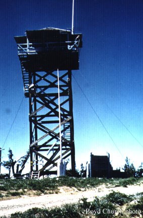 With an elevation of 6981’, Darland Mountain is located on the west side of Ahtamnum State Forest approximately 34 miles WSW of Yakima, Washington. In 1925 a D-6 cupola cabin was constructed, which was replaced in 1935 with an L-4 tower. The tower stood until 1942 at which point it was trucked to Blue Slide LO. In 1942 the tower was destroyed.
This cache is placed near the site of Darland Mountain Lookout. Remnants of the former lookout are still there along with spectacular views of Mt. Rainier, Mount Adams, Mt. St. Helens, Mt. Hood, Mt. Jefferson and the Goat Rocks.
Due to the high elevation, the best times to visit this cache are mid-Summer until the first snow. The drive to the top of Darland Mountain is easily traveled by most vehicles until the last 2 miles. At this point the road becomes rutted and rocky in some places. High clearance vehicles are recommended.
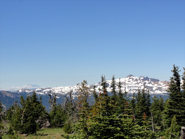
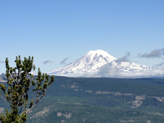
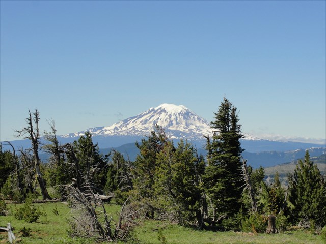
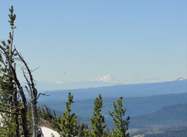
Upper left Mt. St. Helens & the Goat Rocks; Upper right Mt. Rainier
Lower left Mt. Adams; Lower right Mt. Hood & Mt. Jefferson