Damariscotta River
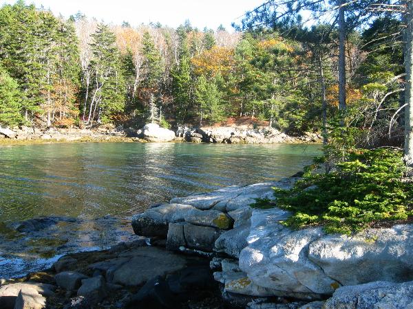
Formerly known as Cache in the Bank. The water reaches too high now for the former location. Moved to higher ground April 2019. "Cache Near the Bank" is located in Plummer Point Preserve off Route 129 in South Bristol, Maine. This beautiful, untrafficked area is managed by the Damariscotta River Association, which owns property all along the river. There is parking with room for 2-3 cars in a pulloff between a cluster of mailboxes, and the Land Trust Sign for Plummer Point Preserve. The coordinates are N43 53.505 / W069 33.850. After parking, follow the unpaved Plummer Pt. Road about .20 miles to the trailhead at about N43 53.641 / W069 33.903. The trailhead is marked with a small kiosk. Damariscotta River Association logo. From here, follow the orange and white arrows to the cache. It's not the best-marked trail, but you should be able to follow it. The trail is mostly flat, although there is one downhill steep section and another where you're walking across a steep grade, so be careful. Cache is now in a painted ammo can.
After finding the cache, you have the option of returning the way you came or completing a loop. To do the latter, return to the main trail and turn left. This will bring you to an old quarry. Bear to the right and continue up the hill until you hit Plummer Point Rd. Turn right and follow this back to your car. It's not as scenic but the quarry is interesting.
Enjoy the cache and the views!
--IntotheWoods