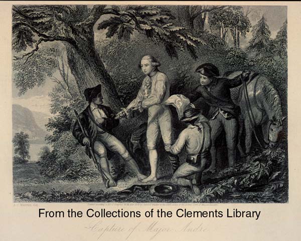
This cache is created to remember an important event during the
Revolutionary War. Benedict Arnold negotiated with the British to
surrender West Point in exchange for 20,000 pounds. This American
Traitor worked with British spy Major John Andre and the stages of
this cache are locations that have to do with John Andre enroute to
deliver Benedict Arnold’s surrender documents to the British. John
Andre was disguised in an American uniform to get through the
American lines on his way to the British ship “Vulture” that was
stationed in the Hudson River. Once Andre entered what he thought
was British controlled territory, he was stopped by three men in
British uniform. When he ordered them to step aside, revealing who
he truly was, these three men arrested him and revealed themselves
to be American militiamen from this local area. These men obtained
the documents hidden in Andre’s boot revealing the treason plot of
Benedict Arnold and in the end, helped save West Point, an
important American stronghold in New York leading into New
England.
The first stop of this multi was a lookout point over what
wascalled “No Man’s Land” and will provide you with the needed
information for stage two, along with experiencing a nice view.
Once you are at the coordinates listed, do the following: 1.
Count the number of trustees listed on the plaque and multiply this
number by 10. 2. Add this number to the each of the following
coordinates to find stage 2: N. 41 04.800 W. 073 51.491
Stage two is a monument in honor of the above event. Once you
are there, look for a plaque posted on a fence around the monument
and do the following: 1. Count the number of letters in the first
and last name of the person who donated this land where this
monument stands and multiply this number by 11. 2. Add this number
to each of the following to get the coordinates of the final stage:
N. 41 05.250 W. 073 51.611. The final stage brings you to another
historical place which I recommend spending the afternoon visiting.
There is a fee to get in and take the tour.
There is a small pull-off near the site of the first stage or
you can park a block or two away on a side street. For stages two
and three, street parking is available very close by but not on the
main street. All cache stages can be accessed day and night. I
recommend daylight / sunset hours to enjoy the view of stage one.
The cache is a micro (log only) and you must bring your own pen or
pencil. Please use stealth when looking for and rehiding the cache
and keep it in the same exact location.