Salto Ángel (Angel Falls) EarthCache
Salto Ángel (Angel Falls)
-
Difficulty:
-

-
Terrain:
-

Size:  (other)
Please note Use of geocaching.com services is subject to the terms and conditions
in our disclaimer.


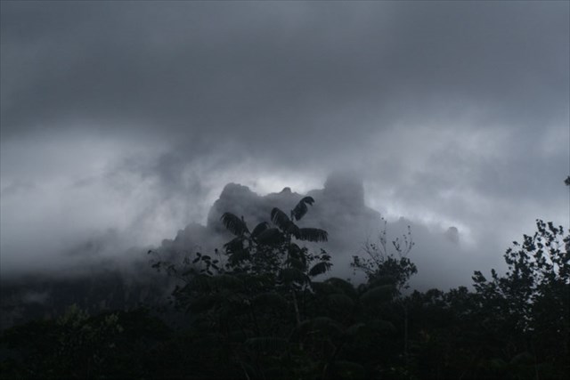
El Salto Ángel (tras el redescubrimiento Jimmie Angel) es una cascada en el sureste de Venezuela. Él está en 979 m (el más grande de un solo nivel 805 m) altura de caída, la cascada más alta en caída libre en el mundo. En el lenguaje de los indígenas Pemón su nombre Kerepakupai Meru, lo que significa que algunos de los siguiente lugar más profundo. La Gran Sabana que pertenece a la cascada forma parte del Parque Nacional Canaima. Sus aguas, las formas Río Churún, afluente del Carrao Río. Se cae de una cornisa del Auyan Roraima, una montaña de mesa con área de 700 kilómetros cuadrados en las profundidades. El Tepui es un remanente del Escudo Guayanés, una roca de cuarcita Roraima-sedimentarias, cuya edad, al menos 1,7 millones de años es estimada. Las rocas sedimentarias contienen fósiles, porque la vida no sólo ha producido única a la Paleoproterozoica. Esto impidió que la edad de los Tepuis sólo se determinará por el método geofísico de uranio-plomo de citas. A mitad de camino el agua atomizada sobre todo en la estación seca a una nube de pequeñas gotas de agua, que recogen al pie del acantilado en un río embravecido. Pronto el agua vuelve a caer a 200 metros de profundidad. La cascada es alimentada por las lluvias a menudo violenta tormenta que entran en la gran meseta de la montaña. Del rock hoyos de 40 m por debajo del borde de los choques de agua en las profundidades. Para registrar este caché, voy a contestar las siguientes preguntas por correo y tomarse una foto con usted o su GPS en frente de la cascada, y agregarlo a su registro! tiene
1) Qué color del Río Churún en el que se llegó?
2) Cuánto tiempo se va del Río Churún el punto más cercano vista del Salto Angel?
3) Qué puede hacer usted para el mirador?
Enviar las respuestas a mi cuenta. Son las respuestas correctas, obtendrá permiso para iniciar sesión. Registros sin permiso y sin cumplir ninguna foto será borrada.

The Angel Falls (after the rediscoverer Jimmie Angel) is a waterfall in southeastern Venezuela. He is at 979 m (largest single level 805 m) drop height, the highest free-falling waterfall in the world. In the language of the indigenous Pemón his name is Kerepakupai Meru, which means some of the deepest place jump. The Gran Sabana belonging to the waterfall is part of the National Park Canaima. Its water, the Río Churún, is a tributary of the Río Carrao. It falls from a ledge of Auyan Tepui, a table mountain with 700 sq km area in the deep. The Tepui is a remnant of the Guiana Shield, a Roraima-Quartzite-sedimentary rocks, whose age, at least 1.7 billion years is estimated. The sedimentary rocks contain no fossils because life has only produced single to the Paleoproterozoic. This prevented the age of the Tepuis only be determined by the geophysical method of uranium-lead dating. Half way the water atomized especially in the dry season to a cloud of small water droplets, which collect at the foot of the cliff into a raging river. Soon the water again falls 200 m in depth. The waterfall is fed by often violent thunderstorm rains which fall on the great plateau of Table Mountain. From rock holes 40 m below the rim of the water crashes into the depths. To log this cache, please answer the following questions by mail and take a photo with you or your GPS in front of the waterfall, and add it to your log!
1) Which color has the Río Churún on which you are arrived?
2) How long are you running from the Río Churún to the nearest view point of the Angel Falls?
3) What can you do at the view point?
Send the answers to my account. If the answers are correct you will get the permission to log. Logs without permission and without matching photo will be deleted without comment.

Der Salto Ángel (nach dem Wiederentdecker Jimmie Angel) ist ein Wasserfall im Südosten Venezuelas. Er ist mit 979 m (größte Einzelstufe 805 m) Fallhöhe der höchste freifallende Wasserfall der Erde. In der Sprache der indigenen Pemón heißt er Kerepakupai merú, was etwa Sprung des tiefsten Ortes bedeutet. Der zur Gran Sabana gehörende Wasserfall ist Teil des Nationalparks Canaima. Sein Wasser, der Río Churún, bildet einen Zufluss des Río Carrao. Es stürzt von einem Vorsprung des Auyan-Tepui, eines Tafelbergs mit 700 km² Fläche, in die Tiefe. Der Tepui ist ein Überrest des Guayana-Schildes, eines Roraima-Quarzit-Sedimentgesteins, dessen Alter auf mindestens 1,7 Milliarden Jahre geschätzt wird. Das Sedimentgestein enthält keinerlei Fossilien, da das Leben bis ins Paläoproterozoikum lediglich Einzeller hervorgebracht hat. Deshalb konnte das Alter der Tepuis nur mit der geophysikalischen Methode der Uran-Blei-Datierung bestimmt werden. Auf halbem Weg zerstäubt das Wasser insbesondere in der Trockenzeit zu einer Wolke aus kleinen Wassertröpfchen; diese sammeln sich am Fuß der Felswand zu einem reißenden Fluss. Kurz darauf stürzt das Wasser abermals 200 m in die Tiefe. Gespeist wird der Wasserfall durch oft heftige Gewitter-Regengüsse, die auf dem großen Plateau des Tafelberges niedergehen. Aus Felslöchern 40 m unterhalb der Abbruchkante stürzt das Wasser in die Tiefe. Um diesen Earthcache zu loggen, beantworte mir folgende Fragen per Mail und mache ein Foto mit dir oder deinem GPS vor dem Wasserfall und füge es deinem Log hinzu!
1) Welche Farbe hat der Río Churún, auf dem Du angereist bist?
2) Wie lang läufst Du vom Río Churún zum nächstgelegenen Aussichtspunkt des Salto Ángel?
3) Was kannst Du an dem Aussichtspunkt machen?
Sende die Antworten an meinen Account. Sind die Antworten richtig, erhältst Du die Erlaubnis zum loggen. Logs ohne Erlaubnis und ohne passendes Photo werden kommentarlos gelöscht.
Additional Hints
(No hints available.)