Tonopah Mining District
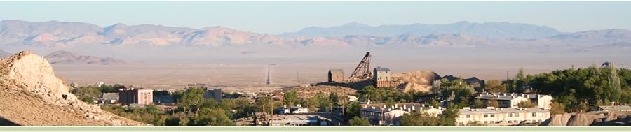 Tonopah, Nevada
The Walker Lane Belt, which trends from eastern California to Western Nevada is a seismic belt or geologic trough roughly aligned with the California/Nevada border southward to Death Valley. The Walker Lane takes up 15 to 25 percent of the boundary motion between the Pacific Plate and the North American Plate, the other 75 percent being taken up by the San Andreas Fault system to the west. The Walker Lane may represent an incipient major transform fault zone which could replace the San Andreas as the plate boundary in the future.
The Walker Lane Trend hosted some of the most famous gold and silver deposits in Nevada. These include the Comstock, Central Tonopah, Goldfield and Round Mountain districts which have produced 35 million gold-equivalent ounces of ore.
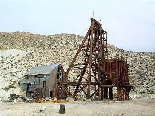
The mine workings at Tonopah comprised three vertical shafts and about 50 miles of lateral workings. The deepest shaft was 1,500 feet. They maintained a high gold and silver production record until the Great Depression of the 1920's and 30's. By World War II, only four major mining companies were operating. At the end of the war, even these companies ceased to operate in Tonopah and the era came to an end in 1947 with the demise of the Tonopah and Goldfield Railroad.
Tonopah and the Tonopah Divide districts lie in Miocene and younger volcanic rocks of the San Antonio Range in west-central Nevada. Tonopah Divide shares nearly all the same volcanic rock types, similar styles of alteration and similar styles of silver and gold mineralization with the adjoining, prolific Tonopah district. The Tonopah Divide district can be thought of as lying in the southern portion of a major Miocene volcanic center within the Tonopah district. In this Miocene volcanic center a series of mostly rhyolitic intrusions, cross-cutting breccias, domes and other bodies have been spatially linked to both earlier silver-dominated and later gold-dominated mineralizing events.
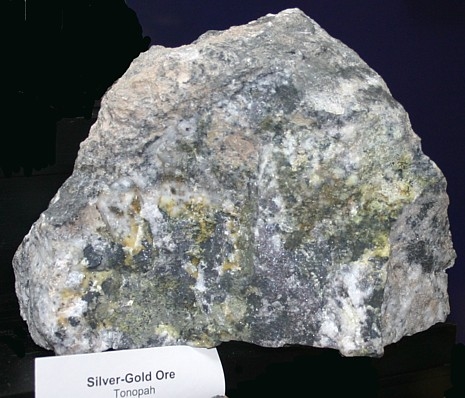 Tonopah Silver-Gold Ore
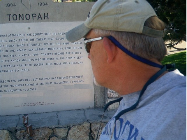
The community of Tonopah began about 1900 with the discovery of gold and silver ore by prospector Jim Butler when he went looking for a lost burro he owned. The burro had wandered off during the night and had sought shelter near a rock outcropping. When Butler discovered the animal the next morning, he picked up a rock to toss at the burro, but instead noticed the rock was unusually heavy. He had stumbled upon the second-richest silver strike in Nevada history! Tonopah quickly became one of Nevada’s most prosperous mining communities, drawing hundreds of prospectors from its founding.
Gold and silver are obtained from a variety of ores, in some of which the gold predominates, in others, silver. These two metals may be mixed with base metals, such as lead, copper, zinc, and iron. Few silver ores are absolutely free from gold, and vice versa, so that a separate consideration of the two is more or less a difficult task. For ores where the most valuable element is silver, the silver is normally contained in minerals colored gray to black in appearance. These minerals range from a metallic sheen to an earthy soot-like appearance. Sooty black minerals are common in many very rich silver ore samples. Most of these sooty black deposits consist of acanthite or various complex silver sulfides.
______________________________________________________
 Tonopah has the darkest sky in the country!
Tonopah, Nevada has the unique distinction of having one of the darkest nighttime skies in the world! Take advantage of this rare opportunity where the brightest lights around are what you see in the sky. After the moon sets, let your eyes adjust and then simply look up and lose yourself in the darkest skies in the nation! See the RELATED WEB PAGE above for more and go night caching under the stars of Tonopah!
__________________________________________
Area 52
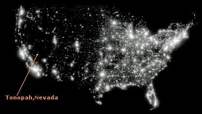
The Tonopah Test Range, also known as Area 52, is a restricted military installation located about 30 miles southeast of Tonopah, Nevada. It is part of the northern fringe of the Nellis Test Range, measuring 625 sq mi. Tonopah Test Range is located about 70 miles northwest of Groom Dry Lake, home of the Area 51 facility. Like the Groom Lake facility, Tonopah is a site of interest to conspiracy theorists, mostly for its use of experimental and classified aircraft. As such, it is not the focus of alien enthusiasts, unlike its neighbor, Area 51.
______________________________________________________
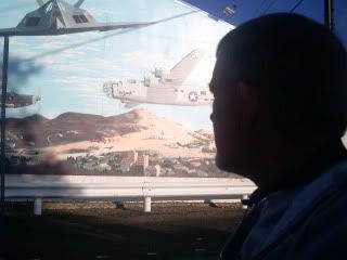
Where is Tonopah? The coordinates will take you to the roadside marker shown in the image (below left) at the center of this small remote mining town located 6,047 feet of elevation in the San Antonio Mountains between Las Vegas and Reno (there is a wall mural nearby of regional relevance).
 Above images are visible from the waypoint.
______________________________________________________
Photos are welcome, but none are required.
However, to demonstrate the educational value of the Earthcache, please email answers to the following questions to ARF! at the link below:
1. What geological feature is Walker Lane?
2. What two tectonic plates converge at the San Andreas fault?
3. Walker Lane strikes have produced how many ounces of precious metal?
4. What does the fountain adjacent to the Tonopah marker feature as a centerpiece?
5. From the marker at this waypoint, complete this sentence, 'in the wake of Tonopah's boom, most of which have become '_ _' (Two Words).
Please email answers to:
ARF!
The ET Earthcache series include the most FAVORITED Earthcaches in Nevada! Thanks to everyone who posts a
FAVORITE
_____________________________
Alamo to Tonopah Earthcaches:
Groom Mining District Rachel, NV (GC2GHE8)
Alamo Breccia Alamo, NV (GC37ZKW)
Playa Goblin Knobs, NV (GC2GP44)
Walker Lane Tonopah, NV (GC36DRD)
Golden Arrow Mine Golden Arrow, NV (GC4QX9J)
______________________________________________________
Please do not wait on a reply from me. Simply email the answers and log the Earthcache.
Logs which do not meet requirements will be quietly removed.
______________________________________________________