La baie Eternité
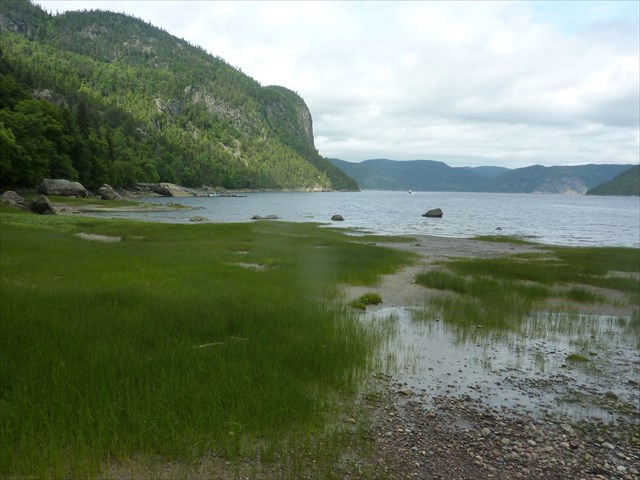
Vous êtes actuellement dans une vallée glacière. Tout le fjord du Saguenay témoigne du passage des glaciers.
Le paysage exceptionnel qui s’offre à vous sur le territoire de ce parc se transforme continuellement. L’eau qu’elle soit sous forme solide ou liquide est responsable de cette évolution.
Un relief moutonné. Regardez autour de vous : pas de pics, pas de saillies ou d’éperons rocheux. Tout le territoire est poli, arrondi adouci comme le dos d’un mouton. Cette abrasion est la conséquence du passage des glaciers qui ont recouvert et écrasé le territoire de leur poids immense.
Des versants asymétriques. Les deux versants de la baie Eternité présentent des profils biens différents. L’Effet abrasif des glaciers a raboté le versant du cap Eternité qui faisait face au mouvement des glaces, alors que le versant du cap éternité qui lui faisait dos a été épargné.
Une auge glaciaire La rivière Eternité semble couler dans une vallée trop grande pour elle. Le passage des glaciers a contribué à éroder ce bassin et à lui donner une forme en « U » caractéristique d’une auge glacière.
Aujourd’hui encore l’eau transforme le paysage
1 Le dépôt des sédiments. La rivière Eternité transporte une importante quantité de matières en suspension. Au contact du Saguenay, la vitesse de l’eau diminue, ce qui favorise le dépôt de ces particules et forme un delta. Celui-ci est bien visible à marée basse. Le front du delta progresse vers le Saguenay de ( . . . ) mètres par année, comblant peu à peu la Baie Eternité.
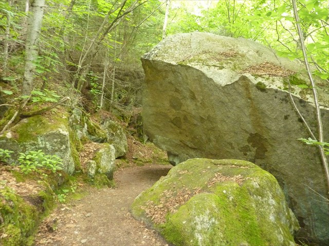
2. La gelifraction et les cônes d’éboulis. Attention, la stabilité des parois rocheuses n’est qu’apparente. En réalité les falaises se modifient continuellement, en particulier sous l’action du gel et du dégel. Lorsque l’eau infiltrée dans les fissures du roc gèle, l’expansion de la glace fait éclater la roche. Ce phénomène s’appelle la gélifraction. Le long des versants, les éclats qui s’écroulent forment des amoncellements appelés cônes d’éboulis. Parfois même des blocs gigantesques se détachent créant de spectaculaires abris sous roche.
3. Le jeu des marées. Oui il y a bien des marées dans le fjord. Le long des parois rocheuses, à marée basse, on peut voir la bande colorée indiquant leur niveau maximal. Cette variation régulière du niveau de l’eau entraîne de l’érosion dans les zones fragiles qui se transforment avec le temps.
Pour valider cette cache vous devez répondre à ces trois questions
1) D’après le panneau de combien de mètres par an le front du delta progresse t’il dans la Saguenay à cause du dépôt des sédiments ?
2) Un peu plus loin sur le long du sentier de la statue on peut découvrir un magnifique abri sous roche formé par la gélifraction. Selon le panneau d’information à combien de mètres se situe t’il ?
3) D’après le panneau d’information que peut on percevoir en été sur le sentier des meandres à faliase en passant entre les cavitée des parois rocheuses ?
Loguez cette cache "Found it" et envoyez-moi vos propositions de réponses soit via mon profil, soit via la messagerie geocaching.com (Message Center), et je vous contacterai en cas de problème.
Vous pouvez, si vous le désirez, publier quelques photos du site ! !
Baie Eternité
You are currently in a glacial valley.
The entire Fjord du Saguenay bears the traces of the glaciers.
The Park’s exceptional landscape is in constant transition, due mainly to the action of water in both solid and liquid form.
Rounded landscape forme Look around you. There are no sharp peaks, protusions or rocky outcrops. The entire landscape is polished, rounded, smooth as a sheep’s back. This is the result of abrasion by the glaciers that covered the area and crushed it with their tremendous weight.
Asymmetrical Bluffs. The two sides of Baie Eternité have very different profiles. The abasive impact of the glaciers wore down the Cap Eternité side which bore the brunt of the movement of the ice, while the Cap Eternité side behind the glacier escaped its impact.
A glacial through. You might think the Riviére eternité flows through a valley that is too big for it. The glaciers were partly responsible for eroding the area and giving the characteristic « U » shape of a glacial trough.
Even today the water alter the landscape
1. Sediment deposits. The rivière Eternité carries a large volume of suspended matter. When it joins the Saguenay, the water slow down, depositing the particles and creating a delta that is clearly visible at low tide. The front of the delta is advancind into the Saguenay at a rate of ( . . .) metres per years, and is slowly filing Baie Eternité.
2. Congelifraction and talus cones. Be careful ! The apparent « stability » of the rock walks does not exist in reallity. The cliffs are in constant transition, especially during the winter freeze and spring thaw. When water enters cracks in the rock face and freezes, the expansion of the ice causes the rock to splinter. This is known as congelifraction. The splinters of rock collect on the hillsides to form piles known as taus cones. Giant rocks sometimes fall from the cliffs and create spectacular rock shelter.
3. The action of the tides . Yes, the fjord is tidal. At low tide, a coloured band becomes visible along the rock wall, indicating the high tide line. This regular variation in the water level causes érosion in fragile areas. The Riviere eternité’s banks continue to change over time.
To be able to validate this Earth hides, answer these questions
1) On the bulletin how many meters in a year the front of the delta is advance into the Saguenay because of the deposit of sediments ?
2) A little farther on along the path of the statue , we can discover a magnificent shelter under rock formed by the gélifraction. According to the bulletin board has how many meters is you there ?
3) According to the bulletin board , That we can perceive in summer on the meandres a Falises Trail in passing between the cavitée of rock faces ?
Log this hiding place “Found it” and send to me your proposals for answers either via my profile, or via the transport geocaching.com (Center Message), and I will contact you in the event of problem.
If you want, you can publied your pictures of the Fjord ! ! !