To log this earthcache, don’t worry about answering all questions perfectly correct. Simply send your best attempts at answers for the questions in a private message to me, (the cache owner), and then go ahead and log it as found.
You don’t need to wait for my approval. All attempts will be accepted.
- [REQUIRED] Please post a photo in your log of yourself or a personal item at the outcrop to prove you visited the site.
- Describe the sandstone at the first outcrop in terms of colour and texture from top to bottom.
- Describe the sandstone at the second outcrop in terms of colour and texture from top to bottom.
- What features do the two outcrops have in common?
- Why is there a difference in colour?
The Avalon zone once formed part of a small continent called Avalonia. Due to plate tectonic movements, the remains of Avalonia are now scattered far and wide around the world. By 555 million years ago, uplift along a series of major faults had created a mountainous area with low-lying basins in between.
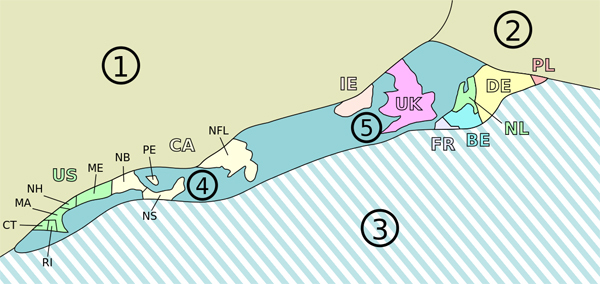
The Avalon Platform of the island of Newfoundland includes the Burin, Bonavista and Avalon Peninsulas. The rocks in this zone consist of late pre-Cambrian volcanic, plutonic and sedimentary rocks with Paleozoic sedimentary rocks lying on top. The sedimentary sequences formed from terrestrial deposition as well as shallow marine deposition. No other rocks on the island of Newfoundland are like these. Compared to those found through Central Newfoundland, rocks from this zone are relatively undeformed. Rock units of the same age with similar structural features and fossils are found on the other side of the Atlantic Ocean in Britain, France and North Africa.
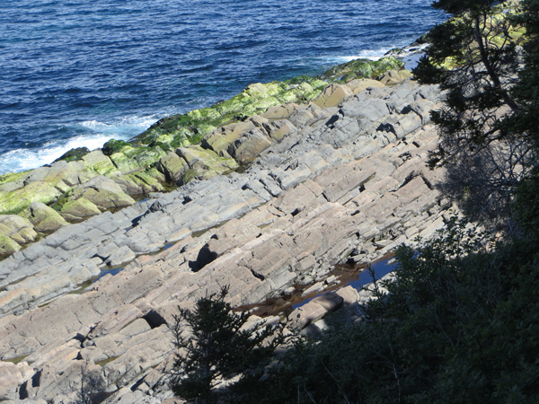
On Signal Hill, the bedrock’s age is not known with certainty as fossils are absent, but because of its stratigraphic position, it is considered of Precambrian age, possibly late Proterozoic. We will be observing two main members of the Signal Hill Formation:
- a grey or greenish grey to green sandstone with black argillite and slate near the base
- a reddish to reddish brown sandstone, with reddish slate and argillite
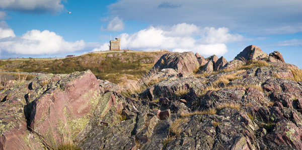
Gibbet Hill Formation
The location of this earthcache, the Gibbet Hill formation, is a small mounded bank, lying west of the Queen's Battery area, across the swale in which the new Interpretation Centre is located. The outcrop you will be viewing is near the east end of Outer Battery Road. A small road cut has exposed a fresh surface of sandstone for you to examine. This outcrop was buried in deep water from the flowing river and buried during it’s creation in the geologic past.
Second waypoint – Quidi Vidi Formation
About 100 metres (approximately 328 feet) further down the road, around a bend, the next outcrop of sandstone is available for your review. (Waypoint for this included). This is the Quidi Vidi Formation.
Alluvial plain
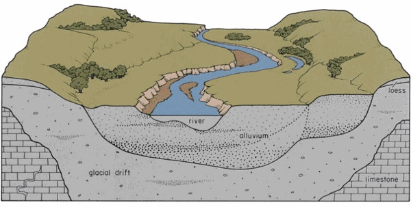
The Quidi Vidi Formation is an Ediacaran period stratigraphic unit consisting of red sandstone deposited on an alluvial plain. The Ediacaran Period, spans 94 million years from the end of the Cryogenian Period 635 million years ago, to the beginning of the Cambrian Period 541 Mya. The stratigraphic unit here is a volume of rock of identifiable origin and relative age range that is defined by the distinctive and dominant features that characterize it. The alluvial plain is created by the deposition of sediment over a long period of time by a river coming from highland regions, from which alluvial soil forms. A floodplain is part of the process, being the smaller area over which the rivers flood at a particular period of time, whereas the alluvial plain is the larger area representing the region over which the floodplains have shifted over geological time. This outcrop was exposed to more oxygen during its formation due to the location further along the river.
There is iron present in the outcrops but displays itself differently in each one. Deep water or rapid burial can choke off the iron in an outcrop so that it won’t oxidize. If the accumulated layers of iron are exposed to plenty of oxygen, they will have a reddish tinge.