
The Maryland Geocaching Society welcomes you to the 2017 edition of Cache Across Maryland! This is one of eleven geocaches placed throughout the ‘Old Line State’ in locations specifically chosen to showcase its diverse beauty. From the mountains of Western Maryland to the wetlands of the Eastern Shore, CAM 2017 will demonstrate that Maryland truly is ‘America in Miniature’.
Each Cache Across Maryland 2017 geocache contains a code which you will use to determine the location of the CAM 2017 Picnic to be held on May 6th. The code can be found on the inside of the cache container and on the inside front cover of the logbook. Don't forget to record this code! Any geocacher who has completed TEN of the eleven CAM 2017 geocaches and attends the CAM Picnic on May 6th will receive a Certificate of Completion and a CAM 2017 Geocoin. We hope you enjoy a very special CAM 2017!
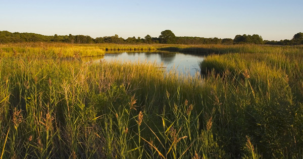
Chesapeake Bay Environmental Center
The Wildfowl Trust of North America Inc. was founded in 1979 with the intent to protect wetlands for waterfowl while maintaining captive waterfowl collections for educational purposes. In 1981 the Trust purchased a 315-acre farm tract in Grasonville, Maryland on which it initially established Horsehead Wetlands Center and opened to the public in 1985. In 1998 the trust purchased an additional 195 acres and placed the now 510-acre preserve under conservation easement.
In 2002 the Trust revamped its mission to address the issues of declining water quality, urban sprawl and habitat loss and set a goal to be recognized as a leader in environmental education and bay restoration. The site was renamed the Chesapeake Bay Environmental Center to reflect the new focus of the mission.
In 2004 the State of Maryland recognized there was a need to find more effective and efficient restoration methods in order to meet the 2010 Chesapeake Bay Agreement and beyond. CBEC was designated as “the”site for testing and developing comprehensive restoration techniques resulting in bay-wide implications. As a result, partnerships with private businesses, universities, state and federal governmental agencies have afforded CBEC the opportunity to expand research and restoration capabilities while encouraging stewardship through volunteerism.
In 2008 CBEC opened a new LEED certified arts and education facility to meet the growing needs of its educational programs. The new facility itself is a teaching tool on sustainable building practices, serves as a model for green living on Eastern Shore, is a resource center for developers engaging in smart growth and a portal for visitors to admire the local culture through rotating art exhibits. (http://www.bayrestoration.org)
The Geocache
Follow the Lake Trail west to the beginning of the South Meadow trail (waypoints included). The trail will split after about 330 feet; bear right to stay on the South Meadow trail. The geocache is located about 60 feet from the trail. The round-trip hike is about 1 mile.
The park is open from 9am to 5pm.
This geocache was placed by permission of the Chesapeake Bay Environmental Center. The MGS thanks the CBEC for approving this cache placement.