Florida's Grand Canyon EarthCache
-
Difficulty:
-

-
Terrain:
-

Size:  (other)
Please note Use of geocaching.com services is subject to the terms and conditions
in our disclaimer.
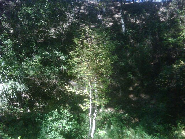
The type of landform you see at this location is called a steephead ravine. Ravines such as this are rare east of the Florida panhandle. Undisturbed ones are rarer still. The ravine lengthens and enlarges through a natural erosion process. As the springs at its head erode the soil, the material is washed away by the current causing the ravine to continually grow. Other springs along the course of the stream may, in time, form lateral valleys in the same manner. Designated a State Natural Feature Site, the Gold Head Branch ravine is approximately _____ feet deep and 1.5 miles long. The width varies throughout, but reaches several hundred feet in some areas.
Stream flow in Gold Head Branch can range from 43,200 gallons per hour (gal/hr) to 75,780 gal/hr. This seepage stream, fed by the springs of the surficial aquifer, flows for 6,700 feet before going back underground into a series of braided channels which eventually feed in to Little Lake Johnson located to the southeast.
The earth here consists of several layers of semi-consolidated marine and non-marine deposits of sand, clay, marl, gravel, limestone, dolomite and dolomitic limestone. The upper layer which can be seen here in the walls of the ravine is composed of young marine and estuarine terrace deposits from the Holocene and Pleistocene age; old terrace deposits and unnamed coarse clastics of the Pleistocene age; the Choctawhatchee Formation and Hawthorn Formation of the Miocene age; and the Ocala Limestone, Avon Park Limestone and Lake City Limestone of the Eocene age.
The uppermost section of this layer is made up of recent deposits of sands and clayey sands that may be gray, brown or black in color and contain organic matter. In addition, these may have beds of clay marl and sandy clay with shell marl and concentrations of shell in some areas.
The cool, moist ravine is covered by a dense canopy of loblolly pines, hickories and magnolias. Near the bottom of the ravine is a sweet gum tree that was selected as the state champion of its species in 1984. The tree measured 102 feet in height and 13.5 feet in diameter. Lightning strikes and rot have relegated that tree to past-champion status. The stump of this once majestic giant can still be seen near the bridge over the ravine.
The posted coordinates are for the parking area at the top of the stairs. To claim credit for this cache please follow the steps down in to the ravine then email the cache owner your answer to the following question --
Currently, how deep is the ravine? ______________
You can send the actual depth of the ravine or calculate it by using this method - assume the steps are each one (1) foot tall and count them as you proceed to the bottom.
Also, it would be nice if you were to post a picture from the man made structure at the bottom of the ravine. This is strictly optional and not required to claim credit for visiting this earthcache.
Additional information about the ravine and Gold Head Branch State Park can be found at the following websites -
Florida State Parks
Florida State Park Unit Management Plan

This cache is owned by a member of the
Northeast Florida Geocachers Association
Additional Hints
(No hints available.)