Slí Na Rosann
Many thanks to The Irish Sports Council of Ireland and Irish Trails for the modified description of the route given below and kind permission to publish the trail maps
Slí na Rosann is a 65km circular route covering an area called the Rosses, which lies between the western outliers of the Derryveagh Mountains and the much indented Atlantic coast in west County Donegal. It is a wonderfully scenic, rock-strewn landscape scattered with more than a hundred lakes, which make it a mecca for anglers.
Slí na Rosann brings walkers through this dramatic and often harsh landscape, passing on its way through the town of Dunglow and the villages of Crolly, Maghery and Burtonport. Terrain on the Slí consists mainly of boreens, some open ground which can be very wet, and quiet country roads that rise and fall as they cross open country. There are some short busy road sections which carry fast-moving traffic, so care is needed.
Some sections of the route, particularly that between Maghery and Crolly are quite remote and little overnight accommodation is available.
The total aggregate ascent over the entire route is 770 metres, with no significant climbs. Among the many offshore islands visible from Slí na Rosann is the island of Aranmore, which is accessible by ferry from Burtonport.
Travelling the route
WALKING
This is a long distance walking route and you should be properly equipped for changeable weather and open moorland conditions in certain areas where it can be very wet. Planning of the route between Dungloe and Crolly should allow for the lack of accommodation.
BY CAR
1.Most of the caches on the route are reasonably close to a road. However the roads are very narrow and parking will frequently not be possible at the closest point to the cache.
2.There are also open country caches which cannot be approached by car. Planning for these caches will involve both a return to the car and a significant drive round to get back to the Slí on the other side.
3. Parts of the route are on roads you will find on the map but you do not like your car if you travel them. They are farm access/bog roads - planning should be as per item 2
BY BIKE
A great way to see this trail if time is an issue.
With the exception of the areas under section 2 for the cars the route is great for a bike. Areas under section 3 for cars can be travelled by bike with ease.
The Maps
Personal copies of The Sports Council of Ireland and Irish Trails maps of the route may be obtained by visiting www.irishtrails.ie or by following the links below
Map 1 An Clochán Liath (Dungloe) to N56
Map 2 (N56 to Loch Gaol)
Map 3 (Loch Gaol to Croithlí (Crolly) to Mín Beannaid)
Map 4 (Mín Beannaid to Ailt an Chorráin (Burtonport) to An Clochán Liath (Dungloe)
It is highly recommended that you also have the OSI Discovery Series Sheet 1 map with you as well.
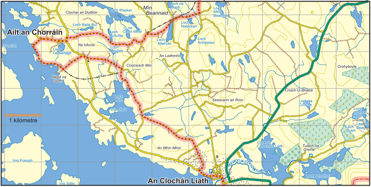
Map 4 Mín Beannaid to Ailt an Chorráin (Burtonport) to An Clochán Liath (Dungloe)
The Cache
The cache is a camo regular tabloc box