
Preamble:
The São Domingos and Chança mines are located in the municipality of Mértola and are examples of polymetallic sulphide deposits of the Iberian Pyrite Belt (IPB), formed in a marine environment, during the Upper Devonian (approximately 382 to 359 Ma). The mineralized structures are formed by masses of massive ore and stockworks, associated with volcanic and sedimentary rocks affected by hydrothermal alteration (silica, chlorite and sericite) of the Volcano-Sedimentary Complex (VSC) of the IPB. In both cases, the deposits outcrop, being represented by iron caps, corresponding to the zone of supergenic enrichment and consequent oxidation of the sulphides. 5 km apart, the two mines were exploited in Roman times and in the nineteenth century, and both were concessioned to Mason & Barry. (Source: Matos, JX, Pereira, Z, Batista, MJ, de Oliveira, D. 2014)

Chança Mine: Geological setting:
The Chança Mine is located in the northern sector of the Iberian Pyrite Belt (IPB) in the Volcano-Sedimentary Complex (VSC – Famennian to Upper Visean in age) lineament that includes, in Portugal, the old Chança Mine and, in Spain, the old mines of Vuelta Falsa, El Carmen, San Fernando, Los Silos, Romanera, El Cura and Sierrecilla.
The mineralisation is associated with E-W orientated VSC rhyolitic structure. The local sequence is made up of porphyritic felsic volcanic lavas and volcanic breccias, locally in contact with the sediments forming peperite structures and siliceous shales. The Chança VSC sequence is overlain by the Gafo Formation (Frasnian age), which is made up of shales, greywackes and intrusive volcanic rocks.
There is intense hydrothermal alteration associated with the massive sulphides marked by chlorite, quartz-sericite and sericite. (Source: Matos, JX, Inverno, CMC, Morais, I, Albardeiro, L.2017 – EXPLORA Field Exploration Workshop I – Field Trip Book)
Mineralisation: Mining took place during the Roman occupation of the peninsula and during the 19th and 20th Centuries.
Mineralised lenses are orientated as NNW-ESE and plunging to the NE. Exploration drill holes confir the presence of >100m of stockwork structures hosted in rhyolites and furthermore suggests the existence of several metric massive sulphide lenses.
Primary mineralisation is present in the form of pyrite (FeS2), chalcopyrite (CuFeS2) and sphalerite (ZnS) occurring in both stockworks and massive ores.
The Chança deposit is also affected by supergene alteration and this is shown by the occurrence of hematite, limonite, goethite, probable cuprite and sulphates.


Iron Cap/Gossan:
Gossan (eiserner hut or eisenhut) is intensely oxidized, weathered or decomposed rock, usually the upper and exposed part of an ore deposit or mineral vein. In the classic gossan or iron cap all that remains is iron oxides and quartz often in the form of boxworks, quartz lined cavities retaining the shape of the dissolved ore minerals. In other cases quartz and iron oxides, limonite, goethite, and jarosite, exist as pseudomorphs replacing the pyrite and primary ore minerals. Frequently gossan appears as a red stain against the background rock and soil due to the abundance of oxidized iron and the gossan may be a topographic positive area due to the abundance of erosion resistant quartz and iron oxides. Although most gossans are red, orange, or yellow, black gossans from manganese oxides such as pyrolusite, manganite, and especially psilomelane form at the oxidized portion of Mn-rich mineral deposits.
In the 19th and 20th centuries gossans were important guides to buried ore deposits used by prospectors in their quest for metal ores. An experienced prospector could read the clues in the structure of the gossans to determine the type of mineralization likely to be found below the iron cap.
(Source: Here)
The EarthCache:
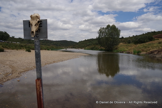
At the indicated coordinates you must face north (away from the river) and look at the small oxidised “cliff” in front of you.
To validate your presence and demonstrate that you have learned to identify the sericite, you will have to answer three questions:
1- What is the predominant colour of the iron cap? (choose: black, brown, red, yellow, orange)
- Estimate the height of the iron cap from your position to the top of the cliff? (Choose: 1m, 3m, 5m, 8m, 10m, 15m, 20m or >20m)
- Are the “cliff” faces regular or irregular?
If you feel you have all the answers correct, please log your found but also send me the answers via e-mail so I can check them. If I don’t answer you it is because they are correct and you have another found.Please note that when you e-mail me, please supply the reference (GCxxxxx) and name (Mina do Chança 2 - Gossan - DP/EC92) of the cache and please click on the “I want to send my e-mail address along with this message” so that when I reply to you the messages don’t go into e-mail heaven (or hell).


Preâmbulo:
As minas de São Domingos e de Chança localizam-se no concelho de Mértola e constituem exemplos de jazigos de sulfuretos maciços polimetálicos da Faixa Piritosa Ibérica (FPI), formados em ambiente marinho, durante o Devónico superior (382 a 359 Ma aproximadamente). As estruturas mineralizadas são formadas por massas de minério maciço e de tipo stockwork (veios entrecruzados), associadas a rochas vulcânicas e sedimentares afectadas por alteração hidrotermal (sílica, clorite e sericite) do Complexo Vulcano-Sedimentar (CVS) da FPI. Em ambos os casos, os jazigos afloram à superfície, estando representados por chapéus de ferro, correspondentes à zona de enriquecimento supergénico e consequente oxidação dos sulfuretos. Distanciadas entre si cerca de 5 km, as duas minas foram exploradas na época romana e no século XIX, tendo sido ambas concessionadas à empresa Mason & Barry. (Fonte: Matos, JX, Pereira, Z, Batista, MJ, de Oliveira, D. 2014)
Mina do Chança: Enquadramento geológico
Localizada no vale do rio Chança, a mina de Chança constitui um pequeno jazigo de sulfuretos maciços (pirite acompanhada de rara calcopirite, esfalerite e galena), com amplos stockwork intersetados em sondagem. A mina foi concessionada em 1877, laborando em pequenos períodos através de escavações de poços e de galerias. O chapéu de ferro é formado por hematite, limonite, goethite, sílica e provável cuprite e está bem exposto em Portugal, no Cerro das Minas e no Cerro do Ouro, e em Espanha junto ao poço de Tremancia. Com uma possança inferior a 40 m, a estrutura mineralizada apresenta uma atitude WNW-ESSE, 45NE.
As rochas encaixantes incluem -se no CVS, sendo representadas por lavas riolíticas, brechas vulcanoclásticas e pomíticas e xistos siliciosos. Estas litologias estão bastante deformadas e foram afetadas por alteração hidrotermal, bem expressa no corte geológico ao longo do rio. A mina de Chança situa-se no extremo ocidental de um alinhamento de jazigos de pirite espanhóis que inclui de oeste para leste Vuelta Falsa, El Carmen, San Fernando, Los Silos, Romanera, El Cura e Sierrecilla. (Source: Matos, JX, Inverno, CMC, Morais, I, Albardeiro, L.2017 – EXPLORA Seminário de Prospecção I – Livro de Campo)
Gossan (ou Chapéu de Ferro) é uma rocha intensamente oxidada, degradada ou decomposta, geralmente a parte superior e exposta de um depósito de minério ou veio mineral. No clássico gossan ou capa de ferro, tudo o que resta é óxidos de ferro e quartzo, muitas vezes sob a forma de boxworks, cavidades revestidas de quartzo que mantêm a forma dos minerais de minério dissolvidos. Noutros casos, óxidos de quartzo e ferro, limonite, goetite e jarosite, existem como pseudomorfos que substituem os minerais de pirite e minerais primários. Frequentemente o gossan aparece como uma mancha vermelha contra o fundo da rocha e do solo devido à abundância de ferro oxidado e o gossan pode ser uma área topográfica positiva devido à abundância de quartzo resistente à erosão e óxidos de ferro. Embora a maioria dos gossans sejam vermelhos, alaranjados ou amarelos, gossans negros a partir de óxidos de manganês, como a pirrolite, a manganite e especialmente a forma de psilomelano ocorrem na porção oxidada de depósitos minerais ricos em Mn.
Nos séculos 19 e 20, os gossans eram guias importantes para descobrir depósitos de minério debaixo da superfície pelos garimpeiros na busca de minérios metálicos. Um prospector experiente poderia ler as pistas na estrutura dos gossans para determinar o tipo de mineralização que provavelmente se encontrava debaixo do chapéu de ferro. (Fonte: Aqui)

A EarthCache:
Nas coordenadas indicadas, deves virar-te para norte (põe-te de costas para o rio) e observar o pequeno "penhasco" oxidado à tua frente.Para validar a tua presença e demonstrar que você aprendeu a identificar o gossan, terás que responder a três perguntas:
1- Qual é a cor predominante da gola de ferro? (Escolhe: preto, roxo, vermelho, amarelo, laranja)
- Estima a altura do chapéu de ferro da sua posição até o topo do penhasco? (Escolhe: 1m, 3m, 5m, 8m, 10m, 15m, 20m ou> 20m)
3. As faces do "penhasco" são regulares ou irregulares?
Se achas que tens as respostas correctas, faz o teu log de "found", mas envia-me também as respostas por e-mail para que eu possa vê-las. Se eu não te responder é porque elas estão correctas.
Por favor, nota que quando me enviares um e-mail, por favor forneçe a referência (GCxxxxx) e nome (Mina do Chança 2 - Gossan - DP/EC92) da cache e clica em “I want to send my e-mail address along with this message”para que quando eu responder as mensagens não sigam para o saco roto do geocaching.com.

 The most exciting way to learn about the Earth and its processes is to get into the outdoors and experience it first-hand. Visiting an Earthcache is a great outdoor activity the whole family can enjoy. An Earthcache is a special place that people can visit to learn about a unique geoscience feature or aspect of our Earth. Earthcaches include a set of educational notes and the details about where to find the location (latitude and longitude). Visitors to Earthcaches can see how our planet has been shaped by geological processes, how we manage the resources and how scientists gather evidence to learn about the Earth. To find out more click HERE.